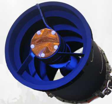
Elbit Space Imaging Systems, JUPITER and VENµS Were Launched
2nd August 2017
Elbit Space Imaging Systems, JUPITER and VENµS Were Launched
2nd August 2017
Elbit Space Imaging Systems, JUPITER and VENµS Were Launched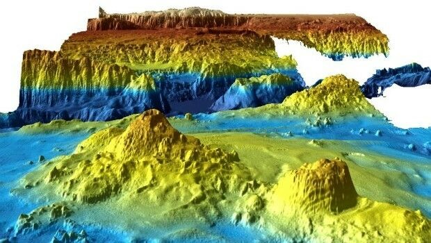
28th July 2017
Unique Seafloor Data Provides New Insight To Scientific Communities26th July 2017
DroneMapper Chooses Global Mapper for UAV Imagery Processing26th July 2017
PCI Geomatics to Celebrate 35 years in Business
25th July 2017
Shaping the future of spatial data management and analytics
24th July 2017
Plowman Craven Launches Vogel R3D Rail Survey System20th July 2017
LizardTech and Extensis Optimize Digital Asset Management14th July 2017
U.S. Army Corps Adds Global Mapper to its List of Approved Software11th July 2017
ArcGIS 10.5 Enterprise Architecture Powers DigitalGlobe's Offerings11th July 2017
Esri Adds Airbus Global Elevation Data to Online Maps10th July 2017
PCI Geomatics to Present Historical Airphoto Processing Case Study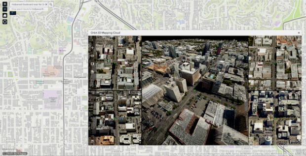
7th July 2017
Orbit GT and Vexcel Imaging showcase Oblique and Streetlevel 3D data
6th July 2017
Esri's Online Learning Guide for Working with Imagery and ArcGIS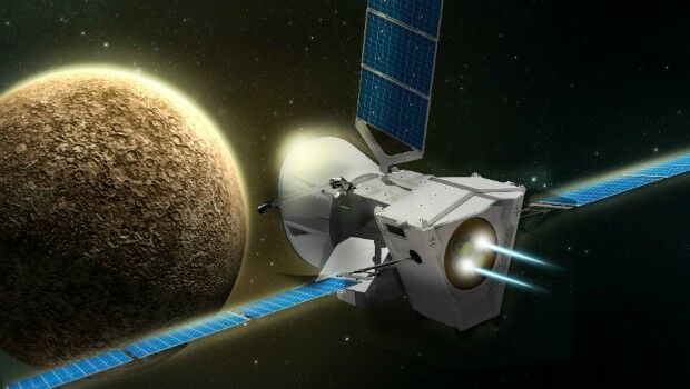
6th July 2017
BepiColombo - a four in one satellite to uncover Mercury´s mysteries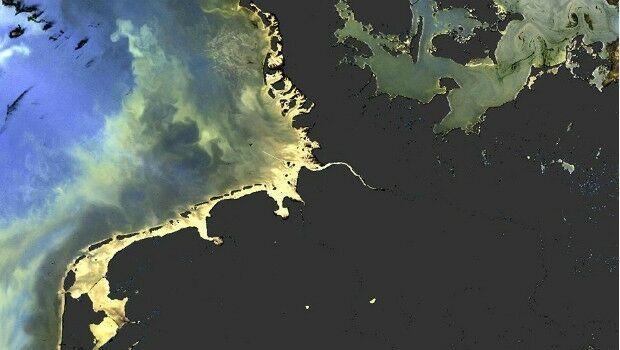
5th July 2017
Sentinel-3 OLCI and SLSTR Level 2 Products now fully operational4th July 2017
Copernicus App Lab is open for registration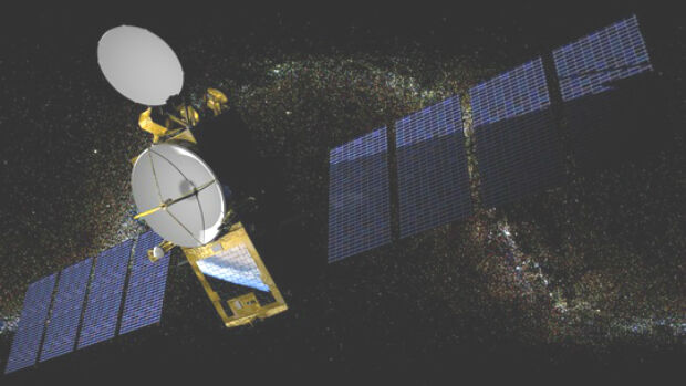

29th June 2017
Dairy farmers to benefit from satellite data29th June 2017
Latest update to CH2M’s next generation Flood Modeller software28th June 2017
HERE partners with Mapillary to make better maps28th June 2017
Remote sensing technologies key to the future of the oil palm industry
26th June 2017
Nine More Satellites in exactEarth's Real-Time Constellation Launched
23rd June 2017
Pix4D and Parrot announce the climate innovation grant winners
22nd June 2017
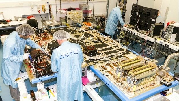
SSTL selected to build third batch of Galileo navigation payloads
21st June 2017
Drone Inspections go nuclear with GPS and RADAR20th June 2017
Digital image evaluation heading for new markets13th June 2017
PCI Geomatics Delivers GXL System to L3 Link Simulation & Training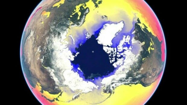
9th June 2017
Copernicus Marine Hackathon Coding Event @EUMETSAT8th June 2017
Blue Marble Conducts Successful Global Mapper Training Class2nd June 2017
Photogrammetry Firm Visiontek searching for business partners globally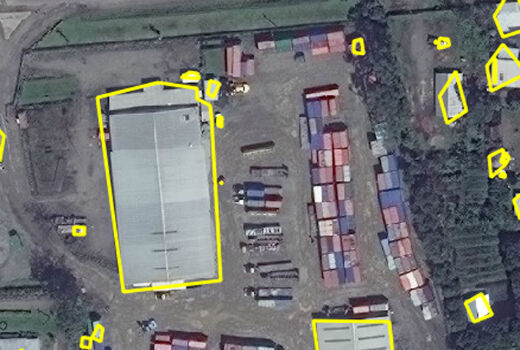
1st June 2017
Automated Feature Identification in Machine Learning Trials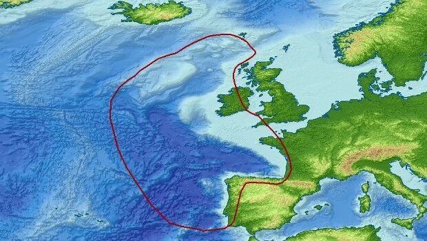
31st May 2017
Getech Brings Greater Insight to Both Sides of the North Atlantic31st May 2017
IRS data now available free of charge to scientific users
17th May 2017
Eni to utilize Earth Observation satellite data and services
15th May 2017
Icaros Releases Ver 5.0 of OneButton™ Drone Image Processing Software15th May 2017
Responding to Emerging Environmental Threats
15th May 2017
AeroScientific Picture of the Month May 201711th May 2017
30 Years of Success Leads DAT/EM to Virtual Reality and UAS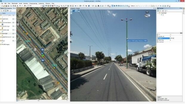
10th May 2017
Imajing provides ESRI users with online 3D enabled images
10th May 2017
Duke of Edinburgh's Award Entrusts SPOT and Mapyx9th May 2017
European satellite technology maps storms, pollution and marine safety9th May 2017
PCI Geomatics Now a Planet Ecosystem Partner9th May 2017
Wantman Completes Extensive UAV Project with SimActive
8th May 2017
Google Streetview used to find Britain's “lost” 1930s-era cycleways
8th May 2017
Phase One Industrial Adds Support for DJI Drones