New Esri Textbook Teaches the Fundamentals of ArcGIS
27th March 2018
New Esri Textbook Teaches the Fundamentals of ArcGIS
27th March 2018
New Esri Textbook Teaches the Fundamentals of ArcGIS23rd March 2018
Phase One Industrial and Aerialtronics Sign Partnership Agreement22nd March 2018
World’s First Wide-Area Security with Multiple Autonomous Flying Drones21st March 2018
Global Mapper and LiDAR Module SDK v19.1 Now Available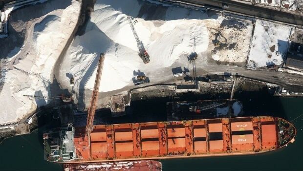
21st March 2018
Col-East Inventories Salt Piles from the Air Each Winter20th March 2018
SimActive Launches Free Data Processing Service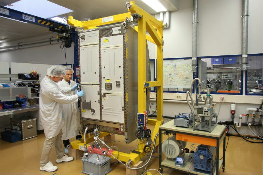
19th March 2018
Airbus delivers new life support system for the ISS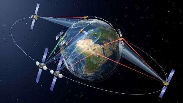
19th March 2018
SpaceDataHighway starts full Copernicus service12th March 2018
Jean-François Delepau named as new chairman of the Sofradir Group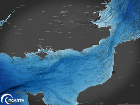
8th March 2018
TCarta to Highlight Safety Benefits at Oceanology International 20182nd March 2018
CityEngine Used to Create Oscar-Nominated Effects in Blade Runner 204926th February 2018
TEOCO launches UAV Service Enablement Platform for Drones20th February 2018
Earth-i receives £2.7 million from UK Government to improve crop yield14th February 2018
Rezatec announces completion of £2m financing14th February 2018
Microsoft and Ordnance Survey join forces13th February 2018
A Turkish Point of View on the Gallipoli Campaign
13th February 2018
ICAROS Uses TatukGIS SDK to Develop New Aerial Geospatial Data Viewer12th February 2018
Airbus-built Aeolus successfully passes all tests in Liège (Belgium)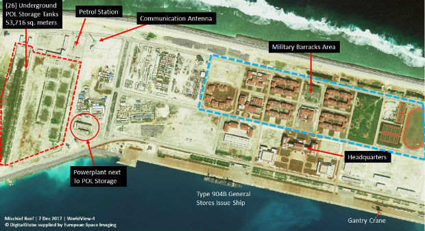
9th February 2018
Satellite images unveil Chinese military fortresses in Spratly Islands8th February 2018
PCI Geomatics Releases Geomatica Software Update6th February 2018
A partnership to integrate LiDAR and Photogrammetric technologies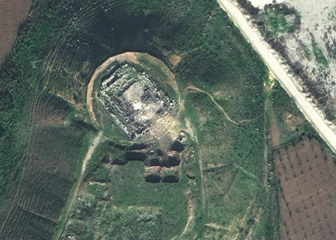
5th February 2018
Satellite Images of Afrin Identifies Massive Damage to Ancient Temple31st January 2018
Columbus: 10 years in Space, close to 60,000 Earth orbits31st January 2018
Orbit GT releases 3D Mapping Content Manager v18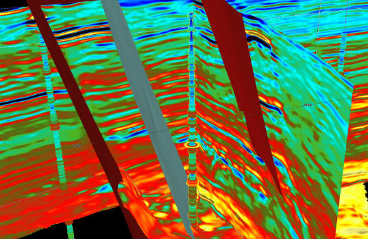
31st January 2018
CGG GeoSoftware Donates Jason Reservoir Characterization Software30th January 2018
Airbus to provide near real-time access to its satellite data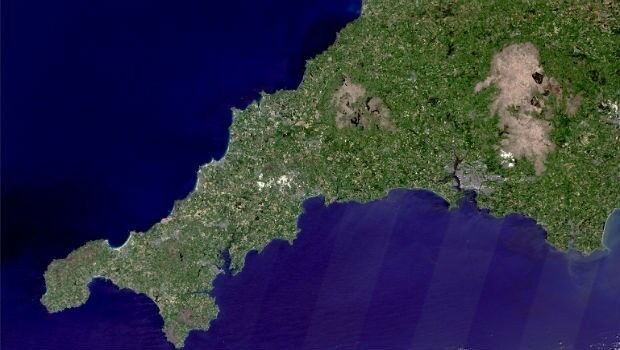
25th January 2018
Prospecting for Lithium in Cornwall from Space24th January 2018
GeoCalc SDK 7.4 Update Includes Support for New Functionality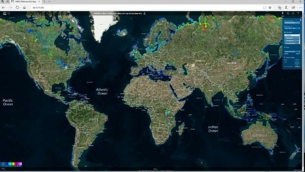
22nd January 2018
Global Water Quality Portal Built to Support UNESCO Programme17th January 2018
EARSC and AGI sign memorandum of understanding22nd December 2017
Fugro’s Data Brings Successful Close To The Search For Lost Sub AE122nd December 2017
Airbus ships high-power electric SES-14 satellite to Kourou22nd December 2017
Unlock Information from Imagery for Use in Maps and Analysis18th December 2017
A year of progress for commercial drone industry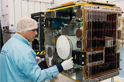
18th December 2017
SSTL ships RemoveDEBRIS mission for ISS launch16th December 2017
EUMETSAT takes ownership of two MTG ground stations
12th December 2017
New Version of Trimble eCognition Suite available6th December 2017
OGC seeks public comment on CDB Multi-spectral Imagery Extension6th December 2017
EUMETSAT ground segment is ready for launch of Copernicus Sentinel-3B6th December 2017
Committed Revenue Backlog for UrtheDailyTM Constellation6th December 2017
UrtheCast and Twenty First Aerospace Technology Partnership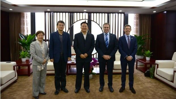
4th December 2017
UrtheCast and Beijing Space View Technology sign Strategic Agreement1st December 2017
Esri Signs Global Enterprise Agreement with Airbus Defence and Space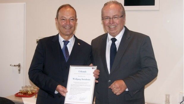
30th November 2017
Dr Wolfgang Steinborn Awarded DDGI’s Golden Badge of Honor