
Satellite Imagery: Before/After of Notre Dame Cathedral Fire
18th April 2019
Satellite Imagery: Before/After of Notre Dame Cathedral Fire
18th April 2019
Satellite Imagery: Before/After of Notre Dame Cathedral Fire17th April 2019
Blue Marble’s Global Mapper Mobile App Now Available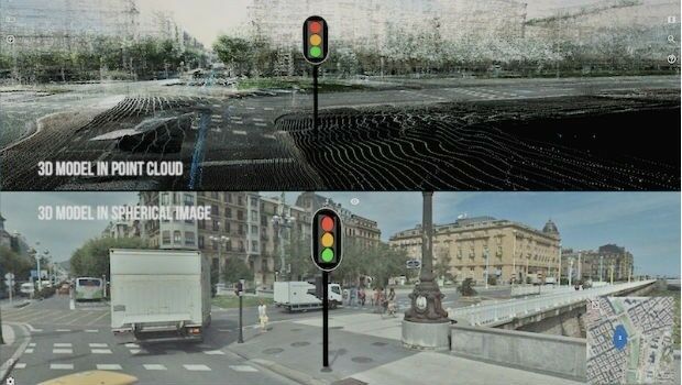
13th April 2019
PCI Geomatics announces educational campaign in Brazil
13th April 2019
Esri's Participation in Dubai's Future Cities Show 2019

11th April 2019
OGC Requests Information on Earth Observation Big Data Architecture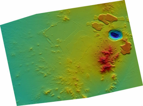
9th April 2019
CGG Launches MineScope for Essential Insight throughout the Mining Lifecycle
9th April 2019
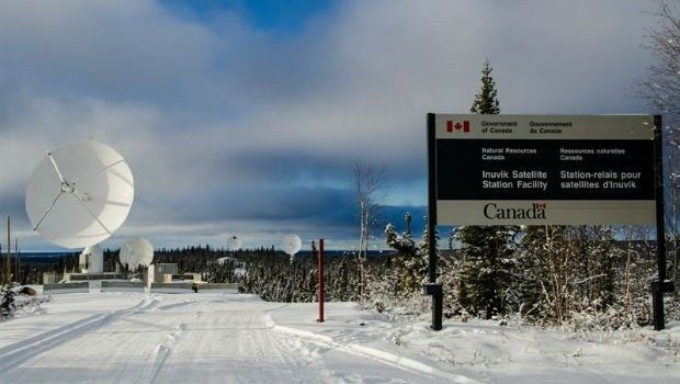
Canadian-Swedish co-operation to strengthen Earth Observation9th April 2019
Airbus and The Climate Corporation join forces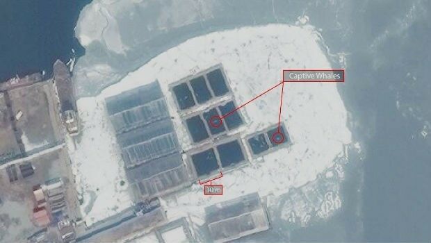
5th April 2019
Russia: Satellite Imagery shows whales held captive in Srednyaya Bay5th April 2019
New Version of the Global Mapper SDK Now Available
5th April 2019
EUMETSAT control room wins Prolight + Sound Award for SWiCA4th April 2019
HawkEye 360 Launches First Commercial Product – RFGeo.jpg)
3rd April 2019
Space tech set to help combat cocoa-fuelled deforestation
1st April 2019
Airbus and SSC to cooperate on Pléiades Neo1st April 2019
2019 EuroSDR Award for the best PhD thesis related to geoinformation science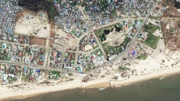
29th March 2019
BEIRA: Satellite Images highlight damage from Cyclone Idai27th March 2019
Ocean Business Announces High-Profile Speakers for Opening Session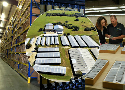
26th March 2019
New Ultramodern CGG Facility Boasts Secure and Cost-Effective Storage25th March 2019
Kaarta announces $6.5M in Series A Financing
19th March 2019
Waterproof Drones Solves Mapping & Inspection On Marine Areas
7th March 2019
Image & text analytics through CASPAR02, the Combined Automated Semantic Processing Array project4th March 2019
Exceptional Achievement at Partner Conference
26th February 2019
TCarta Wins Contract to Map Seafloor around Remote Pacific Island Nation
26th February 2019
Cobham SATCOM extends partnership with Inmarsat
26th February 2019
Routescene Inc. drone based LiDAR system26th February 2019
Hexagon Acquires Thermopylae Sciences & Technology
25th February 2019
Hexagon advances its 5D visualisation portfolio
19th February 2019
Airbus turns imagery into insight with The OneAtlas Platform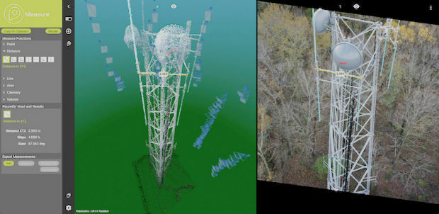


15th February 2019
Research project to offer neural networks training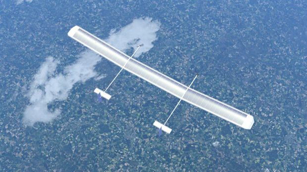
13th February 2019
New high-altitude platform to revolutionise the way we look at earth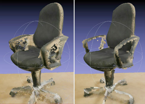
12th February 2019
NavVis now uses SLAM to automatically remove point cloud artifacts12th February 2019
PCI Geomatics Releases Geomatica and GXL 2018, SP1
12th February 2019
SimActive Expands its Partner Network for Medium Format Camera Solutions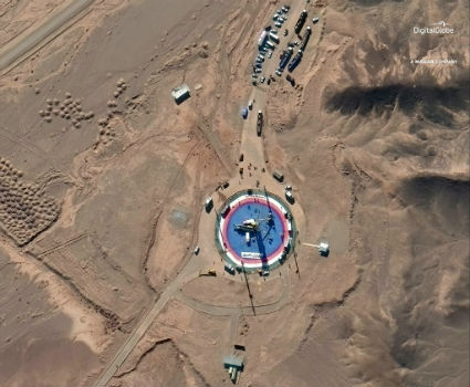
8th February 2019
Pre- and Post-Launch at of Iranian Satellite
8th February 2019
Terra Drone Invested in Indonesia’s Drone Service Company AeroGeosurvey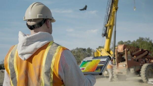
21st December 2018
GAF has been awarded a Framework Contract by the European Union Satellite Centre19th December 2018
French military Earth observation satellite (CSO) launched successfully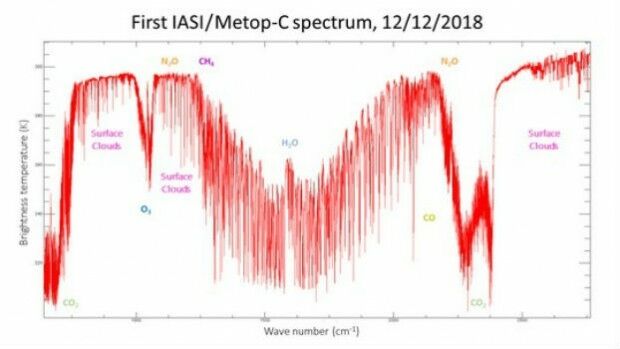
14th December 2018
Metop-C’s IASI instrument delivers first spectrum10th December 2018
Blue Marble Releases Geographic Calculator 2019