Share
Two students at the Swiss Federal Institute of Technology Lausanne (EPFL) have compared the ability of a forest in Vaud Canton to protect against avalanches before and after it was ravaged by fire in 2018. Their method could be applied to other forested slopes, helping to enhance local reforestation strategies.
Widespread drying as a result of climate change is driving an increase in forest fires around the world. By the end of the 21st century, Switzerland is expected to experience many more fires between May and November than it does today. According to experts, the worst-affected areas will be the Aare valley and lowland areas of Bern Canton. Moderate increases are predicted in Ticino Canton and the Engadin, while larger areas of Valais Canton will likely be set ablaze.
These fires could trigger erosion and compromise the protective role played by forests. “Forest fires will become commonplace in Switzerland,” predicts Johan Gaume, who heads EPFL’s Snow and Avalanche Simulation Laboratory (SLAB). “The good news is that, unlike with other climate-change impacts, we’re looking at fairly long timescales.”
In 2018, a fire destroyed six hectares of trees in Les Voëttes, a forested slope in the Diablerets mountain range in Vaud Canton. Gaume and Xingyue Li, a postdoctoral researcher at SLAB, were keen to learn more about whether and how the damage might have affected the forest’s ability to protect against avalanches in the winter. So they asked two Master’s students in environmental engineering to examine the case for their Design Project, working directly with Vaud Canton’s Environment Department (DGE).
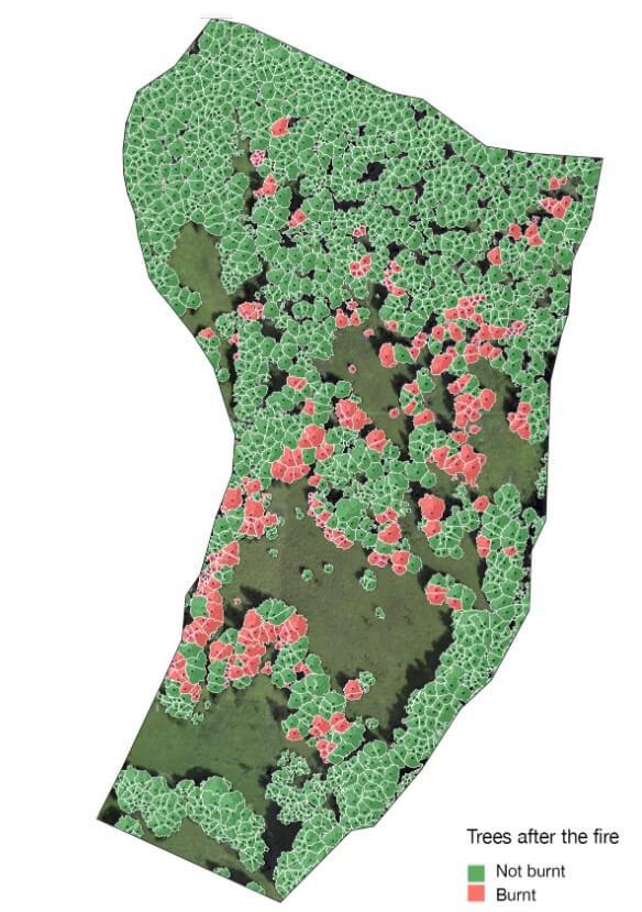
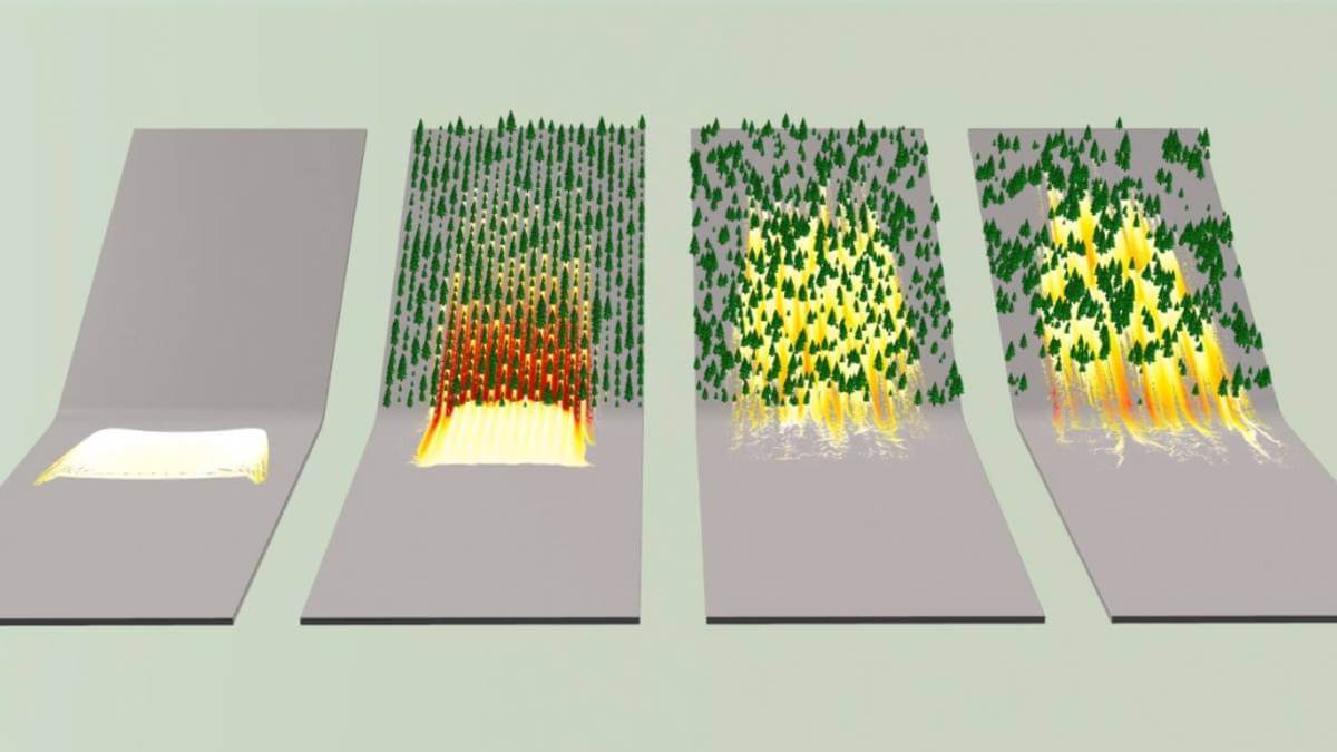
Map of the position of trees after forest fires © SLAB/EPFL
Mapping avalanche risk
Using a digital model developed at SLAB, the students produced a new avalanche risk map to inform the DGE’s reforestation strategy. They found that, although future avalanches will move faster down the slope at Les Voëttes, the relatively shallow gradient will stop them from reaching the houses below. The expanded avalanche risk zone only includes one extra chalet that was previously outside the boundary.
The students made two recommendations for the DGE: to plant dense clusters of trees in highly localized spots in order to improve stability, and to employ random planting patterns across the rest of the forest to provide enhanced protection. “Smaller, non-hazardous avalanches play a key role in supporting biodiversity,” says Francesc Molné, one of the two Master’s students who worked on the Design Project. “In ecosystems like these, plants and wildlife are adapted to these types of event, so it’s important that they continue.”
“Our findings were broadly in line with what we expected, but they’re less alarming than the DGE’s own predictions,” says fellow student Clara Streule. “We know that trees hold back some of the snow during an avalanche,” adds Molné. “The EPFL simulation model factors in the spatial distribution of trees to a high degree of accuracy. The model the DGE uses” – the RAMMS model developed at the WSL Institute for Snow and Avalanche Research SLF – “isn’t quite as accurate on that front. Perhaps that’s where the difference lies.”
Multiple parameters
The engineering students fed multiple parameters into the model, all of which influence how quickly an avalanche travels and how it behaves. These included the precise position and layout of surviving and damaged trees, the exposure and topography of the terrain, and different types of snow (fresh snow, wet snow, and packed and densely packed wind slabs). Molné and Streule used a drone to take aerial photographs of the area, which they combined using photogrammetry. They also scoured historical records for the region, using the heaviest snowfall figures for the past 100 years in their model.
“What I found most interesting was putting our faith in a digital model to come up with effective solutions, while recognizing the model’s limits and understanding how different factors influenced the end result,” says Molné. Streule notes: “The complex terrain made the topographic survey challenging. Programming the drone’s flight path put our math skills to the test – I really enjoyed rolling up my sleeves and applying the theory we’d learned in class to a hands-on problem.” She adds: “Making recommendations for Vaud Canton also taught me an important lesson about my future career. If we can’t reverse climate change, a big part of my job will be finding ways to adapt our lifestyles and shield ourselves from its worst effects.”
More collaborations to come
The students’ method could be applied to protection forests across Europe. “This pilot study was a chance to test our digital model,” says Gaume. “Now we’re keen to see how far we can take it.” His enthusiasm is shared by Vaud Canton. “This research gives us new insights into how forested slopes protect against avalanches at low altitude and will help improve our forest maintenance strategy,” explains Jean-Louis Gay from the DGE’s Forestry Inspectorate Division. “We’ll be working with EPFL again at other sites in the Canton.” A scientific paper based on the students’ work is also in the works.
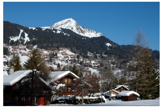
Les Diablerets, in Vaud Canton. © iStock
References
"Avalanche Modelling in Forested Slopes", Design Project, Francesc Molné, Clara Streule, Master Environmental Sciences and Engineering, EPFL, June, 2020.
External partner:
Canton de Vaud. Direction générale de l’environnement
Mr. Jean-Louis Gay
Laboratory:
EPFL Snow and Avalanche Simulation Laboratory (SLAB)
Prof. Johan Gaume
Dr. Xingyue Li
Author: Sandrine Perroud
Source: EPFL
Subscribe to our newsletter
Stay updated on the latest technology, innovation product arrivals and exciting offers to your inbox.
Newsletter