Cartography

The compilation, reproduction and dissemination of maps and charts by means of manual (analogue) or digital techniques, tools and workflows. This topic covers the compilation, reproduction, dissemination and use of both analogue (paper) and digital maps, charts and atlases. As well as the science of cartography, including georeferencing and geocoding, digital techniques for compiling and generating various types of raster and vector maps and charts are covered, as are the digital mapping tools and Geographic Information Systems available for this purpose. The application of cartography for aeronautical, terrestrial and marine purposes is also covered

Airbus and ZF to develop high precise end-to-end autonomous driving solution (from import)

Airbus and ZF to develop high precise end-to-end autonomous driving solution

15th April 2019

Airbus and ZF to develop high precise end-to-end autonomous driving solution
CTRACK LAUNCHES ULTRA COMPACT TRACKING DEVICES (from import)

CTRACK LAUNCHES ULTRA COMPACT TRACKING DEVICES

15th April 2019

CTRACK LAUNCHES ULTRA COMPACT TRACKING DEVICES

Outward Bound Chooses SPOT Gen3 Satellite Messengers

15th April 2019

Outward Bound Chooses SPOT Gen3 Satellite Messengers
Nanotron and Decawave shorten time to revenue (from import)
Nanotron and Decawave shorten time to revenue

15th April 2019

Nanotron and Decawave shorten time to revenue
Scientists chart history of vital Greenland Ice Sheet for first time (from import)

Scientists chart history of vital Greenland Ice Sheet for first time

15th April 2019

Scientists chart history of vital Greenland Ice Sheet for first time
GSSI Launches New Video Training Series (from import)

GSSI Launches New Video Training Series

14th April 2019

GSSI Launches New Video Training Series

PCI Geomatics announces educational campaign in Brazil

13th April 2019

PCI Geomatics announces educational campaign in Brazil
Esri's Participation in Dubai's Future Cities Show 2019 (from import)
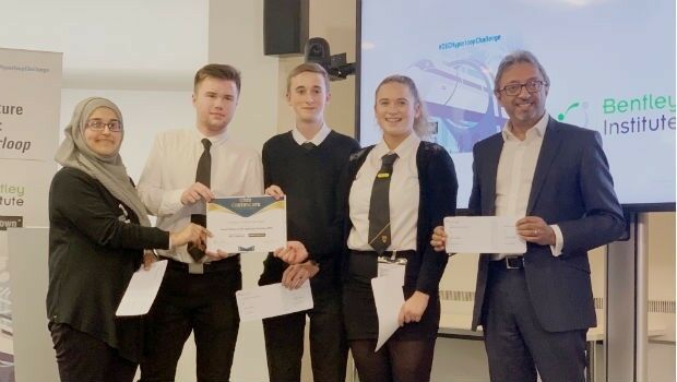
Esri's Participation in Dubai's Future Cities Show 2019

13th April 2019

Esri's Participation in Dubai's Future Cities Show 2019
Bentley Systems Announces Drummond Community High School Team as Winners (from import)

Bentley Systems Announces Drummond Community High School Team as Winners

12th April 2019

Bentley Systems Announces Drummond Community High School Team as Winners
UAVOS Developed New Auto-Tracking Antenna System f (from import)

UAVOS Developed New Auto-Tracking Antenna System f

12th April 2019

UAVOS Developed New Auto-Tracking Antenna System f
SimActive Software Used with eBee X for Shoreline Mapping (from import)
SimActive Software Used with eBee X for Shoreline Mapping

12th April 2019

SimActive Software Used with eBee X for Shoreline Mapping
Terra Drone acquires stake in Slovenia’s aerospace solutions provider C-Astral (from import)
Terra Drone acquires stake in Slovenia’s aerospace solutions provider C-Astral

12th April 2019

Terra Drone acquires stake in Slovenia’s aerospace solutions provider C-Astral
Topcon introduces new heads-up display (from import)

Topcon introduces new heads-up display

11th April 2019

Topcon introduces new heads-up display
“The Future of Digital Mapping is Now” (from import)

“The Future of Digital Mapping is Now”

11th April 2019

“The Future of Digital Mapping is Now”
Future Cities Show concludes on a grand note (from import)
Future Cities Show concludes on a grand note

11th April 2019

Future Cities Show concludes on a grand note
OGC Requests Information on Earth Observation Big Data Architecture (from import)

OGC Requests Information on Earth Observation Big Data Architecture

11th April 2019

OGC Requests Information on Earth Observation Big Data Architecture
PARAGON ENHANCES FLEXIPOD WITH TRACK MY DRIVER FUNCTIONALITY (from import)

PARAGON ENHANCES FLEXIPOD WITH TRACK MY DRIVER FUNCTIONALITY

11th April 2019

PARAGON ENHANCES FLEXIPOD WITH TRACK MY DRIVER FUNCTIONALITY
Elbit Systems Awarded $30 Million Contract (from import)

Elbit Systems Awarded $30 Million Contract

11th April 2019

Elbit Systems Awarded $30 Million Contract
CHC Navigation introduces the P2 GNSS Sensor Series (from import)
CHC Navigation introduces the P2 GNSS Sensor Series

11th April 2019

CHC Navigation introduces the P2 GNSS Sensor Series
Terra Drone Indonesia teams with Japan’s leading power industry research (from import)

Terra Drone Indonesia teams with Japan’s leading power industry research

11th April 2019

Terra Drone Indonesia teams with Japan’s leading power industry research
Garmin® receives EASA approval of the GFC 500 autopilot (from import)

Garmin® receives EASA approval of the GFC 500 autopilot

11th April 2019

Garmin® receives EASA approval of the GFC 500 autopilot
Trimble Announces High-Accuracy Field Solution for GIS Applications (from import)

Trimble Announces High-Accuracy Field Solution for GIS Applications

10th April 2019

Trimble Announces High-Accuracy Field Solution for GIS Applications
Paving process simplified with Topcon's latest launch (from import)

Paving process simplified with Topcon's latest launch

10th April 2019

Paving process simplified with Topcon's latest launch
Bentley Systems Names Dr. Nabil Abou-Rahme as Chief Research Officer (from import)

Bentley Systems Names Dr. Nabil Abou-Rahme as Chief Research Officer

10th April 2019

Bentley Systems Names Dr. Nabil Abou-Rahme as Chief Research Officer
OGC leads Geospatial Track at ApacheCon NA 2019 (from import)

OGC leads Geospatial Track at ApacheCon NA 2019

10th April 2019

OGC leads Geospatial Track at ApacheCon NA 2019

HERE launches XYZ: mapmaking and geospatial data management
10th April 2019

HERE launches XYZ: mapmaking and geospatial data management
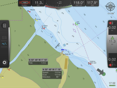
Pilots view Port-Log tide and weather data on Safe Pilot PPU (from import)
Pilots view Port-Log tide and weather data on Safe Pilot PPU

10th April 2019

Pilots view Port-Log tide and weather data on Safe Pilot PPU
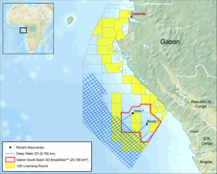
CGG 2D Survey Offshore Gabon Completed (from import)

CGG 2D Survey Offshore Gabon Completed

10th April 2019

CGG 2D Survey Offshore Gabon Completed

Hemisphere GNSS Announces Strategic Partnership with C-Nav®


10th April 2019

Hemisphere GNSS Announces Strategic Partnership with C-Nav®
ALBALUX FM: First in Bright White Light (from import)

ALBALUX FM: First in Bright White Light

10th April 2019

ALBALUX FM: First in Bright White Light
Fugro Wins Gamechanger Award With Innovative Platform For Power Industry (from import)

Fugro Wins Gamechanger Award With Innovative Platform For Power Industry

10th April 2019

Fugro Wins Gamechanger Award With Innovative Platform For Power Industry

Announcing the FOSS4G EO Data Challenge

10th April 2019

Announcing the FOSS4G EO Data Challenge
The 26th BAPCO Annual Conference and Exhibition (from import)
The 26th BAPCO Annual Conference and Exhibition

10th April 2019

The 26th BAPCO Annual Conference and Exhibition
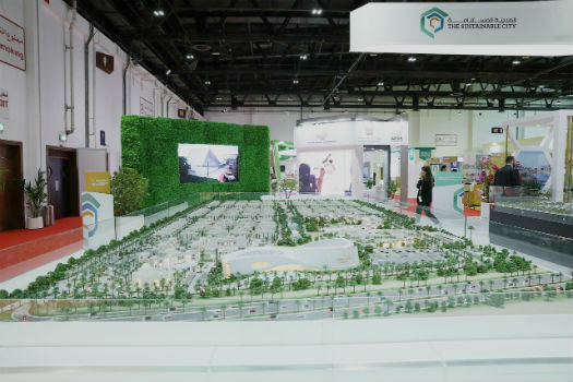
Futuristic Technologies on Display at Future Cities Show (from import)

Futuristic Technologies on Display at Future Cities Show

10th April 2019

Futuristic Technologies on Display at Future Cities Show
OGC publishes results from its Testbed-14 Innovation Initiative (from import)
OGC publishes results from its Testbed-14 Innovation Initiative

10th April 2019

OGC publishes results from its Testbed-14 Innovation Initiative
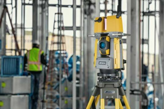
NEW scanning robotic solution for vertical construction from Topcon (from import)

NEW scanning robotic solution for vertical construction from Topcon

10th April 2019

NEW scanning robotic solution for vertical construction from Topcon

Hemisphere GNSS Announces New Atlas®-Capable GNSS Compass
9th April 2019

Hemisphere GNSS Announces New Atlas®-Capable GNSS Compass
CGG Launches MineScope for Essential Insight throughout the Mining Lifecycle (from import)

CGG Launches MineScope for Essential Insight throughout the Mining Lifecycle
9th April 2019

CGG Launches MineScope for Essential Insight throughout the Mining Lifecycle
Future Cities Show (from import)

Future Cities Show

9th April 2019

Future Cities Show
Maptitude 2019 Is Available Now (from import)

Maptitude 2019 Is Available Now

9th April 2019

Maptitude 2019 Is Available Now
COUNT Series - Higher Level of Photon Conversion Efficiency (from import)
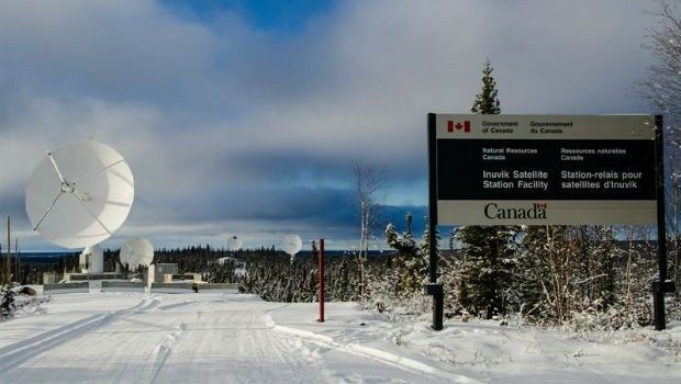
COUNT Series - Higher Level of Photon Conversion Efficiency

9th April 2019

COUNT Series - Higher Level of Photon Conversion Efficiency
Canadian-Swedish co-operation to strengthen Earth Observation (from import)

Canadian-Swedish co-operation to strengthen Earth Observation

9th April 2019

Canadian-Swedish co-operation to strengthen Earth Observation

Airbus and The Climate Corporation join forces

9th April 2019

Airbus and The Climate Corporation join forces
New Topcon automatic excavator system featuring fingertip control (from import)
New Topcon automatic excavator system featuring fingertip control

8th April 2019

New Topcon automatic excavator system featuring fingertip control
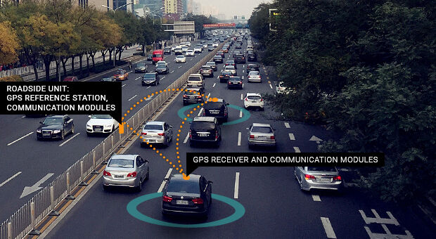
Septentrio GPS/GNSS helps cars work together to avoid collisions on a ‘Smart Highway’ (from import)

Septentrio GPS/GNSS helps cars work together to avoid collisions on a ‘Smart Highway’

8th April 2019

Septentrio GPS/GNSS helps cars work together to avoid collisions on a ‘Smart Highway’

Sercel Brings its Technical Expertise to Structural Health (from import)

Sercel Brings its Technical Expertise to Structural Health

8th April 2019

Sercel Brings its Technical Expertise to Structural Health

Hemisphere GNSS Introduces GradeMetrix™ Positioning Systems

8th April 2019

Hemisphere GNSS Introduces GradeMetrix™ Positioning Systems
UAE’s intelligent transportation system sector (from import)

UAE’s intelligent transportation system sector

7th April 2019

UAE’s intelligent transportation system sector