
Cartography
The compilation, reproduction and dissemination of maps and charts by means of manual (analogue) or digital techniques, tools and workflows. This topic covers the compilation, reproduction, dissemination and use of both analogue (paper) and digital maps, charts and atlases. As well as the science of cartography, including georeferencing and geocoding, digital techniques for compiling and generating various types of raster and vector maps and charts are covered, as are the digital mapping tools and Geographic Information Systems available for this purpose. The application of cartography for aeronautical, terrestrial and marine purposes is also covered
Workshop and Presentation Proposals Invited for #GIS/ValTech2020
8th May 2019
Workshop and Presentation Proposals Invited for #GIS/ValTech2020
Infrastructure Inspection – UAS Are All Over It
8th May 2019
Infrastructure Inspection – UAS Are All Over It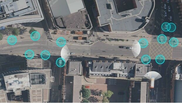

Maptitude Mapping Software Team Provides Awards & Prizes for 2019 AAG
8th May 2019
Maptitude Mapping Software Team Provides Awards & Prizes for 2019 AAG
CSA Completes Field Surveys Offshore Puerto Rico
8th May 2019
CSA Completes Field Surveys Offshore Puerto Rico
TCarta teams up with King’s College London and wins ESA Funding
7th May 2019
TCarta teams up with King’s College London and wins ESA Funding
Engineering Reports and Videos documenting successful Vector Tiles Pilot
7th May 2019
Engineering Reports and Videos documenting successful Vector Tiles Pilot
HERE powers new serverless location-based functions
7th May 2019
HERE powers new serverless location-based functions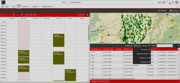
PTV Group's new route planning app now available on Salesforce AppExchange
7th May 2019
PTV Group's new route planning app now available on Salesforce AppExchange
Firefighting drones are the future of fire safety
7th May 2019
Firefighting drones are the future of fire safety
Globalstar Satellite IoT Devices for Smart Animal Tracking
7th May 2019
Globalstar Satellite IoT Devices for Smart Animal Tracking
GEO Business acts to improve gender balance in Geospatial
7th May 2019
GEO Business acts to improve gender balance in Geospatial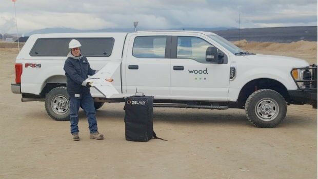
Wood Adopts Delair UX11 UAV For Large Scale Surveying
7th May 2019
Wood Adopts Delair UX11 UAV For Large Scale Surveying
Caliper Offers 2019 Census Block Groups Data
7th May 2019
Caliper Offers 2019 Census Block Groups Data
Esri releases ArcGIS 10.7 unifying Esri software and services
6th May 2019
Esri releases ArcGIS 10.7 unifying Esri software and services
Airbus takes next major step for Telesat’s LEO satellite constellation
6th May 2019
Airbus takes next major step for Telesat’s LEO satellite constellation
Airbus to build multimission satellite for MEASAT
6th May 2019
Airbus to build multimission satellite for MEASAT
Hisdesat appoints Airbus and Thales Alenia Space
6th May 2019
Hisdesat appoints Airbus and Thales Alenia Space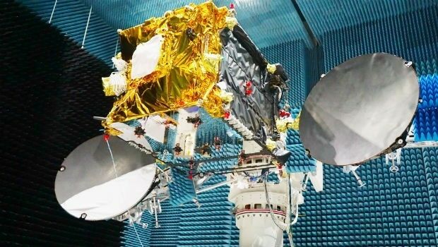
Launch of the second SpaceDataHighway satellite
6th May 2019
Launch of the second SpaceDataHighway satellite
Orbit GT and TCract, France, sign Reseller Agreement
6th May 2019
Orbit GT and TCract, France, sign Reseller Agreement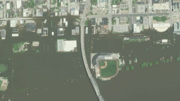
Space Flight Laboratory Highlights Microspace Earth Observation
4th May 2019
Space Flight Laboratory Highlights Microspace Earth Observation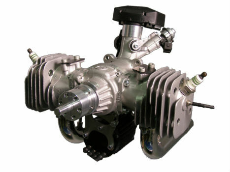
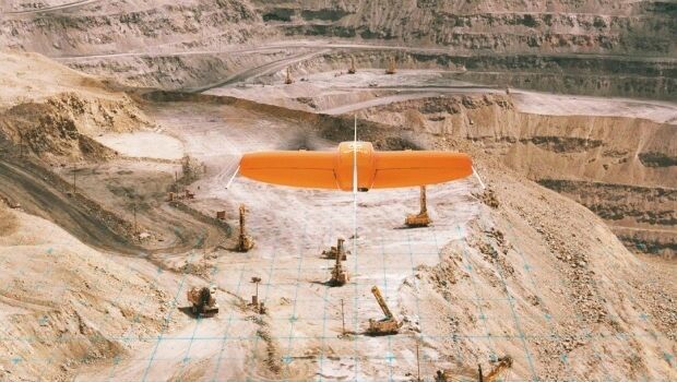
The Future is Two-Stroke: Hirth Engines Look to the Future of Hybrid UAVs
3rd May 2019
The Future is Two-Stroke: Hirth Engines Look to the Future of Hybrid UAVs

Geospatial luminary runs London Marathon for MapAction
2nd May 2019
Geospatial luminary runs London Marathon for MapAction
GeoDATA Forum Announce thought provoking programme
2nd May 2019
GeoDATA Forum Announce thought provoking programme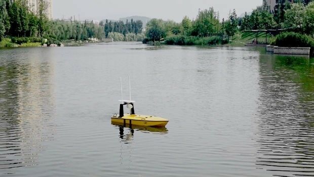
A new, high-performing USV for ocean surveying
2nd May 2019
A new, high-performing USV for ocean surveying
Submissions for Galileo Masters 2019 Open May 1
2nd May 2019
Submissions for Galileo Masters 2019 Open May 1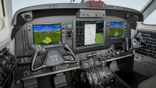
Garmin offers new upgrades for G1000 NXi-equipped King Air aircraft
2nd May 2019
Garmin offers new upgrades for G1000 NXi-equipped King Air aircraft
Several Speakers and Sessions Added to GEOINT 2019 Agenda
2nd May 2019
Several Speakers and Sessions Added to GEOINT 2019 Agenda
Samsung SDS and Telensa Partner for Smart City Infrastructure
2nd May 2019
Samsung SDS and Telensa Partner for Smart City Infrastructure
OGC calls for Sponsors of a major Innovation Initiative, Testbed 16
2nd May 2019
OGC calls for Sponsors of a major Innovation Initiative, Testbed 16
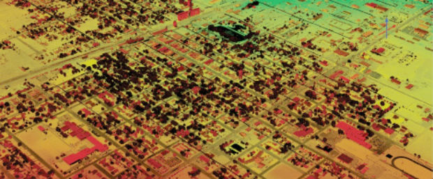
ISG Transforms BIM Delivery Using Pointfuse Laser Scanning Software
1st May 2019
ISG Transforms BIM Delivery Using Pointfuse Laser Scanning Software
Bench-Guard™ and Table-Guard™ - Laser Barriers
1st May 2019
Bench-Guard™ and Table-Guard™ - Laser Barriers
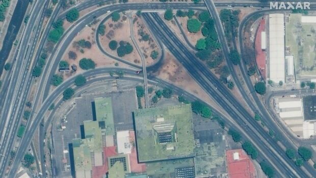
Satellite Imagery: Caracas, Venezuela Protests
1st May 2019
Satellite Imagery: Caracas, Venezuela Protests
Free Highway Exits & Interchanges Data for Use with Maptitude 2019
1st May 2019
Free Highway Exits & Interchanges Data for Use with Maptitude 2019
Wingtra partners with 3DR to offer a complete aerial surveying solution
30th April 2019
Wingtra partners with 3DR to offer a complete aerial surveying solutionScotland’s Rural College Contracts thinkWhere to Deliver GIS
30th April 2019
Scotland’s Rural College Contracts thinkWhere to Deliver GIS
OceanWise Scottish Marine Data Workshop – a great success!
30th April 2019
OceanWise Scottish Marine Data Workshop – a great success!
Tugdual Le Bouar appointed to lead CARL Software, as Managing Director
30th April 2019
Tugdual Le Bouar appointed to lead CARL Software, as Managing Director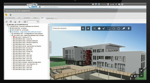
CARL Software presents its new solutions for operational BIM
30th April 2019
CARL Software presents its new solutions for operational BIM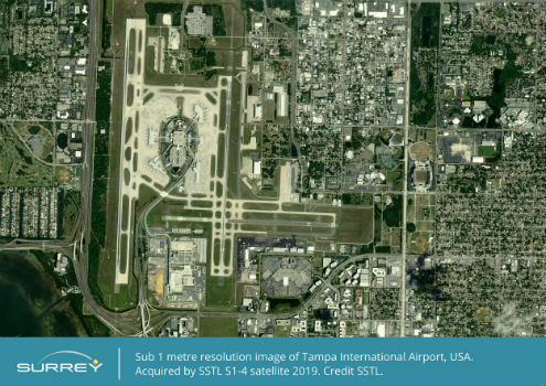
SSTL announces new Earth Observation data contract with Airbus
30th April 2019
SSTL announces new Earth Observation data contract with Airbus