Hemisphere GNSS Announces New Atlas®-Capable GNSS Compass
9th April 2019
Hemisphere GNSS Announces New Atlas®-Capable GNSS CompassThe compilation, reproduction and dissemination of maps and charts by means of manual (analogue) or digital techniques, tools and workflows. This topic covers the compilation, reproduction, dissemination and use of both analogue (paper) and digital maps, charts and atlases. As well as the science of cartography, including georeferencing and geocoding, digital techniques for compiling and generating various types of raster and vector maps and charts are covered, as are the digital mapping tools and Geographic Information Systems available for this purpose. The application of cartography for aeronautical, terrestrial and marine purposes is also covered
9th April 2019
Hemisphere GNSS Announces New Atlas®-Capable GNSS Compass
9th April 2019
CGG Launches MineScope for Essential Insight throughout the Mining Lifecycle
9th April 2019
COUNT Series - Higher Level of Photon Conversion Efficiency
9th April 2019
Canadian-Swedish co-operation to strengthen Earth Observation9th April 2019
Airbus and The Climate Corporation join forces8th April 2019
New Topcon automatic excavator system featuring fingertip control8th April 2019
Septentrio GPS/GNSS helps cars work together to avoid collisions on a ‘Smart Highway’8th April 2019
Sercel Brings its Technical Expertise to Structural Health8th April 2019
Hemisphere GNSS Introduces GradeMetrix™ Positioning Systems
7th April 2019
UAE’s intelligent transportation system sector6th April 2019
2nd SmallSat & Space Access Summit to Take Place June 5-6, 2019
5th April 2019
Juniper Systems releases Archer 3 Rugged Handheld
5th April 2019
2010 Census Data and 2017 ACS Data for Use with Maptitude5th April 2019
Esri helps Lithuanian Transport Safety Administration5th April 2019
First private Moon lander now in orbit around the Moon5th April 2019
Landmark Valuation Services celebrates Q-Mobile’s five millionth milestone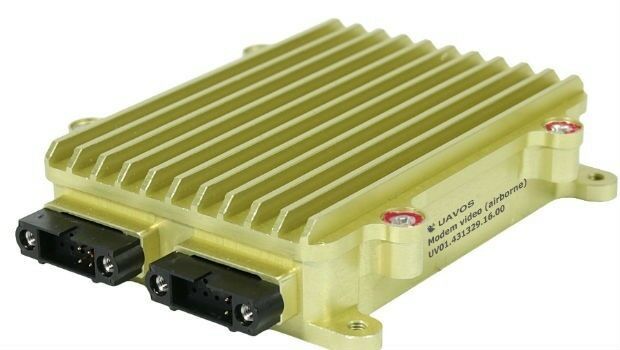
5th April 2019
UAVOS Launched Advanced Data Link for Unmanned Systems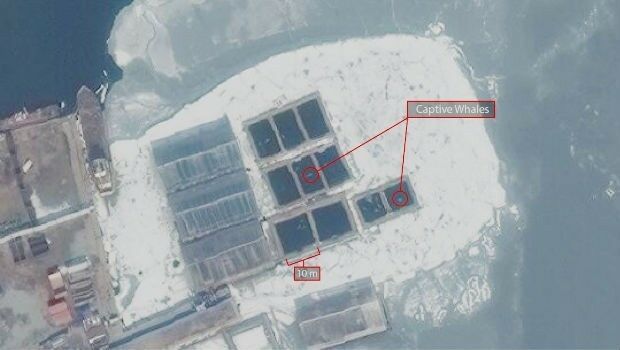
5th April 2019
Russia: Satellite Imagery shows whales held captive in Srednyaya Bay5th April 2019
CHC Navigation Announces Opening of its North American Headquarters5th April 2019
The Institute Of Navigation Releases Beidou Navigation System Special Issue Journal5th April 2019
New Version of the Global Mapper SDK Now Available5th April 2019
ultra-efficient battery for the SXblue receivers product line
5th April 2019
EUMETSAT control room wins Prolight + Sound Award for SWiCA4th April 2019
IP EXPO Manchester 2019 ends with a stark reminder
4th April 2019
Smart cities predicted to deliver more than USD 20 trillion4th April 2019
HawkEye 360 Launches First Commercial Product – RFGeo
4th April 2019
Wide Range of Cutting Edge Seminars and Workshops
4th April 2019
Anglo-Japanese motion sensing joint venture

4th April 2019
Radius boosts telematics division with acquisition of Plant-i
3rd April 2019
OGC invites developers to the OGC API Hackathon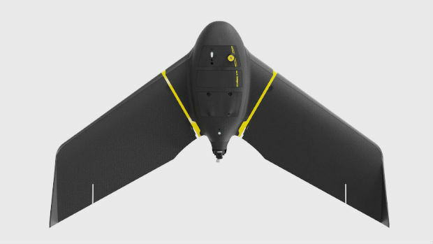
3rd April 2019
senseFly eBee as United States’ Most Popular Commercial Fixed-Wing.jpg)
3rd April 2019
Space tech set to help combat cocoa-fuelled deforestation3rd April 2019
Garmin® demonstrates datalink weather broadcast for pilots in Germany3rd April 2019
RIEGL will be attending and exhibiting at Automate 2019!
2nd April 2019
Golden Software Announces Time Series Data Visualization Webinar
2nd April 2019
WingtraOne & RedEdge-MX: map complicated environments
2nd April 2019
Disasters Resilience 2019 & GEOSS Architecture Implementation Pilot

2nd April 2019
Teledyne CARIS Onboard 2.1 to be featured at Ocean Business 2019
2nd April 2019
JMHC LOGISTICS EXPANDS CTRACK TELEMATICS SOLUTION