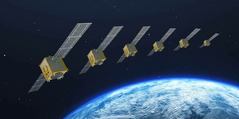
Galileo 2nd generation satellites ready to navigate into the future
8th March 2022
Galileo 2nd generation satellites ready to navigate into the futureNews as it happens! Keep in touch with the latest developments in business and technology in the regions or worldwide.
8th March 2022
Galileo 2nd generation satellites ready to navigate into the future
7th March 2022
3D PluraView – stereoscopic 3D-visualisation for the oil- and gas industry
4th March 2022
Cadcorp SIS 9 service release provides additional benefits to users
4th March 2022
SurvTech Using SimActive Software for Energy Infrastructure Projects
4th March 2022
GISCI Announces GISCI Endorsement Designation
4th March 2022
Recordings Are Now Available For The Riegl Ultimate Lidar February 2022 Webinars

2nd March 2022
Scientists Deploy Globalstar SPOT Trace to Monitor Currents and Biodiversity in the World’s Oceans
2nd March 2022
TDI-Brooks Adds Datem Neptune 5000 Cpt To Geotechnical Capabilities
1st March 2022
RIEGL VMX-2HA Mobile Mapping System in Use for greehill Urban Forest Car
1st March 2022
Join “Mining Peru 2022” in Lima to meet leaders of industry and get the best practices for the mining sector
25th February 2022
CSA and BOEM to Publish Online Open-Access Atlas of US Submarine Canyons
25th February 2022
UltraCam Eagle Delivers Efficiency and Quality for Arrowhawk Imaging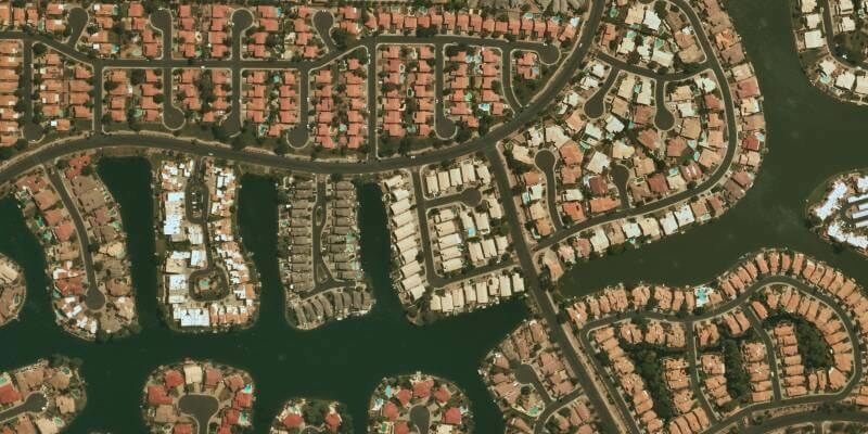
24th February 2022
UP42 Partners with Near Space Labs to Offer Very High-Resolution Imagery using Zero-Emission Balloons
24th February 2022
Bluesky Adds Scottish Cities to MetroVista 3D City Line-up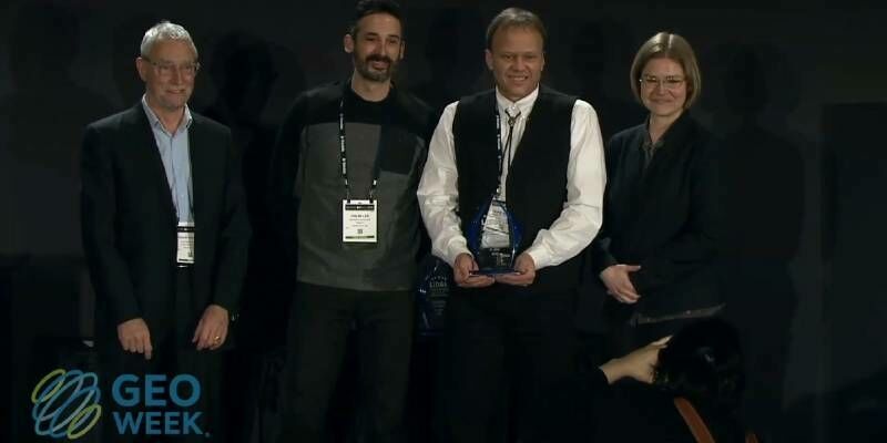
23rd February 2022
Geo Week 2022 Brings the Geospatial and Built Worlds Together In-Person, Exceeds Expectations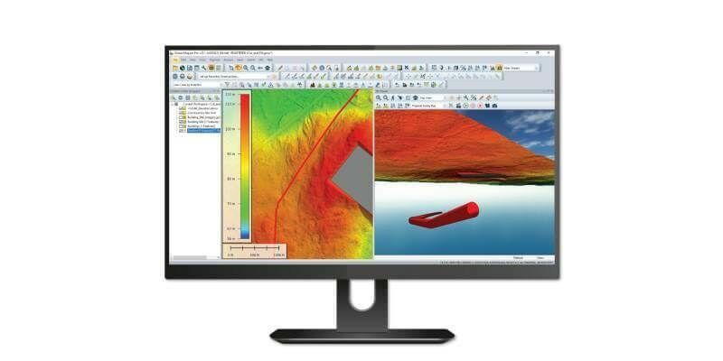
23rd February 2022
Blue Marble Geographics Releases Global Mapper and Global Mapper Pro version 23.1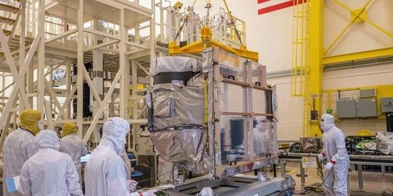
22nd February 2022
L3Harris Completes Imager Integration For NOAA's Advanced Environmental Satellite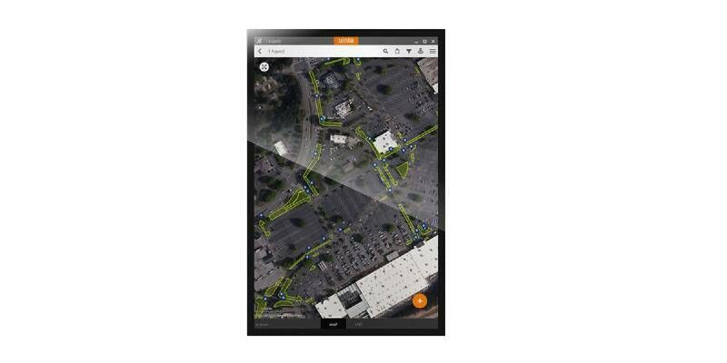
22nd February 2022
Juniper Systems Limited Launches Uinta Software for Android OS Devices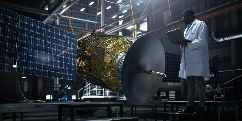
21st February 2022
University of Bradford has plans to launch a mini-satellite into space by 2023
21st February 2022
MAPPS Geospatial Excellence Award Projects for spectacular NV5 and GEO1 projects
17th February 2022
TerraGo Joins the Esri ArcGIS Marketplace with GeoPDF Publisher for ArcGIS Pro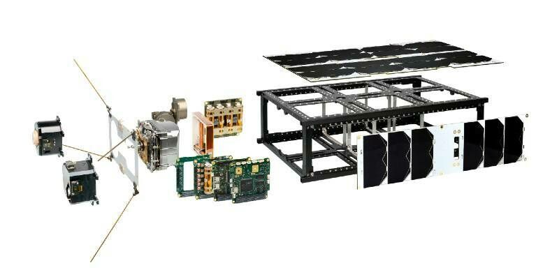
17th February 2022
UNSW Sydney buys nanosatellite bus from NanoAvionics for its Satellite Innovation Laboratory
16th February 2022
XMAP Cloud GIS Brings Government Flexible Working Closer to Home