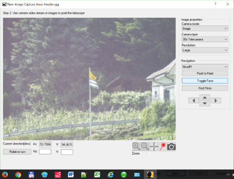
Leica Geosystems introduces imagery, live video stream to monitoring
13th June 2017
Leica Geosystems introduces imagery, live video stream to monitoringThe 2D and 3D measurement of points, distances and angles of features and objects on the Earth’s surface. See also Surveying Instrumentation topic. This topic covers the science and techniques that govern the 2D and 3D measurement of points, distances and angles of natural and man-made features and objects on the Earth’s surface. These measurements are acquired for a wide range of practical applications in construction, engineering, land use planning, mapmaking and cadastral projects, See also Surveying Instrumentation topic for the various tools employed to acquire survey measurements.
13th June 2017
Leica Geosystems introduces imagery, live video stream to monitoring
13th June 2017
Pan-Europe commercial drone event starts next Tuesday. Don’t miss!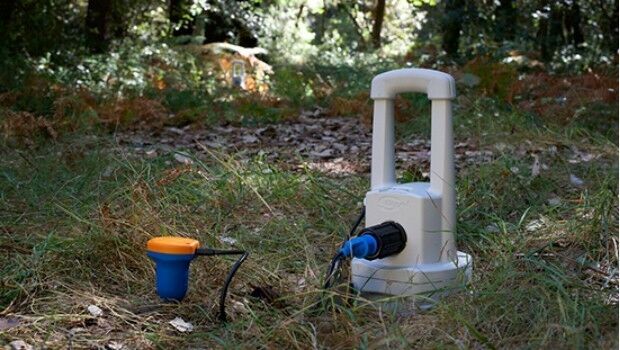
13th June 2017
Sercel Improves Versatility of 508XT Land Acquisition System
9th June 2017
Martek appoint leading UAS “Subject Matter Expert” as Technical Manager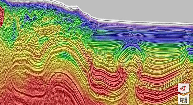
9th June 2017
CGG Delivers Final Data from Encontrado project over Perdido fold belt

6th June 2017
Fugro Venturer To Commence Offshore Survey Campaign
6th June 2017
Leica Geosystems’ new 3D imaging laser scanner now available3rd June 2017
Boost in Performance from the Galileo Constellation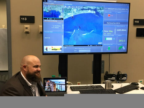
2nd June 2017
Faster and Safer Operations to Navy Missions
2nd June 2017
Driving into the future at simulated The Oxford Science Park
2nd June 2017
Paul Forster: Martek Marine hire Head of UAV Operations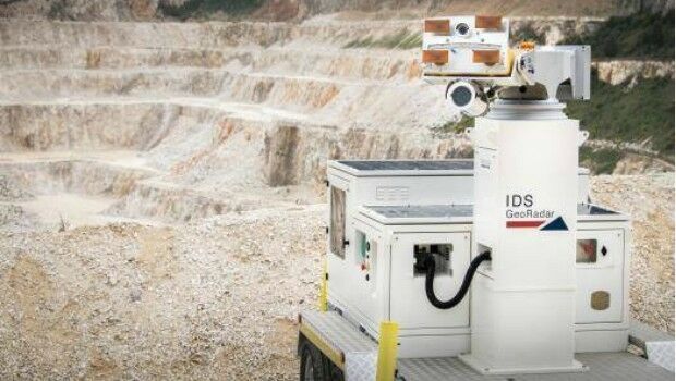
1st June 2017
IDS GeoRadar unveils next generation radar technology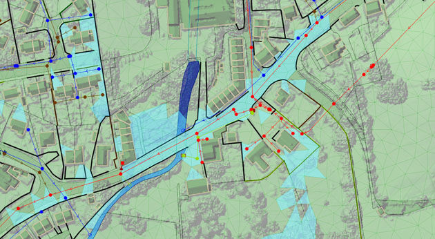
1st June 2017
Bluesky Laser Mapping Helps Create Flood Alleviation Model for Yorkshire Water
30th May 2017
Get Ready for a smarter way to view the world
30th May 2017
Portable UltraCam Panther Offers High-Quality Imagery, Video and LiDAR.jpg)
27th May 2017
National Flood Forecasting and Warning System for Malaysian rivers27th May 2017
Topcon Brings Future of Surveying to Geo Business 2017
18th May 2017
Satlab announces SLX-1 Multi-application Receiver Mobile Upgrade
18th May 2017
Pointfuse Point Cloud Conversion in Arena4D at GEO Business 2017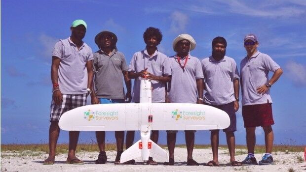
17th May 2017
Aeromapper Talon Surveys A Whole Maldives Island In A Single Flight
15th May 2017
1Spatial releases dates for exciting FME World Tour, courses, webinars11th May 2017
30 Years of Success Leads DAT/EM to Virtual Reality and UAS
11th May 2017
TDI-Brooks International To Perform Site Surveys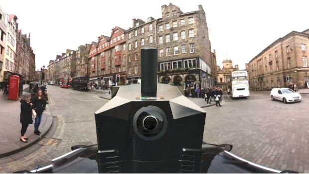
11th May 2017
NCTech partners with Google to pilot new 360-degree Street View camera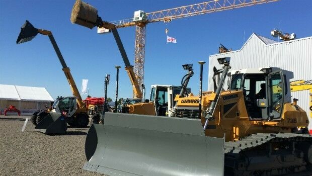
10th May 2017
Leica Ready now offered on Liebherr dozers, excavators_vsm.jpg)
10th May 2017
Fugro Commences Mareano Survey For Norwegian Hydrographic Service
8th May 2017
Parrot develops its commercial drone offer with end-to-end solutions
4th May 2017
Save €225! Early-bird pricing ends tomorrow4th May 2017
Hydrographic Surveys To Improve Maritime Safety In Papua New Guinea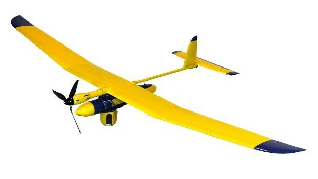
1st May 2017
Elbit Systems of America Presents UAS Capabilities1st May 2017
Maptek advanced modelling and analysis solutions showcased at CIM
28th April 2017
Creaform HandySCAN 3D scanner now certified by Airbus28th April 2017
Join the Leica iCON build webinar on 4 May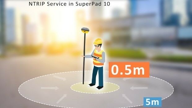
26th April 2017
Enjoying the High-Accuracy Positioning with the Latest SuperPad 10
21st April 2017
New GNSS receiver boards with expanded constellation tracking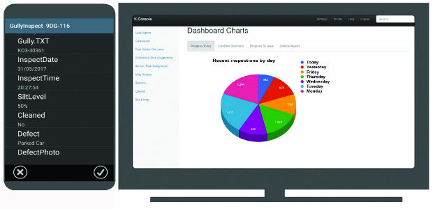
19th April 2017
K-Gully a hosted gully cleaning management system for contractors.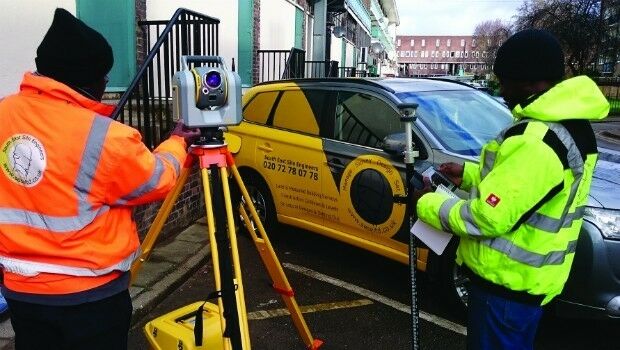
13th April 2017
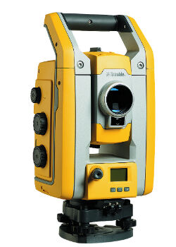
Millimeter Accuracy for Monitoring Applications
13th April 2017
EarthSense Show Trees are Most Cost Effective Way of Tackling Urban Air Pollution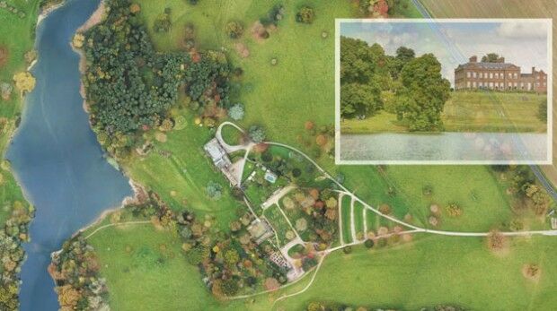
11th April 2017
National Trust Deploys Laser Survey Aircraft from Bluesky to Map in 3D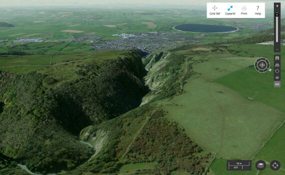
7th April 2017
Cambridge Conference 2017 - Mapping Nations: The Next Decade6th April 2017
Wireless Monitoring to Streamline Utility Operations
6th April 2017
Bluesky LiDAR Maps Used to Monitor the Spread of Deadly Tree Disease