New Leica Zeno GG04 smart antenna enhances tracking performance
6th April 2017
New Leica Zeno GG04 smart antenna enhances tracking performanceThe 2D and 3D measurement of points, distances and angles of features and objects on the Earth’s surface. See also Surveying Instrumentation topic. This topic covers the science and techniques that govern the 2D and 3D measurement of points, distances and angles of natural and man-made features and objects on the Earth’s surface. These measurements are acquired for a wide range of practical applications in construction, engineering, land use planning, mapmaking and cadastral projects, See also Surveying Instrumentation topic for the various tools employed to acquire survey measurements.
6th April 2017
New Leica Zeno GG04 smart antenna enhances tracking performance
29th March 2017
Bluesky 3D maps help protect coastal heritage sites in new EU Project
29th March 2017
Arithmetica and point3D Partnership Promises Digital Transformation in 3D Modelling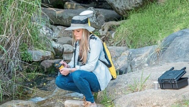

27th March 2017
Sign up for a free Trimble Scanning Workshop
27th March 2017
Bluesky Launches New Online Resource for Geographic Information of Ireland
24th March 2017
Next SuperSurv 10 Release Will Add Powerful Features
22nd March 2017
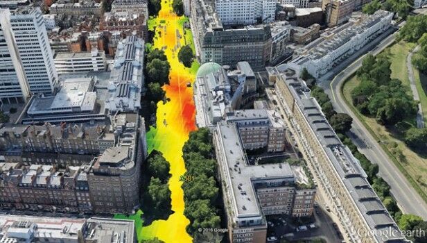
EarthSense Systems Computer Models Impact of Trees on Urban Air Pollution17th March 2017
Fugro hunts for more Hydrocarbon Seeps in US Gulf of Mexico
15th March 2017
Bluesky Acquires US Aerial Survey Company Col-East14th March 2017
RICS unveils plans to get tough on conflicts of interest:14th March 2017
OS and Trimble collaborate to aid geospatial industry innovation
13th March 2017
Highways England renews Trimble VRS Now license
10th March 2017
Fast LiDAR data viewer streamlines work of local governments10th March 2017
Topcon announces new Wi-Fi capability for imaging station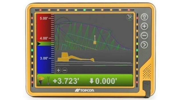
9th March 2017
New 10-inch touchscreen display for construction machine control8th March 2017
Swedish energy company E.ON has chosen Digpro8th March 2017
Maptek delivers innovative smaller lighter, faster laser scanner7th March 2017
Hemisphere GNSS Introduces IronOne Rugged Display & Computer6th March 2017
EarthSense Scientists Help Students Map Air Pollution for BBC News
27th February 2017
Handheld's New Ultra-mobile ALGIZ 8X Rugged Tablet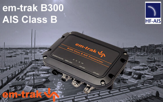
25th February 2017
em-trak is pleased to announce the launch of the new B300 AIS Class B
23rd February 2017
Businesses Aided with Turn-key Streetview Camera Solution
23rd February 2017
New Enterprise Tracks Headline InterDrone 2017 Call For Speakers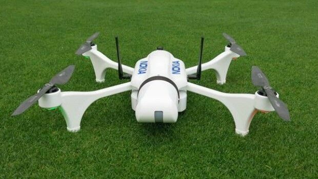
17th February 2017
Nokia showcases power of drones and LTE connectivity for public safety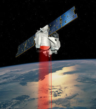
17th February 2017
MERLIN – the first Franco-German Earth observation satellite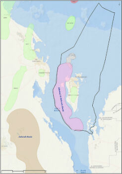
16th February 2017
CGG Completes Industry-First FalconPlus Survey for Bapco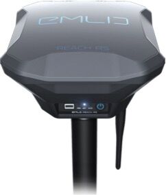
16th February 2017
Emlid unveils Reach RS: field-ready RTK GNSS receiver for only $699
13th February 2017
New Leica SPL100 brings up to 10x more efficiency to airborne LiDAR mapping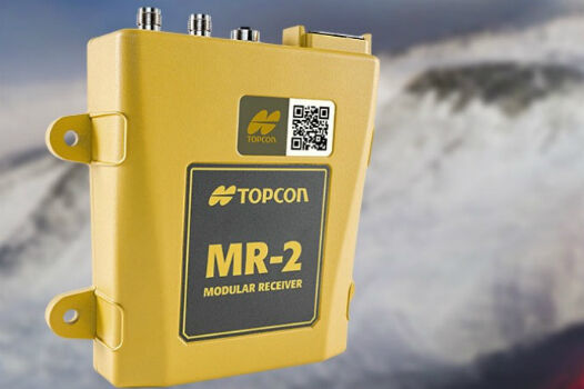
10th February 2017
Topcon GNSS modular receiver integrates with a wide-range of applications9th February 2017
Aeryon and DroneDeploy Partner to Deliver Enterprise UAS Solutions
9th February 2017
Bluesky Wins Innovation Funding for Mobile Phone Mapping Project8th February 2017
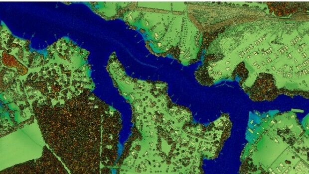
CSA Presents Advanced Coastal Aerial Image Analysis Techniques
8th February 2017
ALGIZ 8X Rugged Tablet, a New Tough Computer from Handheld7th February 2017
Fugro’s Below-Ground Picture Supports Above-Ground Operations7th February 2017
Renishaw releases updated Void Scanner cavity monitoring system
6th February 2017
Bluesky Appoints Strategic Development Manager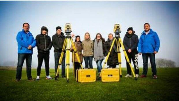
6th February 2017
Topcon helps COYO to inspire the next generation of land surveyors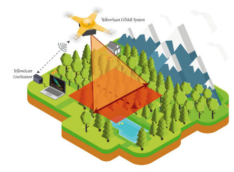
6th February 2017
YellowScan launches YellowScan LiveStation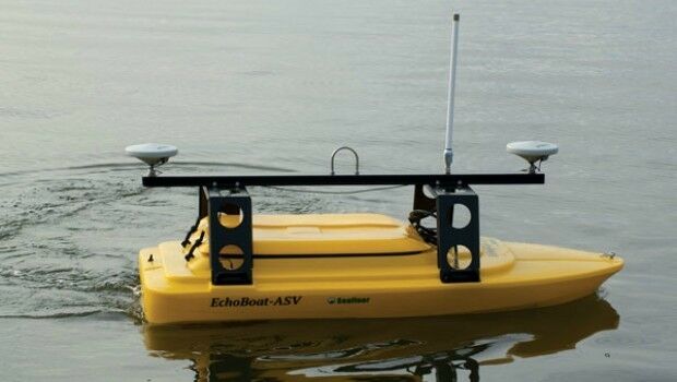
3rd February 2017
Seafloor Systems Introduces Its EchoBoat-G2 Survey Boat2nd February 2017
CartoPac Adds iOS Support to Mobile Asset Management Software Suite
2nd February 2017
Leica Geosystems wins prestigious PRISM Award