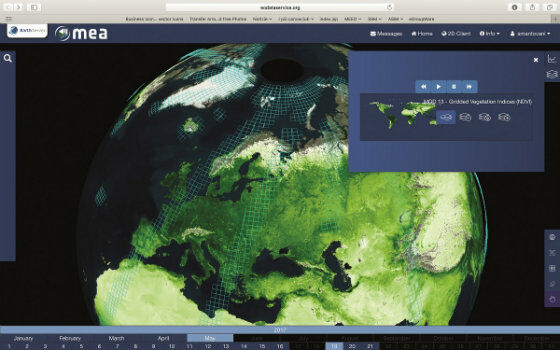
EarthServer: 1+ Petabyte Analysis-Ready Datacubes
25th November 2017
EarthServer: 1+ Petabyte Analysis-Ready DatacubesThe 2D and 3D measurement of points, distances and angles of features and objects on the Earth’s surface. See also Surveying Instrumentation topic. This topic covers the science and techniques that govern the 2D and 3D measurement of points, distances and angles of natural and man-made features and objects on the Earth’s surface. These measurements are acquired for a wide range of practical applications in construction, engineering, land use planning, mapmaking and cadastral projects, See also Surveying Instrumentation topic for the various tools employed to acquire survey measurements.
25th November 2017
EarthServer: 1+ Petabyte Analysis-Ready Datacubes
22nd November 2017
The world is on the brink of a technological revolution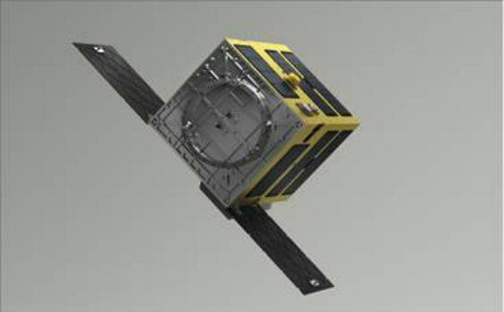
22nd November 2017
SSTL and ASTROSCALE team up for Orbital Debris Removal missions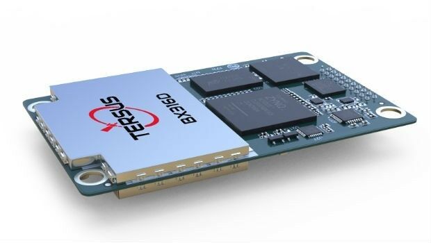
21st November 2017
Tersus Announces BX316D to Extend GNSS OEM Board Offering
21st November 2017
Rennes, France Virtually Experiences its Sustainable Future21st November 2017
New Precise Point Positioning Module comes to Carlson SurveyGNSS
20th November 2017
New Announcement from Aero Surveillance Systems16th November 2017
GeoCue adds Puerto Rico LIDAR data to Support Hurricane Recovery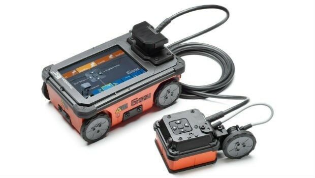
15th November 2017
GSSI Showcases It’s Latest GPR Technology at World of Concrete 2018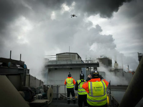
15th November 2017
Centrik Helps Texo DSI Evidence UAV Excellence15th November 2017
Trimble Expands CenterPoint RTX FAST Correction Service15th November 2017
Hi-Target introduces new high performance GNSS Receiver and GIS product
13th November 2017
MV Kobi Ruegg Joins Fugro’s Survey Vessel Fleet13th November 2017
JLT Mobile Computers Selected by Steketee for Smart Farming13th November 2017
Hemisphere GNSS Announces Major Enhancements to Its Atlas® GNSS12th November 2017
Hemisphere GNSS Debuts A222 Scalable GNSS Smart Antenna10th November 2017
Tersus Announces Precis Board Firmware V1.15 Release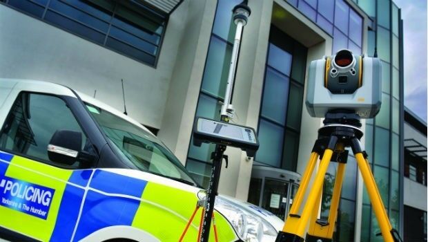
8th November 2017
West Yorkshire Police adopt Trimble SX10 technology8th November 2017
Introducing new high-performance, large screen Trimble T10 tablet
7th November 2017
Bluesky Aerial Photos Help South Pennines Moor Conservation1st November 2017
Swift Enhances its Centimeter-Accurate GNSS Technology31st October 2017
Sierra Leone Makes Fourth Licensing Round Pre-Announcement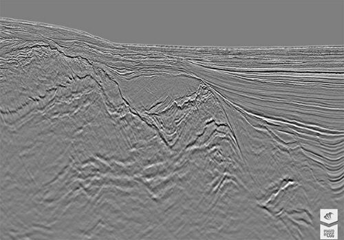
30th October 2017
CGG Delivers Final PSDM Products for Cairenn Multi-Client Survey27th October 2017
OGC supports American Geographical Society’s 2017 Fall Symposium
27th October 2017
Topcon helps DEC! develop maths skills that are fit for site.jpg)
26th October 2017
Fugro Applies Seeps Expertise To Canada’s Growing Offshore Industry26th October 2017
Commercial UAV Expo and Drone World Expo Come Together in 201826th October 2017
Tulloch Mapping Purchases the FIRST RIEGL VMX-2HA!
25th October 2017
Bluesky's Tree Map Helps Community Forest Rebuild Environment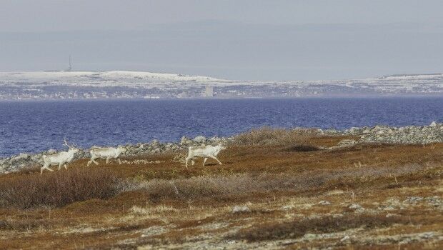
24th October 2017
Globalstar IoT Solution Protects Norway Reindeer from Train Collisions23rd October 2017
Commercial UAV Expo Announces Highlights of Upcoming 2017 Event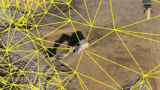
21st October 2017
Virtual Surveyor Unveils Productivity Tools at Commercial UAV Expo16th October 2017
Topcon launches three new technology updates for the built environment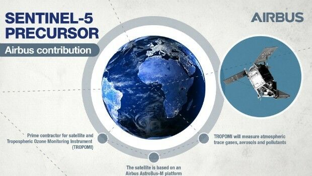
14th October 2017
Sentinel-5P successfully launched to monitor world’s pollution13th October 2017
Maptek Announces New Montréal and Vancouver Offices
13th October 2017
Airborne LiDAR production fully integrated with Leica HxMap workflow
11th October 2017
First Lockheed Martin GPS III Satellite “Available for Launch

10th October 2017
UAV exhibition opens doors to businesses across Europe
9th October 2017
Collaboration for Constructioneering Academy initiative
6th October 2017
Top honour in the Wichmann Innovations Award at INTERGEO 2017