
Cartography
The compilation, reproduction and dissemination of maps and charts by means of manual (analogue) or digital techniques, tools and workflows. This topic covers the compilation, reproduction, dissemination and use of both analogue (paper) and digital maps, charts and atlases. As well as the science of cartography, including georeferencing and geocoding, digital techniques for compiling and generating various types of raster and vector maps and charts are covered, as are the digital mapping tools and Geographic Information Systems available for this purpose. The application of cartography for aeronautical, terrestrial and marine purposes is also covered

Juniper Systems Announces New Windows 10 Rugged Tablet: Mesa 2™
27th May 2016
Juniper Systems Announces New Windows 10 Rugged Tablet: Mesa 2™
Strategic cooperation: BARTHAUER software installed at RIWA
27th May 2016
Strategic cooperation: BARTHAUER software installed at RIWA
UK startup solves drone safety threat on a global scale
27th May 2016
UK startup solves drone safety threat on a global scale
PCI Delivers High Volume Production System to Skymap Global Singapore
27th May 2016
PCI Delivers High Volume Production System to Skymap Global Singapore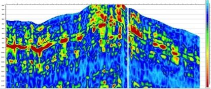
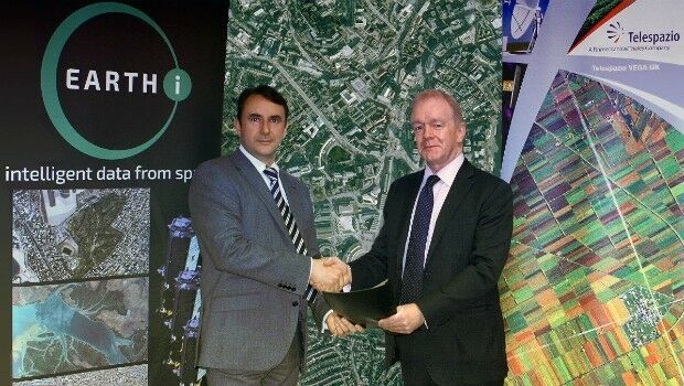
Earth-i and Telespazio Vega Sign Memorandum of Understanding
26th May 2016
Earth-i and Telespazio Vega Sign Memorandum of Understanding
Early Careers Network webinar on 8th June 2016
26th May 2016
Early Careers Network webinar on 8th June 2016
Bentley Calls for Submissions to the 2016 Be Inspired Awards
26th May 2016
Bentley Calls for Submissions to the 2016 Be Inspired Awards
Kieran Murphy is new Non-Executive Chair of Ordnance Survey
26th May 2016
Kieran Murphy is new Non-Executive Chair of Ordnance Survey
Esri's Marcella Cavallaro to Lead DATA Act Discussion Panel
26th May 2016
Esri's Marcella Cavallaro to Lead DATA Act Discussion Panel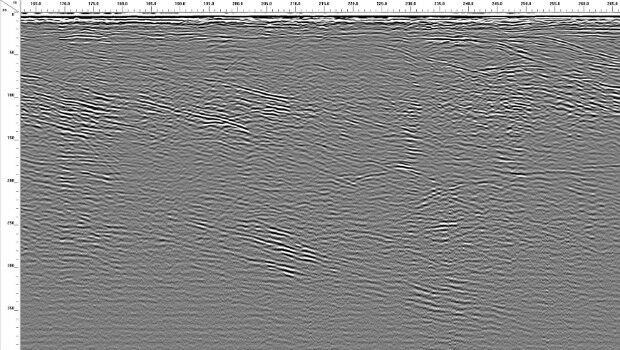
GSSI’s New 350 HS Antenna Uses HyperStacking™ Technology
26th May 2016
GSSI’s New 350 HS Antenna Uses HyperStacking™ Technology
OGC® invites Proposals for an Arctic Spatial Data Pilot project
26th May 2016
OGC® invites Proposals for an Arctic Spatial Data Pilot project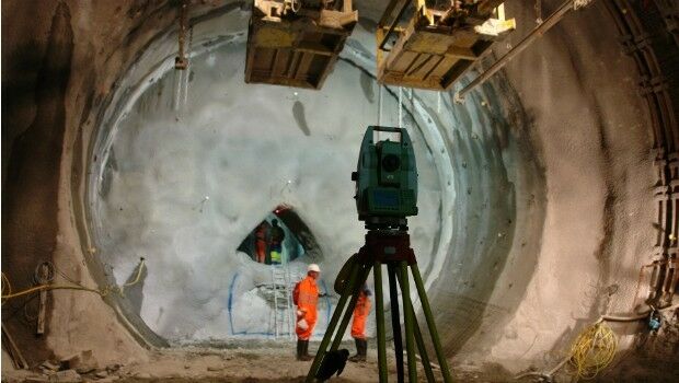
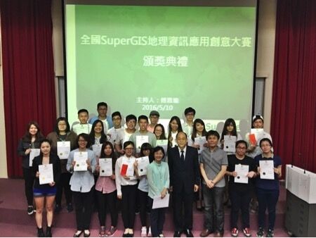
Shih Hsin University wins SuperGIS Youth Award 2016
26th May 2016
Shih Hsin University wins SuperGIS Youth Award 2016
Fugro Enables Safer Drilling For BP In Area Of Strong Currents
26th May 2016
Fugro Enables Safer Drilling For BP In Area Of Strong Currents
CV. Gunapris Elecom Selects SuperPad as GIS Solution
26th May 2016
CV. Gunapris Elecom Selects SuperPad as GIS Solution
IMCA CMID Workshop to be held at Seawork International
25th May 2016
IMCA CMID Workshop to be held at Seawork International
Nation's Largest Geography Department Honors Esri Education Team
25th May 2016
Nation's Largest Geography Department Honors Esri Education Team
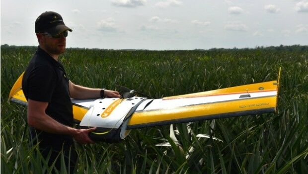
QuestUAV Training Team Starts Large-Team International Training
25th May 2016
QuestUAV Training Team Starts Large-Team International Training
CPH and AICP-CM Credits and Important GIS and Health Topics
25th May 2016
CPH and AICP-CM Credits and Important GIS and Health Topics
ABPmer support CEMEX marine aggregate extraction licence application
25th May 2016
ABPmer support CEMEX marine aggregate extraction licence application
OceanWise grows Distributor Network in South East Asia
25th May 2016
OceanWise grows Distributor Network in South East Asia
Septentrio expands in Europe by signing new partnership with Innovelec
24th May 2016
Septentrio expands in Europe by signing new partnership with Innovelec
OGC and SIBA sign Memorandum of Understanding
24th May 2016
OGC and SIBA sign Memorandum of Understanding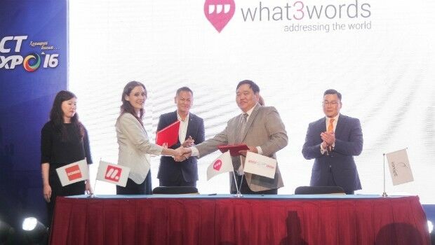
Mongolia adopts what3words as national postal addressing system
24th May 2016
Mongolia adopts what3words as national postal addressing system
Europa adopts Masternaut Connect to create connected fleet workforce
24th May 2016
Europa adopts Masternaut Connect to create connected fleet workforce
Deep Space Industries to Manufacture Pathfinder Small Satellites
24th May 2016
Deep Space Industries to Manufacture Pathfinder Small Satellites
Orbital Tracking Corp. Launches First Online Marketplace in China
24th May 2016
Orbital Tracking Corp. Launches First Online Marketplace in China
3D Laser Mapping Launches New Multiplatform Mapping System
24th May 2016
3D Laser Mapping Launches New Multiplatform Mapping System
FOCUS 35 Total Station Monitors Dam For Movement
23rd May 2016
FOCUS 35 Total Station Monitors Dam For Movement
Orbit GT to exhibit and lecture at GeoBusiness, London.
23rd May 2016
Orbit GT to exhibit and lecture at GeoBusiness, London.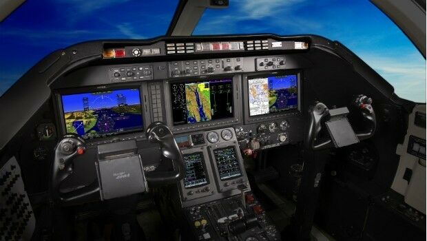
Final stages of Flight Deck Certification for the Garmin® G5000™
23rd May 2016
Final stages of Flight Deck Certification for the Garmin® G5000™
Esri Will Showcase Dedicated Winter Maintenance Solutions
20th May 2016
Esri Will Showcase Dedicated Winter Maintenance Solutions
Luciad Set to Disrupt at 2016 Geospatial World Forum
20th May 2016
Luciad Set to Disrupt at 2016 Geospatial World Forum
Advancing Digital Strategy through GIS Technology
20th May 2016
Advancing Digital Strategy through GIS Technology
Learn to Model Spatial Data and Quantify Uncertainty Using Esri ArcGIS
19th May 2016
Learn to Model Spatial Data and Quantify Uncertainty Using Esri ArcGIS
LizardTech to Demo Latest Version of Express Server
19th May 2016
LizardTech to Demo Latest Version of Express Server
ABACO is awarded the 2016 Geospatial Intelligence Award
19th May 2016
ABACO is awarded the 2016 Geospatial Intelligence Award
Airbus Defence and Space starts Orion service module assembly.
19th May 2016
Airbus Defence and Space starts Orion service module assembly.
CartoConsult delivers instant Smart City models with web streaming
19th May 2016
CartoConsult delivers instant Smart City models with web streaming
Topcon announces integration agreement with Volvo CE
19th May 2016
Topcon announces integration agreement with Volvo CE
HERE extends partnership with Toyota Motor Europe
19th May 2016
HERE extends partnership with Toyota Motor Europe