
Integration of Orion’s European Service Module
11th May 2016
Integration of Orion’s European Service ModuleThe compilation, reproduction and dissemination of maps and charts by means of manual (analogue) or digital techniques, tools and workflows. This topic covers the compilation, reproduction, dissemination and use of both analogue (paper) and digital maps, charts and atlases. As well as the science of cartography, including georeferencing and geocoding, digital techniques for compiling and generating various types of raster and vector maps and charts are covered, as are the digital mapping tools and Geographic Information Systems available for this purpose. The application of cartography for aeronautical, terrestrial and marine purposes is also covered
11th May 2016
Integration of Orion’s European Service Module
11th May 2016
Hyperspectral Imaging and Applications | HSI 2016 Announcement
11th May 2016
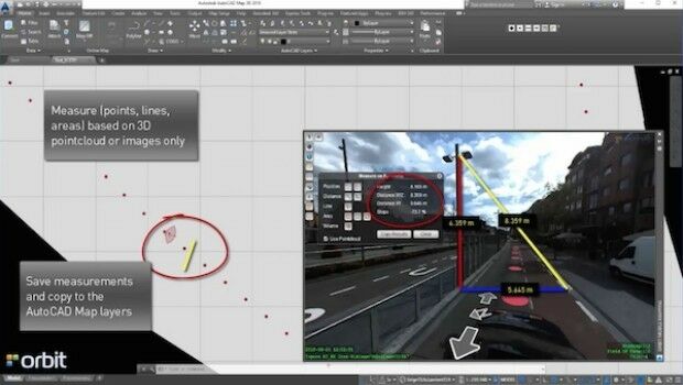
Orbit GT launches AutoCAD MAP plugin for Mobile Mapping

11th May 2016
The AgriFutureDays have been initiated by the Club of Ossiach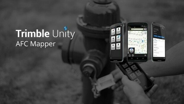
11th May 2016
Trimble Free App for AMERICAN Flow Control Water Valves and Hydrants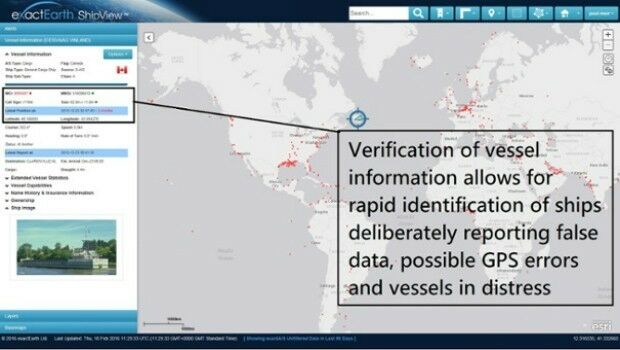
11th May 2016
Knowledge is Power- exactEarth Announces Vital New Information Service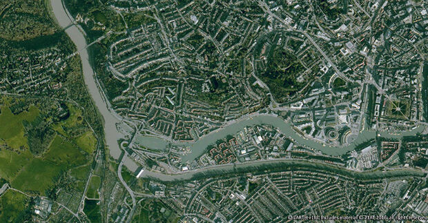
10th May 2016
Earth-i Takes the Best of British to Geospatial World Forum
10th May 2016
Humans in Southern Arabia 10,000 years earlier than first thought10th May 2016
2016 Esri National Security and Public Safety Summit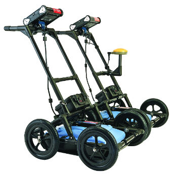
10th May 2016
Radiodetection launches new Ground Penetrating Radar systems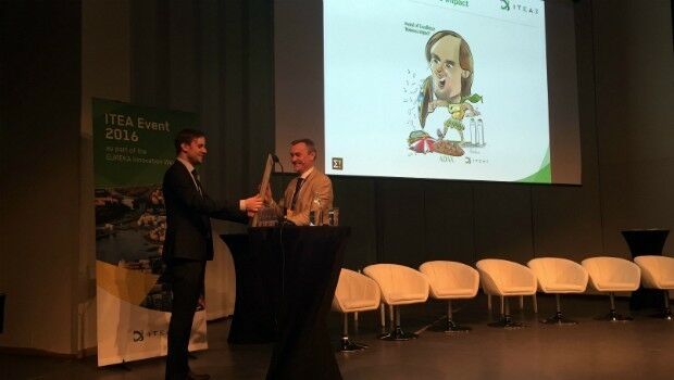
10th May 2016
Airbus D&S and partners win ITEA Award for fight against cyber threats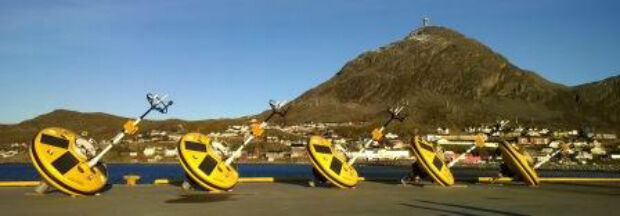
10th May 2016
Fugro commences Barents Sea Metocean and Ice Network Project
10th May 2016
Nottingham flood expert is honoured by Royal Geographical Society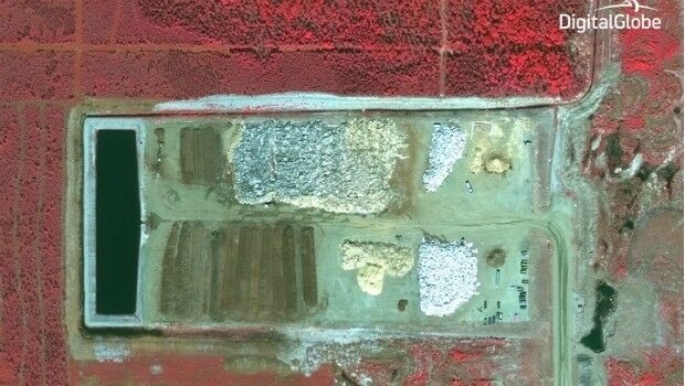
10th May 2016
GreenRoad Sets Its Sights on Field Services Market
9th May 2016
High profile satellite derived bathymetry project from Proteus
9th May 2016
£4 return on every £1 spent on council address and street information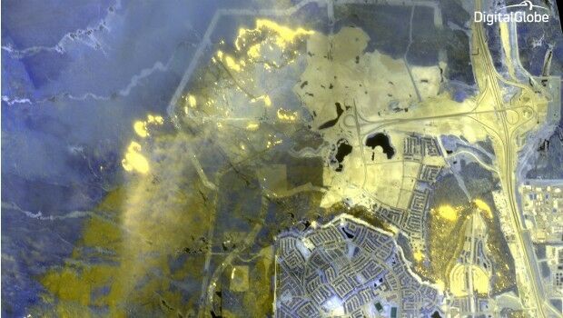
9th May 2016
DigitalGlobe Dramatic Images: Oil Sands Fire
6th May 2016
Esri UK Customer Success Awards Shortlist Announced
5th May 2016
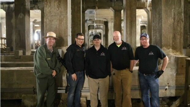
National Mall Employs HighTech Surveying for 21st-Century Preservation
5th May 2016
Senceive Making Waves In Wireless Monitoring
5th May 2016
Take Note of Recent Changes to Insurance Law, Urged by UAVAir5th May 2016
Hemisphere GNSS Announces Management Changes

4th May 2016
VerifEye Technologies Amovi VOC Camera now available with Geotab
4th May 2016
eyesMap3D: The most accurate and powerful 3D photo modeling software4th May 2016
Airbus and Hexagon Geospatial Sign Content Agreement for Smart M.App
4th May 2016
Masternaut launches telematics module that spots vehicle faults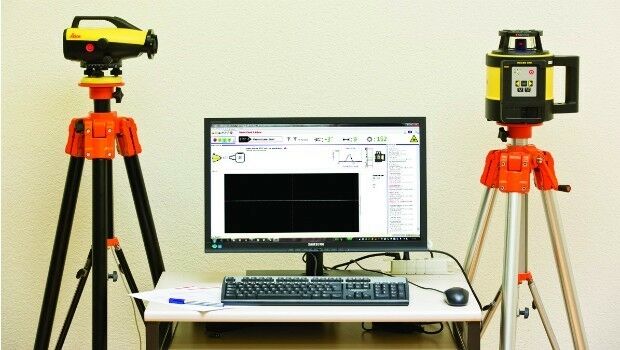
4th May 2016
Leica releases new calibration system for value-added service4th May 2016
Partner: Aligned Assets Introduces what3words into Gazetteer Products4th May 2016
ABPmer reviews MMO's marine information system

4th May 2016
Elbit Systems’ BrightNite™ Performs Successful Demonstration Flights
4th May 2016
GeoPlace announces the winners of the 2016 Exemplar Awards3rd May 2016
OGC requests comment for Land Administration Domain Working Group3rd May 2016
Introducing AeryonLive – the SaaS platform for UAS fleet management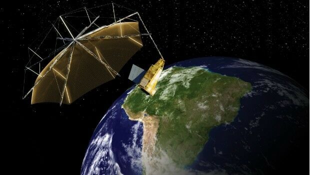
3rd May 2016
Airbus Defence and Space signs contract to build Biomass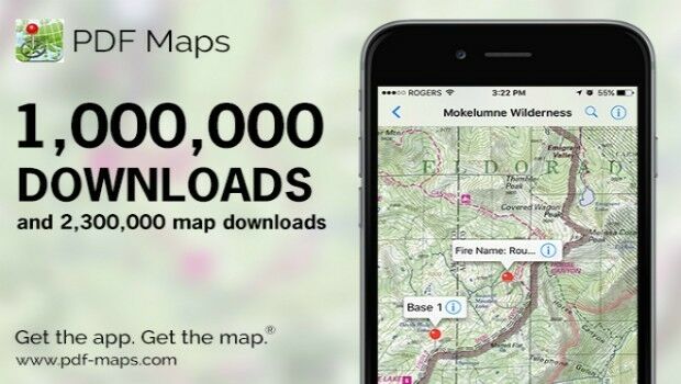
3rd May 2016
Avenza’s PDF Maps App Surpasses One Million Downloads3rd May 2016
Photos shared on Flickr used to track world's protest hotspots3rd May 2016
Leica Captivate Experience continues with self-learning GNSS