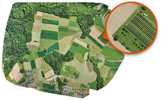
PlanetObserver presents new PlanetSAT Updates
23rd November 2017
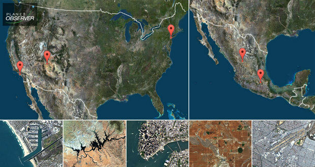
PlanetObserver presents new PlanetSAT UpdatesAerial imaging is revolutionizing the way we capture, analyze, and utilize geospatial data. Using high-resolution aerial photography and remote sensing technologies, it provides accurate and detailed visual information essential for mapping, environmental monitoring, infrastructure planning, and disaster response.
Modern aerial imaging solutions include manned aircraft, UAVs (drones), and satellite-based systems equipped with advanced sensors such as LiDAR, multispectral, and hyperspectral cameras. These technologies enable high-precision mapping, 3D terrain modeling, change detection, and real-time geospatial analysis, supporting industries such as urban planning, agriculture, forestry, defense, and construction.
With cloud-based processing, AI-powered image analysis, and real-time data streaming, aerial imaging continues to advance, offering faster, more accurate, and scalable solutions for GIS professionals and decision-makers.
GeoConnexion provides the latest insights on aerial imaging trends, innovations, and applications, helping professionals leverage aerial data for better spatial intelligence and operational efficiency.
23rd November 2017
PlanetObserver presents new PlanetSAT Updates
23rd November 2017
Orbit GT releases 3D Mapping Publisher v18
22nd November 2017
The world is on the brink of a technological revolution
22nd November 2017
Martek Establish Dedicated Maritime Unmanned Aviation Division

21st November 2017
AirGon LLC Appointed DJI Enterprise Dealer
21st November 2017
Free U.S. Traffic Count Data for Use with Maptitude Mapping Software
21st November 2017
Satellite Images of Turkey Show Whirlwind Damage
21st November 2017
New Announcements from Aero Surveillance
20th November 2017
New Announcement from Aero Surveillance Systems20th November 2017
Announcement EuroSDR 2018 series of e-learning
15th November 2017
Centrik Helps Texo DSI Evidence UAV Excellence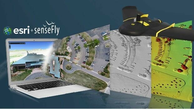
15th November 2017
senseFly teams up with Esri to host free ‘Drone to GIS’ webinar
14th November 2017
Golden Software Releases Surfer® 2D and 3D14th November 2017
Bluesky 3D Models Create Offshore Wind Farm VR Simulation
13th November 2017
European Space Imaging celebrates 15 years of success
10th November 2017
East View Geospatial Signs Reseller Contract with UrtheCast
7th November 2017
Bluesky Aerial Photos Help South Pennines Moor Conservation
3rd November 2017
Phase One Industrial partners with Drone Nerds
2nd November 2017
Bluesky LiDAR Data Used by RPS to Assess Flood Risk for Anglian Water1st November 2017
2018 ISPRS Call for Educational and Capacity Building Initiative
31st October 2017
Sierra Leone Makes Fourth Licensing Round Pre-Announcement
30th October 2017
CGG Delivers Final PSDM Products for Cairenn Multi-Client Survey
30th October 2017
Helping Councils get the Most from Infrastructure Asset Management
28th October 2017
WorldView Global Alliance User Conference 2017 Report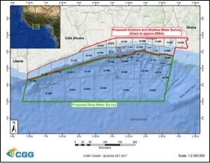
26th October 2017
CGG Awarded Contract for Licenses in Côte d’Ivoire26th October 2017
Commercial UAV Expo and Drone World Expo Come Together in 2018
26th October 2017
Orbit GT updates 3D Mapping Cloud with great new UAV support26th October 2017
PCI Geomatics Signs MOU with AGH University, in Krakow, Poland25th October 2017
Saudi Ministry of Interior Supports Hajj and Umrah Safety with Hexagon Solution
25th October 2017
New Supply-Chain Accessories for the NAUTIZ X225th October 2017
Bluesky's Tree Map Helps Community Forest Rebuild Environment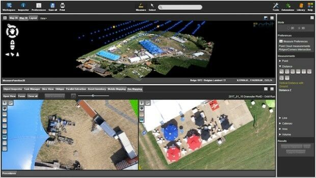
24th October 2017
Orbit GT launches new Feature Extraction product for Drones
24th October 2017
3D Repo Releases Version 2.0 of BIM Collaboration Software23rd October 2017
Commercial UAV Expo Announces Highlights of Upcoming 2017 Event23rd October 2017
Call for Proposals to develop NSDI Metadata Handbook in Namibia23rd October 2017
A new generation of disruptive property and location data businesses
23rd October 2017
Ian MacLeod receives SEG Cecil Green Enterprise Award
21st October 2017
Virtual Surveyor Unveils Productivity Tools at Commercial UAV Expo21st October 2017
Interoute adds Edge SD WAN service to their arsenal
19th October 2017
Bluesky Apppoints Robert Carling and George Dey18th October 2017
Geospatial Themed BIM Event Debates GIS Data Integration18th October 2017
Enhanced and Improved Functionalities for New Release of Global Mapper