
Call for Proposals - ISPRS Scientific Initiatives 2019
19th June 2018
Call for Proposals - ISPRS Scientific Initiatives 2019Aerial imaging is revolutionizing the way we capture, analyze, and utilize geospatial data. Using high-resolution aerial photography and remote sensing technologies, it provides accurate and detailed visual information essential for mapping, environmental monitoring, infrastructure planning, and disaster response.
Modern aerial imaging solutions include manned aircraft, UAVs (drones), and satellite-based systems equipped with advanced sensors such as LiDAR, multispectral, and hyperspectral cameras. These technologies enable high-precision mapping, 3D terrain modeling, change detection, and real-time geospatial analysis, supporting industries such as urban planning, agriculture, forestry, defense, and construction.
With cloud-based processing, AI-powered image analysis, and real-time data streaming, aerial imaging continues to advance, offering faster, more accurate, and scalable solutions for GIS professionals and decision-makers.
GeoConnexion provides the latest insights on aerial imaging trends, innovations, and applications, helping professionals leverage aerial data for better spatial intelligence and operational efficiency.
19th June 2018
Call for Proposals - ISPRS Scientific Initiatives 201918th June 2018
CGG’s Helitem Shatters AEM Low-Frequency Barrier18th June 2018
Inaugural European Drone Summit in Frankfurt16th June 2018
Expanded Focus on Drones in Public Safety at InterDrone
15th June 2018
FIFA World Cup 2018 Stadiums As Seen From Space
14th June 2018
EarthSense Activates Zero Emission Running to Reduce City Air Pollution
12th June 2018
Headwall Integrates Hyperspectral and LiDAR Aboard UAV Platforms
12th June 2018
SimActive Software for Precision Agriculture in Brazil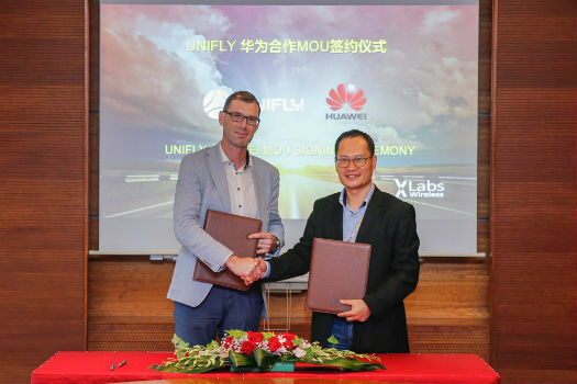
11th June 2018
Huawei and Unifly Collaborate to Identify and Track Drone Flights10th June 2018
AP-Flyer is the Latest Sponsor of UAV Technology Conference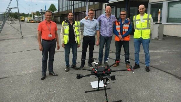
8th June 2018
Unifly and CanardDrones show real capabilities in Finland8th June 2018
Sofradir and ULIS undergo structural reorganization
8th June 2018
Pix4D launches its first fully dedicated product for agriculture
7th June 2018
NAKANIHON and RIEGL to Give Joint Presentation7th June 2018
thinkWhere Helps Manage Disasters in Cambodia
6th June 2018
Bluesky Takes Aerial Mapping to New Levels in 201831st May 2018
Merrick Releases Version 2018 MARS® Software Suite
31st May 2018
Pointfuse Unlocks ‘As Built’ Data with Autodesk Integration
30th May 2018
Bluesky Takes to the Air to Complete Aerial Mapping of Ireland24th May 2018
thinkWhere Supports Global Humanitarian Project to Map Disaster Areas23rd May 2018
Global Mapper Helps Aerial Filmworks, Win Pulitzer Prize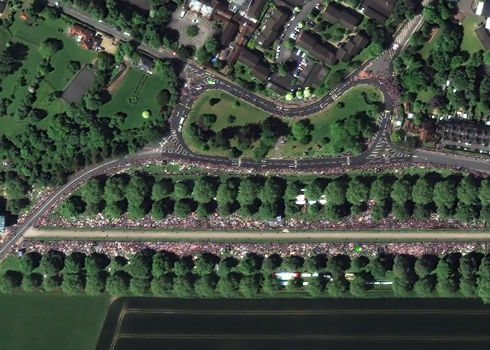
22nd May 2018
Satellite Image Shows Massive Royal Wedding Crowds
22nd May 2018
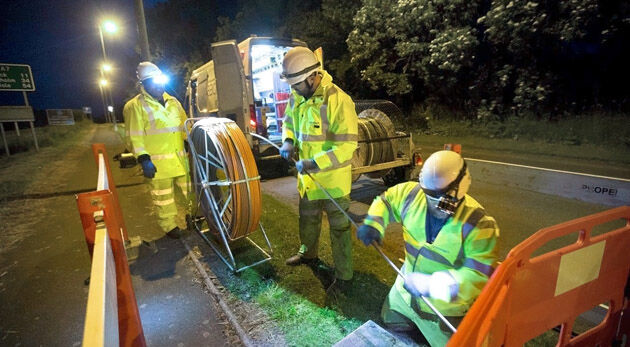
Bluesky Esri UK Partnership Helps Roll-Out of 5G and Full Fibre Networks22nd May 2018
Expanded Enterprise Focus at Largest Commercial Drone Show in USA18th May 2018
SpaceDataHighway: 10,000 successful laser connections17th May 2018
TCarta Delivers Satellite Derived Bathymetry Data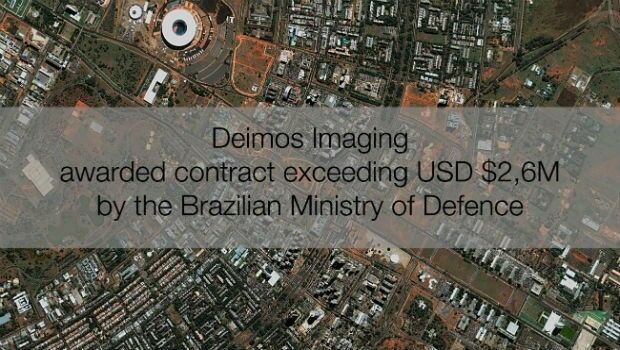
16th May 2018
Deimos Imaging awarded contract exceeding USD $2,6M by Brazilian MoD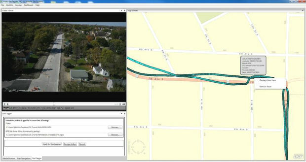
16th May 2018
Remote GeoSystems Releases All-New Video GeoTagger
15th May 2018
SimActive Software Saving Hours for DJI Drone Surveys
14th May 2018
senseFly user conference aims to optimize drone operations
14th May 2018
SphereVision Shows New 360 Imaging Tech at GEO Business
9th May 2018
Sentinel-3B starts delivering on its promise.jpg)
9th May 2018
Geo-data experts pinpoint Birmingham for GeoPlace’s annual conference
9th May 2018
Data Gateway brings powerful data validation and processing via a self-serve, training-free experien9th May 2018
Full solution for Surveying and Stereo viewing of Orientated Aerial photographs8th May 2018
Big Data, 5G, automation and artificial intelligence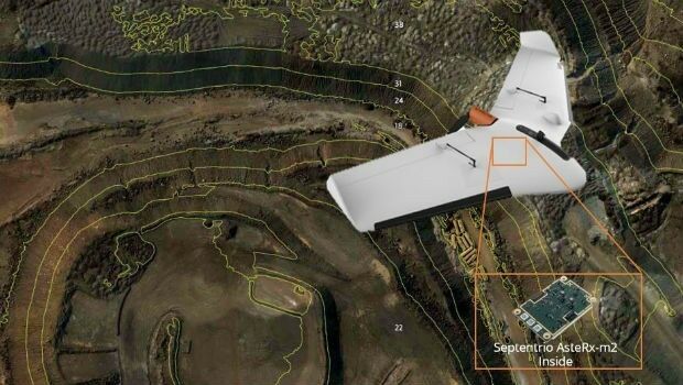
4th May 2018
Septentrio supplies AsteRx-m2 for Delair UX11 large-area mapping UAV
4th May 2018
Sponsorship for MGGG Geometry of Redistricting Workshops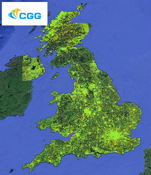
4th May 2018
CGG Launches New MotionMap UK National Ground Stability Database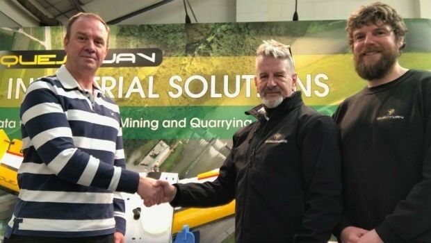
4th May 2018
QuestUAV Closes deal to Map World’s Largest Construction Project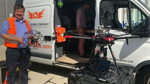
2nd May 2018
thinkWhere helps Scotland's Superfast Broadband achieve 95% coverage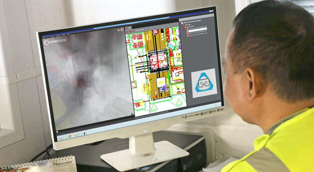
2nd May 2018
SphereVision Introduces Smoke Layer and VR Viewing
2nd May 2018
Free Drone Strategy Sessions Available to UK Surveying Businesses