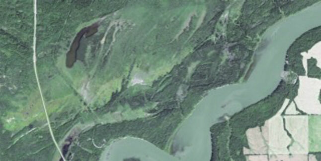
Earth-i’s satellite imagery chosen to monitor tree logging in Canada
17th October 2017
Earth-i’s satellite imagery chosen to monitor tree logging in CanadaAerial imaging is revolutionizing the way we capture, analyze, and utilize geospatial data. Using high-resolution aerial photography and remote sensing technologies, it provides accurate and detailed visual information essential for mapping, environmental monitoring, infrastructure planning, and disaster response.
Modern aerial imaging solutions include manned aircraft, UAVs (drones), and satellite-based systems equipped with advanced sensors such as LiDAR, multispectral, and hyperspectral cameras. These technologies enable high-precision mapping, 3D terrain modeling, change detection, and real-time geospatial analysis, supporting industries such as urban planning, agriculture, forestry, defense, and construction.
With cloud-based processing, AI-powered image analysis, and real-time data streaming, aerial imaging continues to advance, offering faster, more accurate, and scalable solutions for GIS professionals and decision-makers.
GeoConnexion provides the latest insights on aerial imaging trends, innovations, and applications, helping professionals leverage aerial data for better spatial intelligence and operational efficiency.
17th October 2017
Earth-i’s satellite imagery chosen to monitor tree logging in Canada16th October 2017
PDF3D work with Forensics to Bring 3D PDF into the Court Room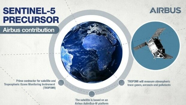
14th October 2017
Sentinel-5P successfully launched to monitor world’s pollution13th October 2017
International Conference on Cultural Heritage and New Technologies
13th October 2017
Airborne LiDAR production fully integrated with Leica HxMap workflow
12th October 2017
EarthSense Partnership Maps City Clean Air Cycle Routes
11th October 2017
EUTELSAT 172B satellite reaches geostationary orbit in record time
11th October 2017
UAV exhibition opens doors to businesses across Europe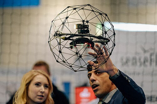
10th October 2017
UAV exhibition opens doors to businesses across Europe
9th October 2017
Bluesky Celebrates 21st Birthday with New Corporate HQ6th October 2017
European Consortium Demonstrates new Internet-of-Things Platform
6th October 2017
Col-East Taps Extensive Image Archive to Create Multi-Function Maps5th October 2017
Commercial UAV Expo to include Workshops/Demos/Training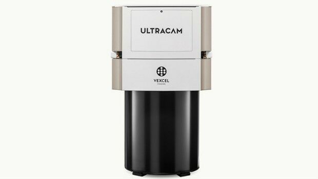
4th October 2017
Vexcel Imaging introduces the new UltraCam Eagle Mark 3
4th October 2017
Bureau Veritas joins the RECOMMS drones project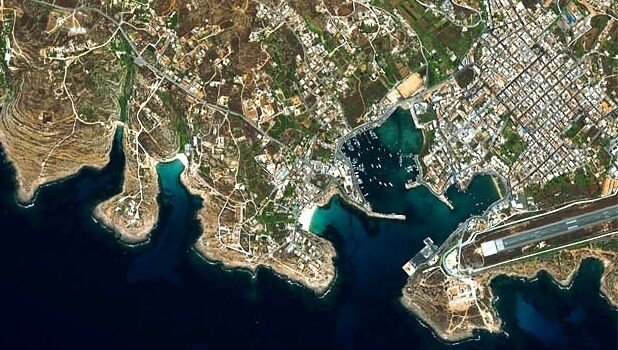
3rd October 2017
Satellite Images show Europe's diversity in new book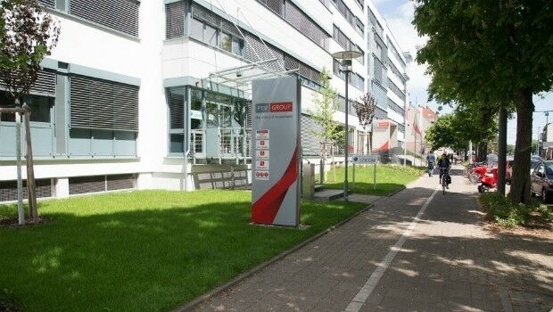
2nd October 2017
Approaches and solutions for tomorrow’s transport
29th September 2017
Bluesky Tree Map Helps Dudley Protect Urban Trees26th September 2017
Partnership Offers Analysis Software for Scholarship Winners26th September 2017
Commercial UAV Expo Europe Moves to Amsterdam in April, 201826th September 2017
New extras added to Global Mapper V.19 - Now Availale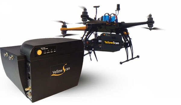
26th September 2017
YellowScan & Quantum Systems partnership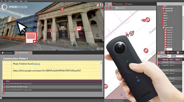
26th September 2017
New SphereVision 360 Imaging System Launched at Intergeo
26th September 2017
3D Repo and Bryden Wood to develop 4D Virtual Reality Models25th September 2017
Bureau Veritas joins Global Industry Alliance (GIA)25th September 2017
Skyline Software Systems Opens Another European Office
21st September 2017
senseFly to launch industry-specific solutions at INTERGEO 201721st September 2017
LizardTech Awarded U.S. Patent for LiDAR Point Cloud Compression
21st September 2017
Wingtra partners with Kentucky-based Precision Capture21st September 2017
Three Swedish neighbouring municipalities choose Digpro20th September 2017
Presentations at Airborne ISR Conference20th September 2017
Phase One Industrial Introduces 190MP Aerial System
19th September 2017
Esri Podcast Series Explores How Location Technology Helps Businesses
19th September 2017
Bentley’s AECOsim Building Designer CONNECT Edition
16th September 2017
Esri to Present at TechCrunch Disrupt SF 2017
16th September 2017
Maptitude Supports High School Course in Geographic Technology15th September 2017
Unmanned Systems industry leaders are gathering in Odense
15th September 2017
VolkerWessels to Use Yotta’s Horizons on Dutch Infrastructure Project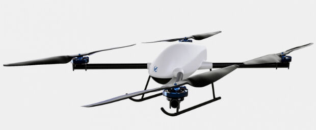
14th September 2017
Skyfront Sets World Record for Drones with 4 hour and 34 minute flight13th September 2017
PCI Geomatics Releases Geomatica 2017, Service Pack 1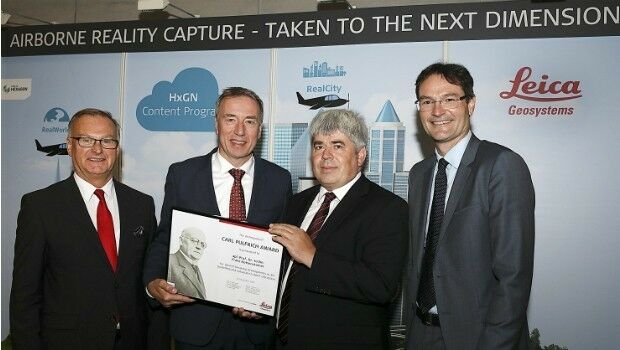
12th September 2017
Carl Pulfrich Award 2017 goes to Prof. Dr. Franz Rottensteiner12th September 2017
Drone Software Donation for Hurricane Recovery
7th September 2017
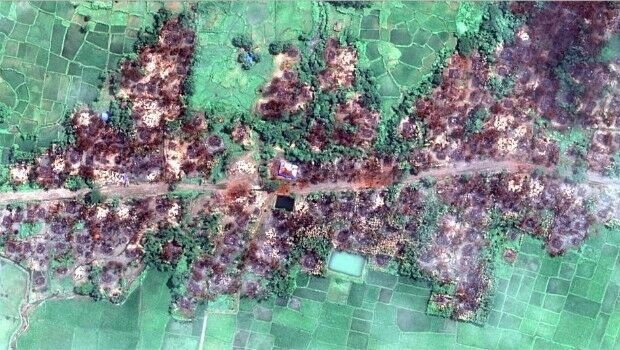
Myanmar: Satellite Images Show Massive Fire Destruction7th September 2017
Locating Bahrain’s Underground Utilities
6th September 2017
Airborne mapping system from 3D Laser Mapping takes off