
September 2105 International Issue
Content
OriginGPS Unveils Smallest Multi-GNSS Module with Integrated Antenna
25th August 2015
OriginGPS Unveils Smallest Multi-GNSS Module with Integrated AntennaNew Leica Zeno 20 redefines GIS data collection
25th August 2015
New Leica Zeno 20 redefines GIS data collectionVisionMap Upgrades A3 Edge Oblique Capabilities
25th August 2015
VisionMap Upgrades A3 Edge Oblique CapabilitiesEnhanced Flexibility from Spectra Precision’s New GNSS Receiver
25th August 2015
Enhanced Flexibility from Spectra Precision’s New GNSS Receiver
Dave Doyle’s nine new courses take GeoLearn catalogue to 65+
25th August 2015
Dave Doyle’s nine new courses take GeoLearn catalogue to 65+
EuroSDR/ISPRS workshop on oblique cameras and dense image matching
25th August 2015
EuroSDR/ISPRS workshop on oblique cameras and dense image matching
Sixth ACM SIGSPATIAL International Workshop on GeoStreaming (IWGS) 2015
25th August 2015
Sixth ACM SIGSPATIAL International Workshop on GeoStreaming (IWGS) 2015
Remote Aerial Surveys is first UK based UAV operator to offer LiDAR Service
25th August 2015
Remote Aerial Surveys is first UK based UAV operator to offer LiDAR Service1st International UAV Humanitarian Award to be Awarded at UK Drone Show
25th August 2015
1st International UAV Humanitarian Award to be Awarded at UK Drone ShowCHC introduces the industry’s first UAV ground control specific GNSS System
25th August 2015
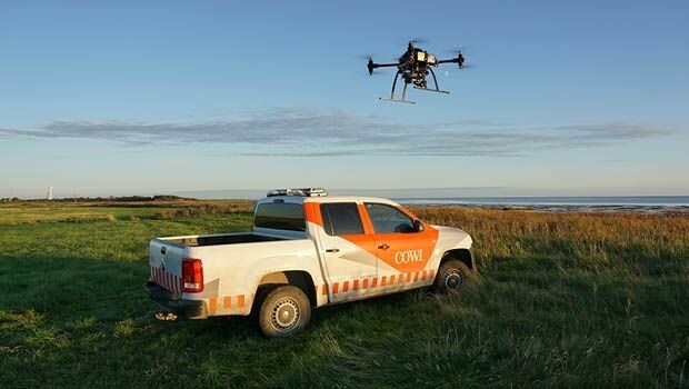
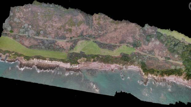
CHC introduces the industry’s first UAV ground control specific GNSS SystemCutting-edge drones put to the temperature test
25th August 2015
Cutting-edge drones put to the temperature testGSSI Announces Completion of New State-of-the-Art Headquarters
25th August 2015
GSSI Announces Completion of New State-of-the-Art Headquarters
Geocue Now Offers Online Training Courses
25th August 2015
Geocue Now Offers Online Training CoursesHERE expands its leading real-time traffic coverage to 50 countries
25th August 2015
HERE expands its leading real-time traffic coverage to 50 countries
GeoDecisions’ GeoILS Intelligent Location Server Used to Track Icebergs
25th August 2015
GeoDecisions’ GeoILS Intelligent Location Server Used to Track Icebergs
Utilities Benefit from the Intergraph SAP Integration Module
25th August 2015
Utilities Benefit from the Intergraph SAP Integration ModuleFugro Awarded Project To Deploy Roames Service In UK
25th August 2015
Fugro Awarded Project To Deploy Roames Service In UKPrince Harry celebrates achievements of humanitarian mapping charity, MapAction
25th August 2015
Prince Harry celebrates achievements of humanitarian mapping charity, MapAction
Clark Labs and NASA DEVELOP National Program
25th August 2015
Clark Labs and NASA DEVELOP National Program
Altus-PS merges into Septentrio Satellite Navigation
25th August 2015
Altus-PS merges into Septentrio Satellite Navigation
EOMAP provides shallow water bathymetry for the South China Sea
25th August 2015
EOMAP provides shallow water bathymetry for the South China SeaProteus announces exclusive partnership with GeoSlam
25th August 2015
Proteus announces exclusive partnership with GeoSlam
Orbit GT and Aerodata International Surveys sign Reseller Agreement
25th August 2015
Orbit GT and Aerodata International Surveys sign Reseller Agreement
Everbridge and IDV Solutions Announce Technical Partnership, Integration
25th August 2015
Everbridge and IDV Solutions Announce Technical Partnership, Integration
CGG GeoSoftware Donates Geophysical Software to Stanford University
25th August 2015
CGG GeoSoftware Donates Geophysical Software to Stanford University
Global Mapper and GM LiDAR SDKs v16.2 Released
25th August 2015
Global Mapper and GM LiDAR SDKs v16.2 Released
SAFEmine Helps South African Mines Meet New Safety Regulations
25th August 2015
SAFEmine Helps South African Mines Meet New Safety Regulations


From the wisdom of the ages to challenges of the modern world
25th August 2015
From the wisdom of the ages to challenges of the modern world
Archive