Terrestrial Surveying
The 2D and 3D measurement of points, distances and angles of features and objects on the Earth’s surface. See also Surveying Instrumentation topic. This topic covers the science and techniques that govern the 2D and 3D measurement of points, distances and angles of natural and man-made features and objects on the Earth’s surface. These measurements are acquired for a wide range of practical applications in construction, engineering, land use planning, mapmaking and cadastral projects, See also Surveying Instrumentation topic for the various tools employed to acquire survey measurements.
OGI selects iXblue FOG INS for new mobile mapping lidar solution
10th June 2020
OGI selects iXblue FOG INS for new mobile mapping lidar solutionTersus Introduces BX40C RTK Board, A Compact GNSS Board with Full Constellation Tracking
4th June 2020
Tersus Introduces BX40C RTK Board, A Compact GNSS Board with Full Constellation TrackingMGISS Helps Highways Sector Adopt New Highways England Standards
4th June 2020
MGISS Helps Highways Sector Adopt New Highways England StandardsFugro’s RILA technology wins Network Rail Western Route track survey contract
2nd June 2020
Fugro’s RILA technology wins Network Rail Western Route track survey contractOrdnance Survey to create the Ordnance Survey of Dubai
25th May 2020
Ordnance Survey to create the Ordnance Survey of Dubai
Monitoring specialist Senceive appoints new growth director
22nd May 2020
Monitoring specialist Senceive appoints new growth director
Septentrio adds Sapcorda SAPA service to GNSS receiver portfolio
22nd May 2020
Septentrio adds Sapcorda SAPA service to GNSS receiver portfolio
Sercel Equipment Supports Sinopec Seismic Survey in Saudi Arabia
18th May 2020
Sercel Equipment Supports Sinopec Seismic Survey in Saudi Arabia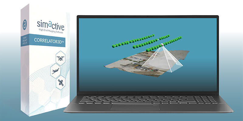
Simactive - How to Perform Aerial Triangulation with Correlator3D
13th May 2020
Simactive - How to Perform Aerial Triangulation with Correlator3D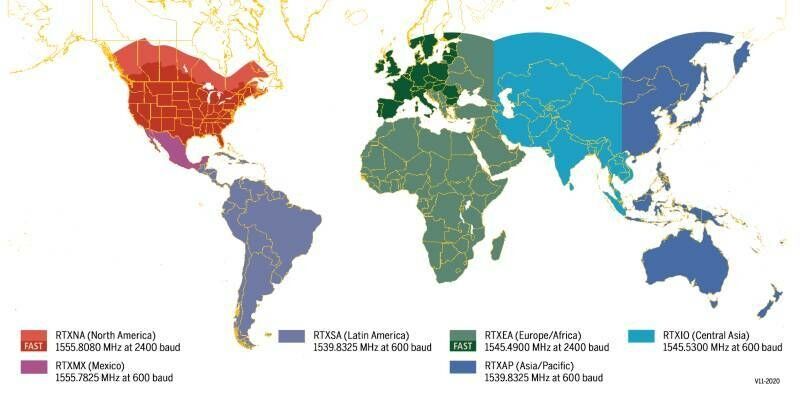
Coast-to-Coast U.S. Coverage Now Deployed for Trimble's CenterPoint RTX Fast Correction Service
12th May 2020
Coast-to-Coast U.S. Coverage Now Deployed for Trimble's CenterPoint RTX Fast Correction Service
U.S. rugged device manufacturer Juniper Systems sees strong demand as global supply chains are impacted by COVID-19
11th May 2020
U.S. rugged device manufacturer Juniper Systems sees strong demand as global supply chains are impacted by COVID-19
New Version of Trimble Access Enables Broader Accessibility to Android OS for Surveyors
8th May 2020
New Version of Trimble Access Enables Broader Accessibility to Android OS for Surveyors

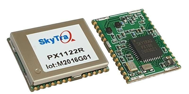
SkyTraq Launches Small Multi-Band RTK Receiver
7th May 2020
SkyTraq Launches Small Multi-Band RTK Receiver
Introducing the Phase One 280MP Aerial Solution
5th May 2020
Introducing the Phase One 280MP Aerial Solution
New GNSS/INS receiver AsteRx-i D UAS with Analog Devices IMU
5th May 2020
New GNSS/INS receiver AsteRx-i D UAS with Analog Devices IMU
Qinertia, SBG Systems’ PPK software now supports third-party IMUs and offers a GNSS post-processing license covering all major GNSS receivers
5th May 2020
Qinertia, SBG Systems’ PPK software now supports third-party IMUs and offers a GNSS post-processing license covering all major GNSS receivers
MicroSurvey - FieldGenius For Android Point Line
4th May 2020
MicroSurvey - FieldGenius For Android Point LineJuniper Systems Announces New Windows 10 Rugged Tablet: Mesa 2™
29th April 2020
Juniper Systems Announces New Windows 10 Rugged Tablet: Mesa 2™
RIEGL’s Combining Terrestrial and UAV-borne Scan Data in an Archeology Application
24th April 2020
RIEGL’s Combining Terrestrial and UAV-borne Scan Data in an Archeology Application
MicroSurvey - FieldGenius for Android Staking
24th April 2020
MicroSurvey - FieldGenius for Android StakingBluesky University of Leicester SPRINT Project Brings AI to Insurance Sector
24th April 2020
Bluesky University of Leicester SPRINT Project Brings AI to Insurance Sector
Gexcel webinar: Fast stockpile volume evaluation
15th April 2020
Gexcel webinar: Fast stockpile volume evaluation


CICES becomes Licensed Member of the Engineering Council
17th March 2020
CICES becomes Licensed Member of the Engineering CouncilVirtual Surveyor Streamlines Volumetric Calculations for Stormwater Retention Ponds, Basins & Quarri
3rd March 2020
Virtual Surveyor Streamlines Volumetric Calculations for Stormwater Retention Ponds, Basins & Quarri
Casablanca’s Medina Buildings Monitored During Tunnel Construction
25th February 2020
Casablanca’s Medina Buildings Monitored During Tunnel Construction
GSSI to Showcase GPR systems at ConExpo-Con/Agg Show
23rd February 2020
GSSI to Showcase GPR systems at ConExpo-Con/Agg ShowLeica Geosystems announces new most accurate total station
21st February 2020
Leica Geosystems announces new most accurate total station

Hexagon Announces Management Team Changes
26th January 2020
Hexagon Announces Management Team Changes

10th IGRSM International Conference and Exhibition
19th January 2020
10th IGRSM International Conference and ExhibitionCarlson Releases Scan2K Terrestrial Scanner
15th January 2020
Carlson Releases Scan2K Terrestrial ScannerSeptentrio PPK gets a boost with BaseFinder
10th January 2020
Septentrio PPK gets a boost with BaseFinder