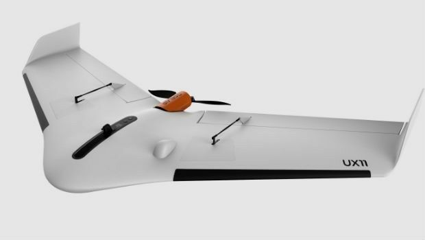
high performance UX11 & UX11 Ag surveying and mapping drones
12th July 2019
high performance UX11 & UX11 Ag surveying and mapping dronesThe 2D and 3D measurement of points, distances and angles of features and objects on the Earth’s surface. See also Surveying Instrumentation topic. This topic covers the science and techniques that govern the 2D and 3D measurement of points, distances and angles of natural and man-made features and objects on the Earth’s surface. These measurements are acquired for a wide range of practical applications in construction, engineering, land use planning, mapmaking and cadastral projects, See also Surveying Instrumentation topic for the various tools employed to acquire survey measurements.
12th July 2019
high performance UX11 & UX11 Ag surveying and mapping drones
11th July 2019
Fugro succeeds with new seep survey license sales offshore Newfoundland10th July 2019
Trimble announces new usage-based plans for Trimble Catalyst8th July 2019
Fugro and SLPE to present case study at Offshore Foundations Conference, Bremen5th July 2019
Telangana seeks to become first ‘BVLOS Compliant’ state in India5th July 2019
Telangana seeks to become first ‘BVLOS Compliant’ state in India5th July 2019
Weaver Consulting adopts Delair UX11 UAV for large scale surveying, mapping
29th June 2019
GSSI Receives Presidential Award for Exports21st June 2019
ABPmer delivers for Arklow Bank Wind Park – Phase 2
20th June 2019
AECOM Uses Bluesky Tree Map to Assess Risks to Infrastructure
5th June 2019
Spectra Geospatial ST10, high performance, large display tablet4th June 2019
SimActive Releases Version 8.2 for Processing of Multispectral Imagery
31st May 2019
UK Hydrographic Office appoints Chief Executive30th May 2019
Ancient Landforms of the Australian Rainforest Revealed by Airborne LiDAR

29th May 2019
Nortek opens Australian office to build on regional demand
29th May 2019
Leica Geosystems opens nominations for Carl Pulfrich Award 201928th May 2019
New Production Facility for Detectors in the USA
28th May 2019
Sercel Delivers Five 508XT Acquisition Systems to ONGC in India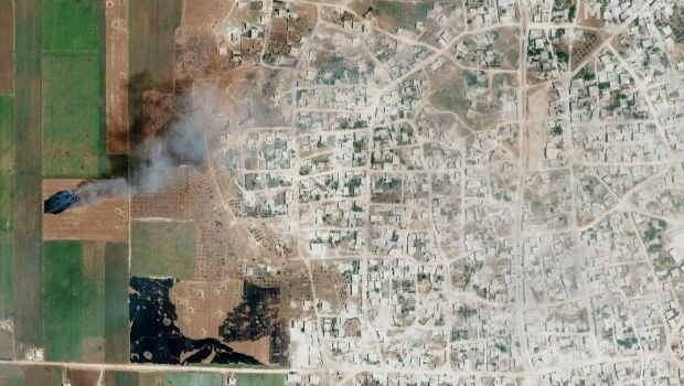
28th May 2019
Satellite Imagery: Syrian Government Offensive in Idlib Province, Syria28th May 2019
Parrot drones selected by U.S. Department of Defense28th May 2019
Ecometrica Uses Drones to Map Vegetation in Scottish Forests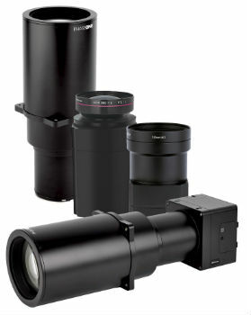
28th May 2019
Phase One Industrial Introduces Three High Performance Lenses27th May 2019
Kleos Satellites Launch Window Confirmed – August Lift-off
23rd May 2019
Likely Russian Bombers Intercepted Near Alaska23rd May 2019
u-blox announces Markus Schaefer as new Executive Director
23rd May 2019
Topcon announces advanced Bentley integration22nd May 2019
Leica BLK360 software integration announcement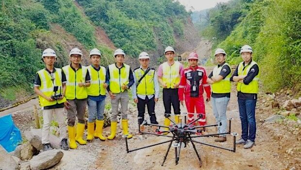
22nd May 2019
Terra Drone Indonesia shows construction companies benefits21st May 2019
Trimble Releases Next-Generation Integrated Smartphone and GIS Data Collector
21st May 2019
Space Flight Laboratory to Highlight ‘Gray Jay’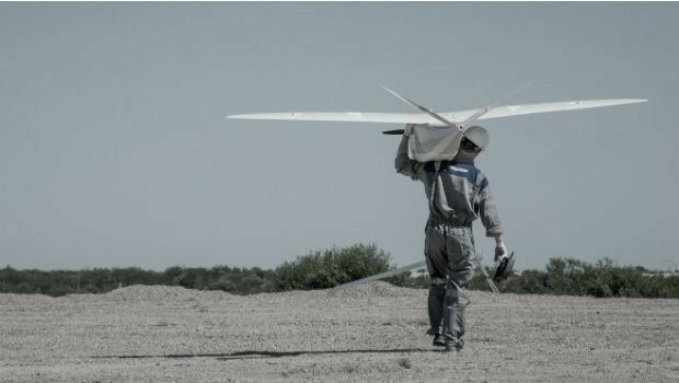
21st May 2019
New Open Payload version of Delair DT26 UAV allows custom configuration_enabling_tru.jpg)
21st May 2019
Introducing Multipurpose Autonomous sub-surface Training Target
21st May 2019
Sonardyne acquires maritime survey software and construction specialist EIVA20th May 2019
Hemisphere GNSS Announces All-New OEM Positioning & Heading Boards20th May 2019
Carlson NR3: New compact, lightweight GNSS Receiver
20th May 2019
Fugro supports two ocean mapping initiatives20th May 2019
Topcon accepts John Deere Supplier Innovation Award
17th May 2019
Western Distribution selects Fugro to unlock value from airborne survey data16th May 2019
SITECO's System for the Emilia Romagna Railways Inspection
16th May 2019
Routescene's improved approach to quantifying accuracy