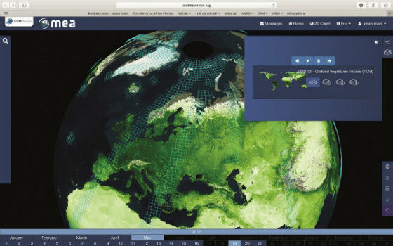
EarthServer: 1+ Petabyte Analysis-Ready Datacubes
25th November 2017
EarthServer: 1+ Petabyte Analysis-Ready DatacubesThe compilation, reproduction and dissemination of maps and charts by means of manual (analogue) or digital techniques, tools and workflows. This topic covers the compilation, reproduction, dissemination and use of both analogue (paper) and digital maps, charts and atlases. As well as the science of cartography, including georeferencing and geocoding, digital techniques for compiling and generating various types of raster and vector maps and charts are covered, as are the digital mapping tools and Geographic Information Systems available for this purpose. The application of cartography for aeronautical, terrestrial and marine purposes is also covered
25th November 2017
EarthServer: 1+ Petabyte Analysis-Ready Datacubes24th November 2017
Landmark Solutions launches ‘Points of Interest – Northern Ireland’24th November 2017
Munkfors Metro Network in Sweden chooses Digpro
23rd November 2017
Senior And Emerging Talent Excel For Fugro At Drilling Awards
23rd November 2017
Airbus SmarTWISP app developer programme moves on to the next stage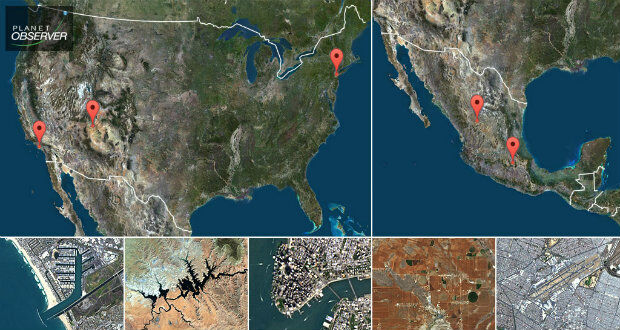
23rd November 2017
PlanetObserver presents new PlanetSAT Updates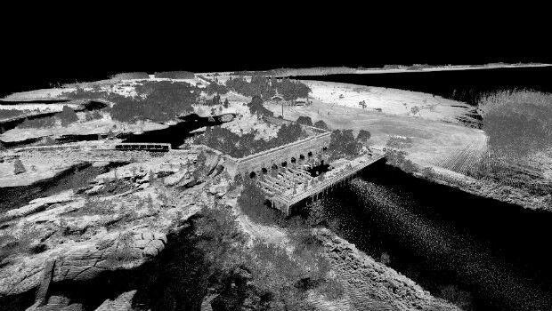
23rd November 2017
3D Laser Mapping launches campaign to release open-source LiDAR data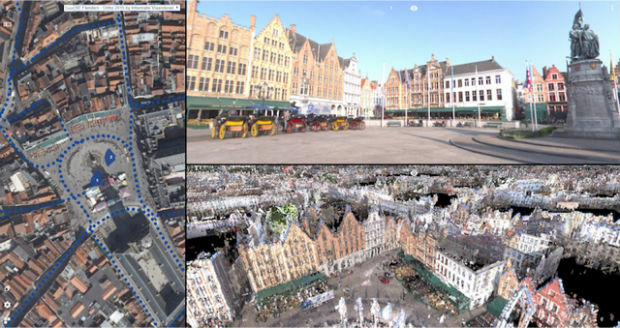
23rd November 2017
Orbit GT releases 3D Mapping Publisher v18
23rd November 2017
Swiss pilot Dario Neuenschwander wins the FAI Drone Racing World Cup
23rd November 2017
SSTL ships CARBONITE-2 and Telesat’s LEO-1 for PSLV launch
22nd November 2017
The world is on the brink of a technological revolution22nd November 2017
OGC's 105th Technical & Planning Committee Meeting
22nd November 2017
Martek Establish Dedicated Maritime Unmanned Aviation Division

22nd November 2017
Getting started with the Airbus “Critical App Challenge”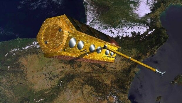
22nd November 2017
The PAZ satellite heads towards its launch base22nd November 2017
Active digital map for French Armed Forces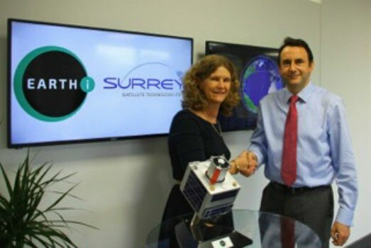
22nd November 2017
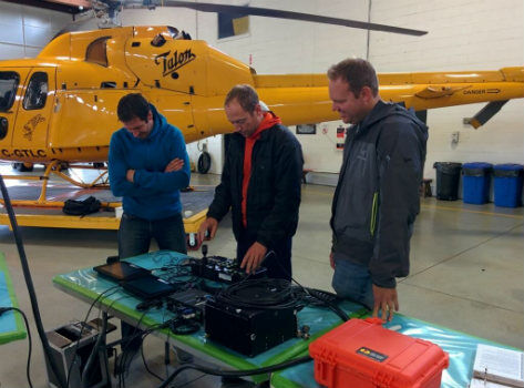
geoDVR for SAR - North Shore Rescue & Talon Helicopters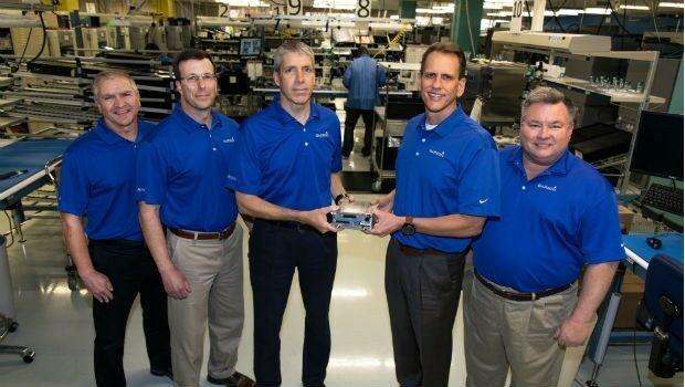
22nd November 2017
Garmin® celebrates a milestone in aviation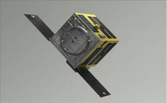
22nd November 2017
SSTL and ASTROSCALE team up for Orbital Debris Removal missions
22nd November 2017
Oceans overlooked as source of solutions to climate change21st November 2017
AirGon LLC Appointed DJI Enterprise Dealer
21st November 2017
OGC Calls for Participation in its Interoperability Plugfest21st November 2017
GeoSpock appoints technology entrepreneur Richard Baker as CEO

21st November 2017
Tersus Announces BX316D to Extend GNSS OEM Board Offering
21st November 2017
Rennes, France Virtually Experiences its Sustainable Future21st November 2017
viaEuropa Cloud Solo service added to G-Cloud 9
21st November 2017
CGG Announces Availability of Broadband High-Resolution Images
21st November 2017
Pix4D partners with Kokusai Kogyo in Japan21st November 2017
New Precise Point Positioning Module comes to Carlson SurveyGNSS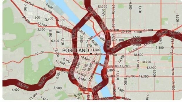
21st November 2017
Free U.S. Traffic Count Data for Use with Maptitude Mapping Software21st November 2017
FREQUENTIS LifeX provides new solutions for “networked safety”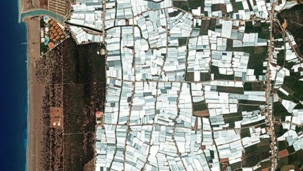
21st November 2017
Satellite Images of Turkey Show Whirlwind Damage
21st November 2017
New Announcements from Aero Surveillance
20th November 2017
New Announcement from Aero Surveillance Systems20th November 2017
Announcement EuroSDR 2018 series of e-learning
20th November 2017
The City of Edinopolis Opens its Doors to the World17th November 2017
Global Mapper SDK Now Available on Amazon Web Services17th November 2017
Esri Supports American Association of Geographers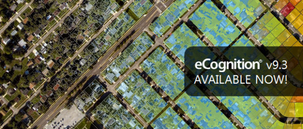
17th November 2017
New Version of Trimble eCognition Suite available
16th November 2017
Utilities Management System wins Satellite Navigation Competition 2017
16th November 2017
Explore South Africa’s National Parks From Your Armchair16th November 2017
Update To Ground-Breaking 5 Metre Groundwater Flood Risk Map
16th November 2017
“What will the weather be like?” – “Like this!”
16th November 2017
GIS People – Microsoft Australia Partner Awards 2017 Winner!