
OGC is seeking sponsors for Phase 2 of its Future Cities Pilot Project
14th December 2017
OGC is seeking sponsors for Phase 2 of its Future Cities Pilot ProjectThe compilation, reproduction and dissemination of maps and charts by means of manual (analogue) or digital techniques, tools and workflows. This topic covers the compilation, reproduction, dissemination and use of both analogue (paper) and digital maps, charts and atlases. As well as the science of cartography, including georeferencing and geocoding, digital techniques for compiling and generating various types of raster and vector maps and charts are covered, as are the digital mapping tools and Geographic Information Systems available for this purpose. The application of cartography for aeronautical, terrestrial and marine purposes is also covered
14th December 2017
OGC is seeking sponsors for Phase 2 of its Future Cities Pilot Project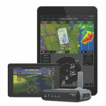
14th December 2017
Garmin® announces availability for the GDL® 52
14th December 2017
Mobility on Demand: Demand-driven transport14th December 2017
Transatel Selected by Airbus to Power Skywise14th December 2017
Airbus CyberSecurity Predictions for 2018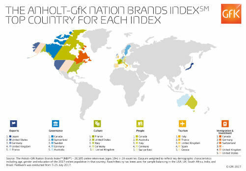
14th December 2017
Anholt-GfK Nation Brands Index study, 201714th December 2017
ESA selects Airbus for Copernicus Data and Information Access Service
14th December 2017
Esri Maps Highlight Net Neutrality Implications14th December 2017
GPS III and OCX Successfully Complete Factory Mission Readiness Test14th December 2017
Caliper Corporation (Maptitude, TransCAD) Joins the USGS Coalition14th December 2017
Orbit GT and Mena 3D, Germany, sign Reseller Agreement13th December 2017
3D Repo & Bryden Wood Launch 4D Virtual Reality Models
13th December 2017
Smart Cities specification for data launched13th December 2017
RUAS and Bangor University work together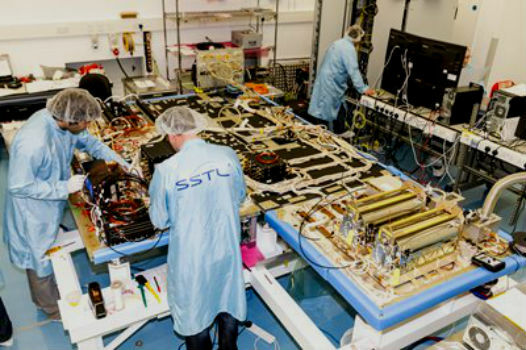

13th December 2017
Maptitude Mapping Software Donated to USGIF Academic Partners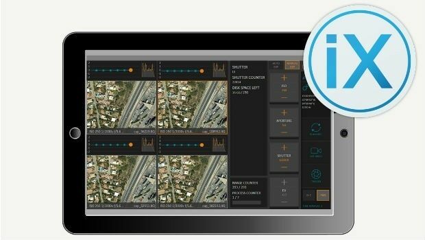
13th December 2017
Phase One Releases iX Capture 3.0 Software for Aerial Photography
12th December 2017
New Version of Trimble eCognition Suite available12th December 2017
Personal touch – what Brits really want this Christmas
12th December 2017
ASCO-DAITO selects Siteco Pave-Scanner Pavement Mobile Mapping System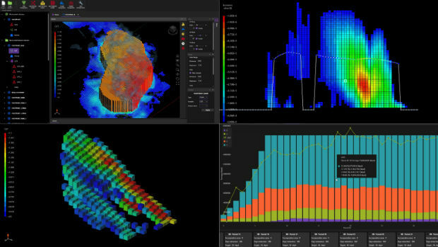
12th December 2017
Maptek unveils new strategic panel caving application12th December 2017
Esri Technology Will Help Power United Nations' New Global Data Hub11th December 2017
OGC Calls for Participation in Major Innovation Testbed (Testbed 14)
11th December 2017
HERE announces new appointments for Americas and EMEA regions
11th December 2017
Bouygues Construction Teams with Dassault Systèmes and Accenture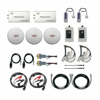
8th December 2017
Finding data ranks as top challenge for geoscience data management8th December 2017
App, App and Away - Gatwick launches first passenger app
7th December 2017
Fugro Specialist Takes Up Role With British Geotechnical Association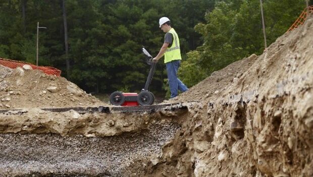
7th December 2017
GSSI to Showcase New UtilityScan® GPR System and Profiler™7th December 2017
Brampton Brick Chooses Flexipod Proof Of Delivery Software7th December 2017
VSTEP Simulation acknowledged with ISO 9001:20157th December 2017
Satellite investment recovered after first year of operations7th December 2017
EUMETSAT takes steps to extend Meteosat and EPS operations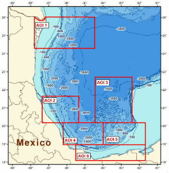
7th December 2017
CGG Releases Multi-Client Airborne GravMag Survey
7th December 2017
Esri Publishes a Textbook on How to Use ArcGIS Pro7th December 2017
Sandvik Mining and Rock Technology Assisted by JDA6th December 2017
HERE earns top spot in Strategy Analytics' 20176th December 2017
telent announced as Control Room Awards Platinum Sponsor
6th December 2017
GeoPlace Recognised As An Investor In People6th December 2017
Elbit to Provide and Operate Simulators for IAF Transport Aircraft6th December 2017
Monsanto and Boundless Collaborate for Open Source GIS Contributions6th December 2017
EUMETSAT ground segment is ready for launch of Copernicus Sentinel-3B