
Cartography
The compilation, reproduction and dissemination of maps and charts by means of manual (analogue) or digital techniques, tools and workflows. This topic covers the compilation, reproduction, dissemination and use of both analogue (paper) and digital maps, charts and atlases. As well as the science of cartography, including georeferencing and geocoding, digital techniques for compiling and generating various types of raster and vector maps and charts are covered, as are the digital mapping tools and Geographic Information Systems available for this purpose. The application of cartography for aeronautical, terrestrial and marine purposes is also covered
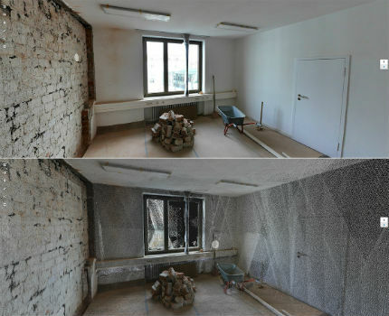
New Indoor Mobile Mapping System from NavVis
19th April 2018
New Indoor Mobile Mapping System from NavVis
Geospatial data making a difference in Commonwealth nations
18th April 2018
Geospatial data making a difference in Commonwealth nations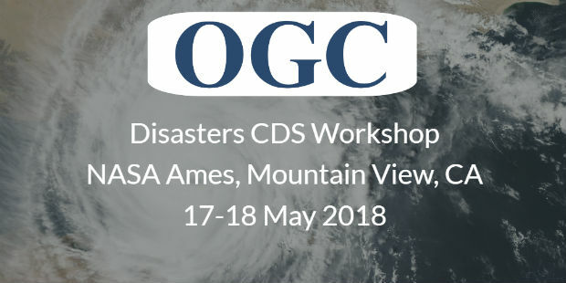
OGC invites you to the Disasters CDS Workshop at NASA Ames
18th April 2018
OGC invites you to the Disasters CDS Workshop at NASA Ames
Restore's Driver Behaviour Improvements With Ctrack Vehicle Tracking
18th April 2018
Restore's Driver Behaviour Improvements With Ctrack Vehicle Tracking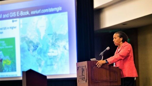
Dawn Wright Celebrates Earth Day by Speaking at EarthxOcean Conference
18th April 2018
Dawn Wright Celebrates Earth Day by Speaking at EarthxOcean Conference
Real-Time Mobile Data Collection with Boundless Anywhere
17th April 2018
Real-Time Mobile Data Collection with Boundless Anywhere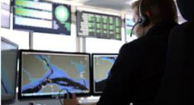
Vattenfall procure OceanWise Raster Charts XL
17th April 2018
Vattenfall procure OceanWise Raster Charts XL
Goonhilly Earth Station, SSTL and Astrobotic join forces
17th April 2018
Goonhilly Earth Station, SSTL and Astrobotic join forces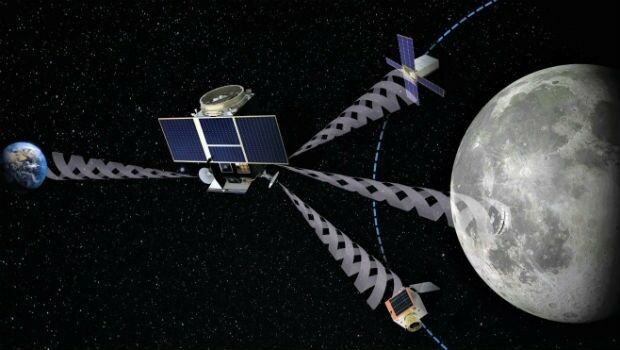
SSTL and Goonhilly Earth Station sign collaboration agreement with ESA
17th April 2018
SSTL and Goonhilly Earth Station sign collaboration agreement with ESA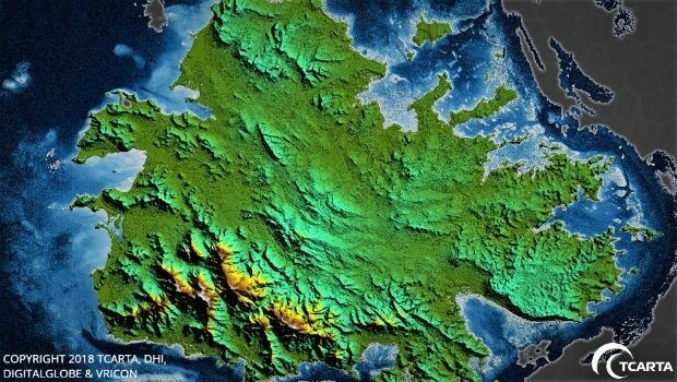
TCarta Delivers Satellite-Derived Land/Sea Floor Surface Models
17th April 2018
TCarta Delivers Satellite-Derived Land/Sea Floor Surface Models
LizardTech to Launch GeoExpress 10 with Expanded LiDAR Functionality
17th April 2018
LizardTech to Launch GeoExpress 10 with Expanded LiDAR Functionality
OGC announces the ESA’s upgrade to Strategic Member
17th April 2018
OGC announces the ESA’s upgrade to Strategic Member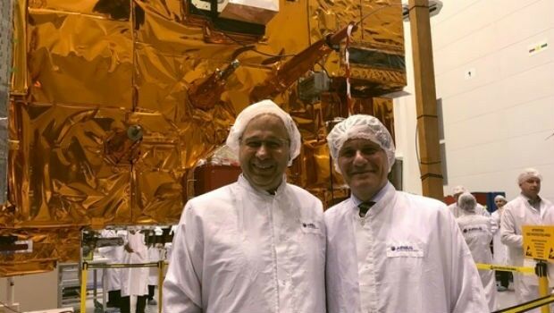
Crucial European weather satellite prepares for launch
17th April 2018
Crucial European weather satellite prepares for launch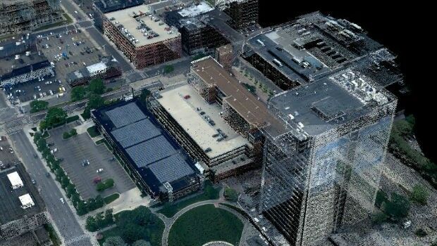
Teledyne Optech to showcase Airborne and Terrestrial survey systems
17th April 2018
Teledyne Optech to showcase Airborne and Terrestrial survey systems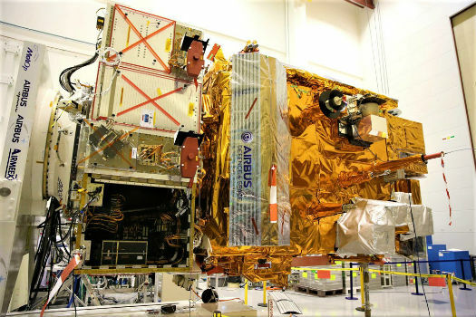
Airbus-built MetOp-C weather satellite gets ready for launch
17th April 2018
Airbus-built MetOp-C weather satellite gets ready for launch
Ownership rights over personal data - By GenerationLibre Think Tank
17th April 2018
Ownership rights over personal data - By GenerationLibre Think Tank
Copernicus App Lab’s Earth Observation Data Tools Ready for Developers
17th April 2018
Copernicus App Lab’s Earth Observation Data Tools Ready for Developers
Intelligent optimisation approach for strategic scheduling control
17th April 2018
Intelligent optimisation approach for strategic scheduling control

Story Maps Team Leader Recognized with AAG Award
17th April 2018
Story Maps Team Leader Recognized with AAG Award
Second Annual Commercial UAV Expo Europe a Huge Success
17th April 2018
Second Annual Commercial UAV Expo Europe a Huge Success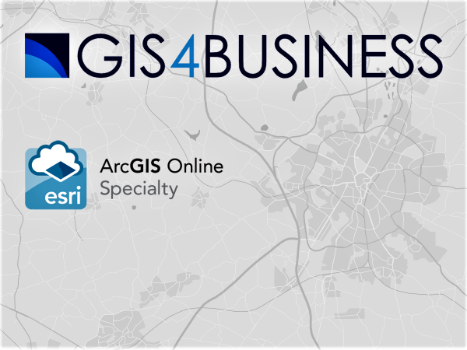
GIS4BUSINESS achieves Esri ArcGIS Online Specialty
17th April 2018
GIS4BUSINESS achieves Esri ArcGIS Online Specialty
GetRentr raises over £500k in seed funding round
16th April 2018
GetRentr raises over £500k in seed funding round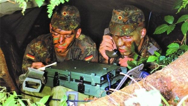
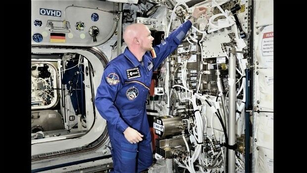
Hardware acceleration boosts science on the ISS
16th April 2018
Hardware acceleration boosts science on the ISS
Mr. Tapio Kallonen appointed CEO, Specim Spectral Imaging Ltd. Oy
12th April 2018
Mr. Tapio Kallonen appointed CEO, Specim Spectral Imaging Ltd. Oy
National Insurance Crime Bureau to Present at the Business Summit
12th April 2018
National Insurance Crime Bureau to Present at the Business Summit
senseFly announces the appointment of new CEO, Gilles Labossière
12th April 2018
senseFly announces the appointment of new CEO, Gilles Labossière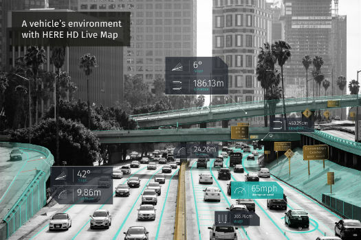
HERE Technologies opens self-driving car R&D site in Boulder, Colorado
12th April 2018
HERE Technologies opens self-driving car R&D site in Boulder, Colorado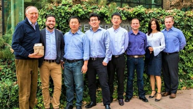
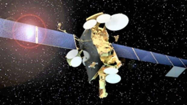
Airbus has shipped SES-12 highly innovative satellite to launch base.
12th April 2018
Airbus has shipped SES-12 highly innovative satellite to launch base.
Satellite imagery and AI software for vineyard health in Australia
12th April 2018
Satellite imagery and AI software for vineyard health in Australia
GEO Business 2018 Launch Brand New Seminar and Workshop Programme
12th April 2018
GEO Business 2018 Launch Brand New Seminar and Workshop Programme
GeoDATA Ireland Showcase 2018 two weeks to go
11th April 2018
GeoDATA Ireland Showcase 2018 two weeks to go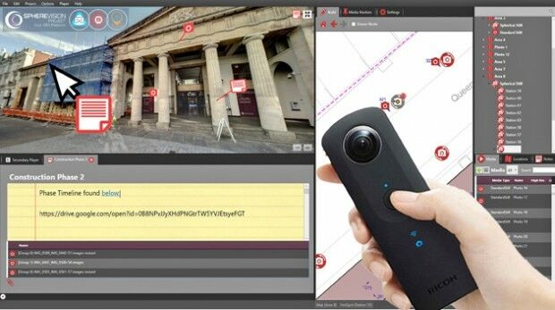
SphereVision Project Provides Complete 360 Imaging Platform
11th April 2018
SphereVision Project Provides Complete 360 Imaging Platform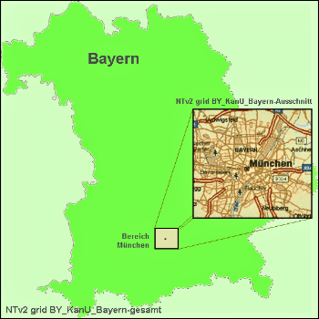
Solutions for problems with large NTv2 files in GIS and Geosoftware
11th April 2018
Solutions for problems with large NTv2 files in GIS and Geosoftware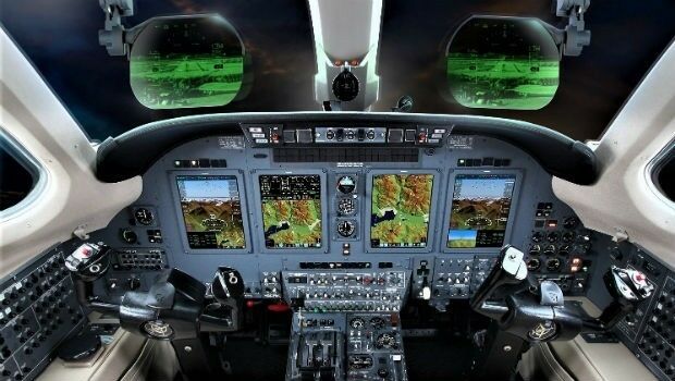
Elbit Systems Acquires Universal Avionics Systems Corporation
11th April 2018
Elbit Systems Acquires Universal Avionics Systems Corporation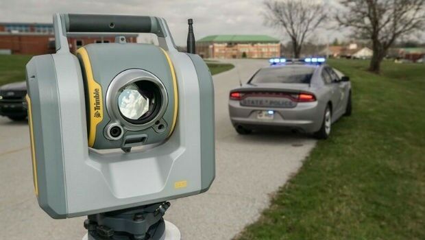
Efficient Data Collection for Crash and Crime Scene Investigators
11th April 2018
Efficient Data Collection for Crash and Crime Scene Investigators
GEO Business 2018 reveal brand new seminar and workshop programme
11th April 2018
GEO Business 2018 reveal brand new seminar and workshop programme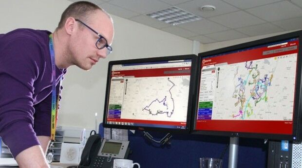
Bedford Boosts Transport Efficiency with QRoutes
11th April 2018
Bedford Boosts Transport Efficiency with QRoutes
More than a Dozen Federal Agencies to Present at GEOINT 2018
10th April 2018
More than a Dozen Federal Agencies to Present at GEOINT 2018
Explore What's in Store for You at the World’s Largest GIS Event
10th April 2018
Explore What's in Store for You at the World’s Largest GIS Event_2017_21AT_Image_All_rights_reserved_-_Distribution_Airbus_DS.jpg)
Airbus further strengthens its Earth observation imagery portfolio
10th April 2018
Airbus further strengthens its Earth observation imagery portfolio
A new generation of high precision multispectral sensor
10th April 2018
A new generation of high precision multispectral sensor
TSA Members welcome SmartWater’s response to equipment theft
10th April 2018
TSA Members welcome SmartWater’s response to equipment theft