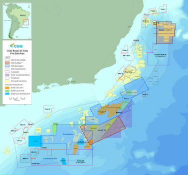
CGG Adds New Santos VIII Multi-Client Survey
16th March 2018
CGG Adds New Santos VIII Multi-Client SurveyThe compilation, reproduction and dissemination of maps and charts by means of manual (analogue) or digital techniques, tools and workflows. This topic covers the compilation, reproduction, dissemination and use of both analogue (paper) and digital maps, charts and atlases. As well as the science of cartography, including georeferencing and geocoding, digital techniques for compiling and generating various types of raster and vector maps and charts are covered, as are the digital mapping tools and Geographic Information Systems available for this purpose. The application of cartography for aeronautical, terrestrial and marine purposes is also covered
16th March 2018
CGG Adds New Santos VIII Multi-Client Survey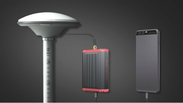
16th March 2018
Tersus Takes New Stride into Surveying with David GNSS Receiver16th March 2018
Airbus launches photonics payload technology project – OPTIMA
15th March 2018
CSA Engineer to be Honored at Australasian Oil and Gas Conference
15th March 2018
Look who's talking at GeoDATA Ireland Showcase 2018
15th March 2018
University of Oldenburg Deploys Globalstar Satellite Technology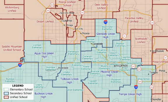
14th March 2018
New 2018 School District Data for Maptitude Mapping Software
14th March 2018
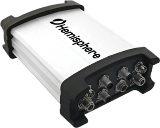
Hemisphere GNSS New Atlas®-Capable Vector™ V1000 GNSS Receiver

13th March 2018
4 weeks until Commercial UAV Expo Europe, 3 days to save.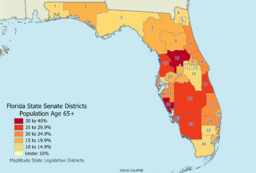
13th March 2018
Maptitude 2018 USA Legislative and Congressional Districts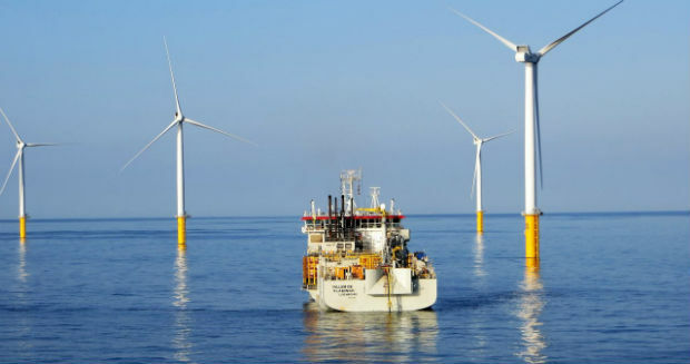
13th March 2018
Septentrio announces special version of AsteRx-U MARINE receiver
13th March 2018
Septentrio introduces SECORX-60 correction service12th March 2018
Jean-François Delepau named as new chairman of the Sofradir Group9th March 2018
CGG announces the cooptation of three new board members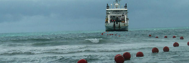
9th March 2018
Successful Permitting Allowed for Submarine Cable Installation9th March 2018
GeoPlace annual conference to take place on 10th May 2018
9th March 2018
Future Cities Show aims at urban innovation as key opportunity for GCC
9th March 2018
Jamie Watson Joins Intelligent Telematics As Field Operations Manager
8th March 2018
EOMAP appointed as Satellite Derived Bathymetry provider8th March 2018
Bentley Systems Issues Call for Submissions8th March 2018
Boundless to Host Roundtable Webinar on Boundless Server Enterprise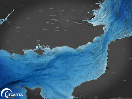
8th March 2018
TCarta to Highlight Safety Benefits at Oceanology International 2018
8th March 2018
OGC publishes Testbed 13 Engineering Reports
8th March 2018
smartStation: The intelligent stop of the future8th March 2018
Esri Releases Survey123 for ArcGIS with New Spike Integration8th March 2018
Space Flight Laboratory to Highlight Missions at Satellite 2018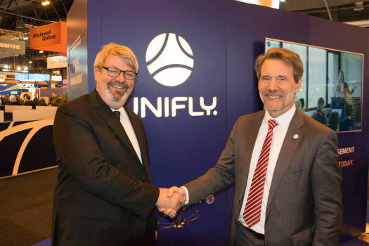
8th March 2018
Integra and Unifly join forces for safer drone traffic near airports
7th March 2018
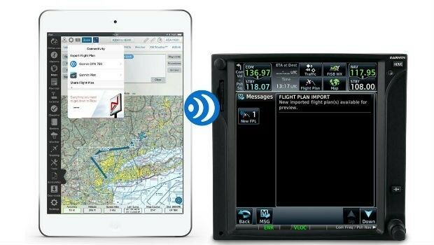
Garmin® grows Connext® wireless cockpit connectivity portfolio
7th March 2018
Rezatec extends its global reach into Canada6th March 2018
OGC joins ApacheCon as Community Partner and Geospatial Track lead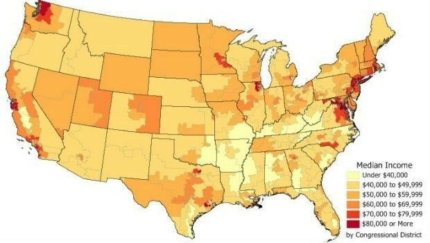
6th March 2018
Data for Use with Maptitude for entire USA6th March 2018
Avenza Releases MAPublisher 10.1 For Adobe Illustrator
6th March 2018
GeoDATA Ireland Showcase 2018 Registration Now Open
6th March 2018
NavAidDrone: new drone-based measurement system6th March 2018
Adapting satellite technologies for general aviation operations
5th March 2018
Woodland Managers in Sweden Choose Globalstar’s SPOT Gen35th March 2018
HERE Technologies autonomous machines study
3rd March 2018
The 4th Myanmar Infrastructure Summit 20182nd March 2018
CityEngine Used to Create Oscar-Nominated Effects in Blade Runner 20492nd March 2018
OGC seeks public comment on Web Services Security Candidate Standard1st March 2018
GeoPlace announces launch of 2018 Exemplar Awards