
Oil Spill Response Limited (OSRL) Announces New Global UAV Service
8th February 2019
Oil Spill Response Limited (OSRL) Announces New Global UAV ServiceThe compilation, reproduction and dissemination of maps and charts by means of manual (analogue) or digital techniques, tools and workflows. This topic covers the compilation, reproduction, dissemination and use of both analogue (paper) and digital maps, charts and atlases. As well as the science of cartography, including georeferencing and geocoding, digital techniques for compiling and generating various types of raster and vector maps and charts are covered, as are the digital mapping tools and Geographic Information Systems available for this purpose. The application of cartography for aeronautical, terrestrial and marine purposes is also covered
8th February 2019
Oil Spill Response Limited (OSRL) Announces New Global UAV Service
8th February 2019
Nanotron contributes to a ground-breaking collaborative project_dipping_sonar_onboard_Seagull_USV.jpg)
8th February 2019
A HELRAS Dipping Sonar Completed Sea Acceptance Test
8th February 2019
Terra Drone Invested in Indonesia’s Drone Service Company AeroGeosurvey8th February 2019
Iridium Declares Victory; $3 Billion Satellite Constellation Upgrade Complete
8th February 2019
Garmin® announces availability of the G1000 NXi upgrade7th February 2019
Airbus and Dassault Aviation sign Joint Concept Study contract
7th February 2019
Pioneering steps into fixed wing - water landing drones in marine ecology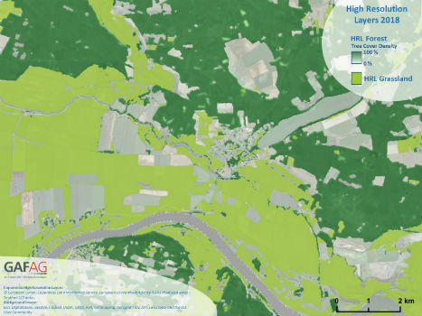
7th February 2019
Copernicus Land Monitoring: High-Resolution Layers 2018 kick off!
6th February 2019
HiDRON Measured Weather Conditions In The Stratosphere
6th February 2019
Airbus and Dassault Systèmes embark on strategic partnership

6th February 2019
11th International Symposium on Digital Earth 20195th February 2019
Intelligent Transport Systems European Congress 2019
5th February 2019
OGC adopts 3D Tiles as Community Standard
5th February 2019
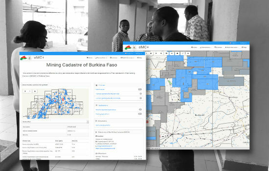
Burkina Faso Establishes Computerised Mining Cadastre
5th February 2019
Goonhilly & Shetland Space Centre join forces for new space opportunities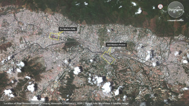
5th February 2019
DigitalGlobe Satellite Imagery: Protests in Caracas, Venezuela
5th February 2019
Canada Awards Microsatellite Contract to Space Flight Laboratory5th February 2019
2019 URISA Exemplary Systems in Government Awards Process Opens
5th February 2019
OGC invites you to participate in its UML-to-GML Application Schema4th February 2019
Airbus adds new service Verde to its precision farming portfolio4th February 2019
Elbit Systems U.S. Subsidiary Awarded a Contract to Provide Avionics
4th February 2019
Instituto Geografico Nacional (IGN) Has Signed With Recursos Tecnicos Madrid, S.L.,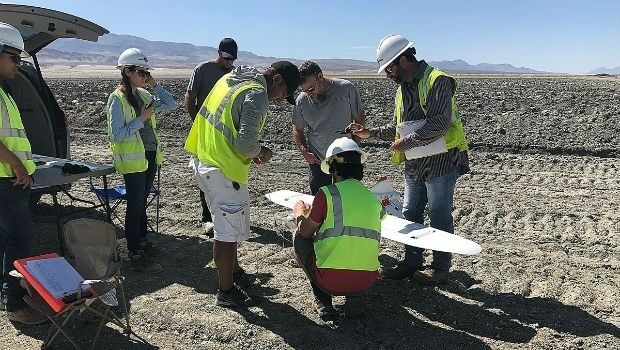
3rd February 2019
Lockheed Martin purchase an Aeromapper Talon UAS
2nd February 2019
Greenvalley International Launches Premium Handheld Mobile Mapping
1st February 2019
CompassDrone, Newest Division Of CompassData,1st February 2019
Worldwide Open Public Safety Technology Standards31st January 2019
Digital platform supported by IBM, Geovation and Ordnance Survey31st January 2019
Esri Releases New Updates to ArcGIS Pro 2.3
31st January 2019
Earth-i Updates Satellite Map of Queensland, Australia
31st January 2019
Handheld launches a new ultra-rugged Android phablet, the NAUTIZ X6
31st January 2019
Juniper Systems Limited Expands EMEA Team
31st January 2019
Juniper Systems Limited Announces New Technical Support Manager Role
31st January 2019
Garmin® announces availability of the GPS 3000
31st January 2019
thinkWhere Creates Map Portal for Open European Geographic Data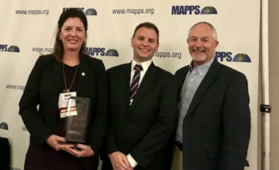
30th January 2019
RIEGL Wins the Prestigious MAPPS Geospatial Products

30th January 2019
Garmin® announces enhancements within FltLogic scheduling program
30th January 2019
OGC Announces Open Invitation to Tender for Testbed-15 ESA Threads30th January 2019
Esri Helps Government Agencies Meet New Open Data Law Requirements30th January 2019
Ordnance Survey make map toolkit for developers
30th January 2019
Integrated Technology Playing Critical Part In Transport Planning
30th January 2019
Delair opens first customer service centers in the US