
GSSI Releases Improved StructureScan™ Mini XT GPR
1st March 2019
GSSI Releases Improved StructureScan™ Mini XT GPRThe compilation, reproduction and dissemination of maps and charts by means of manual (analogue) or digital techniques, tools and workflows. This topic covers the compilation, reproduction, dissemination and use of both analogue (paper) and digital maps, charts and atlases. As well as the science of cartography, including georeferencing and geocoding, digital techniques for compiling and generating various types of raster and vector maps and charts are covered, as are the digital mapping tools and Geographic Information Systems available for this purpose. The application of cartography for aeronautical, terrestrial and marine purposes is also covered
1st March 2019
GSSI Releases Improved StructureScan™ Mini XT GPR
1st March 2019
AEC Next and SPAR 3D 2019 Keynote Speakers Announced27th February 2019
Palatiello Promotes USGS 3DEP Before Congress27th February 2019
Maxar Technologies’ MDA Aids Preservation of Indonesian Rainforest26th February 2019
HawkEye 360 Begins First-of-its-Kind Commercial Geolocation

26th February 2019
GC invites you to its ‘Mixed Reality to the Edge’ Workshop
26th February 2019
TCarta Wins Contract to Map Seafloor around Remote Pacific Island Nation
26th February 2019
Rightware and HERE reimagine the digital automotive user experience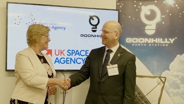
26th February 2019
Goonhilly Partners with the Australian Space Agency
26th February 2019
Cobham SATCOM extends partnership with Inmarsat
26th February 2019
Global Mapper v.20.1 Now Available with Path Profile Zooming26th February 2019
Commercial UAV Expo Americas Announces Massive Support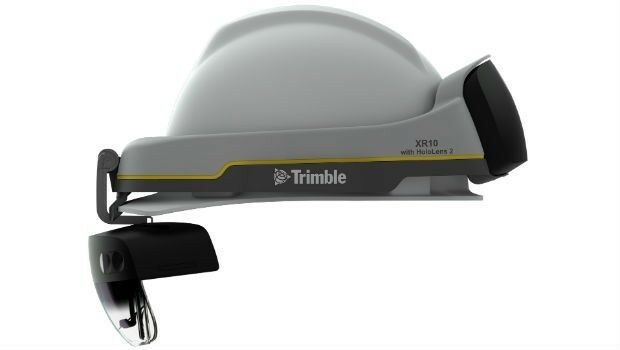
26th February 2019
Trimble Announces Next Generation Mixed-Reality Device
26th February 2019
Routescene Inc. drone based LiDAR system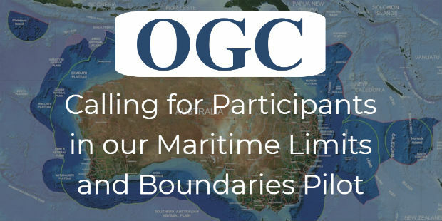
26th February 2019
OGC invites you to participate in its Maritime Limits and Boundaries Pilot26th February 2019
Hexagon Acquires Thermopylae Sciences & Technology
26th February 2019
thinkWhere Helps Atholl Estates Transition to QGIS
25th February 2019
Hexagon advances its 5D visualisation portfolio25th February 2019
HERE to offer mapping and location services for China
25th February 2019
Bentley Systems Introduces Mixed Reality App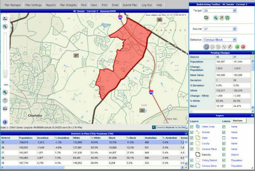
25th February 2019
Selected for Maryland's Online Redistricting Mapping Portal

25th February 2019
Blockchain and Distributed Ledger Technologies (BDLT) Domain Working Group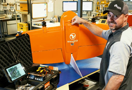
22nd February 2019
RDO becomes first WingtraOne drone Certified Repair Center
22nd February 2019
Satellite building on an entirely new scale
22nd February 2019
OceanWise are running a Scottish Marine Data and GIS Workshop
22nd February 2019
Danish Geodata Agency Partners with Esri
21st February 2019
Terra Drone brings proven UAS solutions to India21st February 2019
Internet of Things Applications Europe 201921st February 2019
OceanTech Program (OT 2019), Zhoushan, China

20th February 2019
New map from HERE Technologies shows quality of cell phone coverage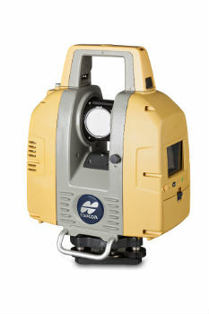
20th February 2019
Topcon GLS-2000 scanner update enhances data capture

20th February 2019
Improves Accuracy On Replica Grade 1 Listed Building Redevelopment
19th February 2019
COMPLETE MOBILE SURVEYING OF AMTRAK’S NEW YORK PENN STATION19th February 2019
Airbus turns imagery into insight with The OneAtlas Platform19th February 2019
American Red Cross to present at Esri UK AC19th February 2019
Nanotron and ClearBlade partner to deliver 360° Edge Analytics