
Cartography
The compilation, reproduction and dissemination of maps and charts by means of manual (analogue) or digital techniques, tools and workflows. This topic covers the compilation, reproduction, dissemination and use of both analogue (paper) and digital maps, charts and atlases. As well as the science of cartography, including georeferencing and geocoding, digital techniques for compiling and generating various types of raster and vector maps and charts are covered, as are the digital mapping tools and Geographic Information Systems available for this purpose. The application of cartography for aeronautical, terrestrial and marine purposes is also covered

URISA Announces 2019-2020 Vanguard Cabinet of Young Professionals
14th January 2019
URISA Announces 2019-2020 Vanguard Cabinet of Young Professionals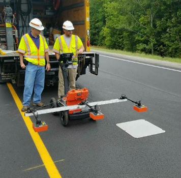
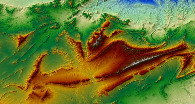
Maine DOT Uses New GPR Technology to Improve Road Pavement Quality
14th January 2019
Maine DOT Uses New GPR Technology to Improve Road Pavement Quality
Industry professionals inspire teachers thanks to Topcon
11th January 2019
Industry professionals inspire teachers thanks to Topcon
SIAP joins Rezatec on UK Space Agency COMPASS project
11th January 2019
SIAP joins Rezatec on UK Space Agency COMPASS project
Experience strongest ever SLAM with GeoSLAM's upgrade any SLAM device campaign
10th January 2019
Experience strongest ever SLAM with GeoSLAM's upgrade any SLAM device campaign
Cyient Positioned as an “Established and Expansive” Player
10th January 2019
Cyient Positioned as an “Established and Expansive” Player
CMAI India and BroadGroup forge strategic partnership agreement
10th January 2019
CMAI India and BroadGroup forge strategic partnership agreement
SSTL completes small geostationary platform build for EUTELSAT QUANTUM
10th January 2019
SSTL completes small geostationary platform build for EUTELSAT QUANTUM
Azteca Systems Opens Regional Office in Indiana
10th January 2019
Azteca Systems Opens Regional Office in Indiana
Startup disruptive technological solutions to be featured
9th January 2019
Startup disruptive technological solutions to be featured
Geospatial Information Technologies at the AAG Annual Meeting
9th January 2019
Geospatial Information Technologies at the AAG Annual Meeting

Bristol Water renews annual subscription with Rezatec
9th January 2019
Bristol Water renews annual subscription with Rezatec
Cambridge-Based GeoSpock Secures £10 Million Additional Funding
9th January 2019
Cambridge-Based GeoSpock Secures £10 Million Additional Funding
Microsatellite Constellation Built by Space Flight Laboratory
9th January 2019
Microsatellite Constellation Built by Space Flight Laboratory
Request for Information: “Mixed Reality to the Edge”
9th January 2019
Request for Information: “Mixed Reality to the Edge”
Amazon & HERE partner to power location services in Alexa
9th January 2019
Amazon & HERE partner to power location services in Alexa
Septentrio & Sapcorda to demonstrate autonomous driving at CES
9th January 2019
Septentrio & Sapcorda to demonstrate autonomous driving at CES
Join the next 1-day Marine Data Management Awareness Course
9th January 2019
Join the next 1-day Marine Data Management Awareness Course
IWCE 2019 Offers Professionals Unrivaled Education
7th January 2019
IWCE 2019 Offers Professionals Unrivaled Education
pdf3d.io introduces rapid integration and RESTful server
7th January 2019
pdf3d.io introduces rapid integration and RESTful server
Valeo Demonstrates Telematics Platform Equipped with Autotalks' Global
4th January 2019
Valeo Demonstrates Telematics Platform Equipped with Autotalks' Global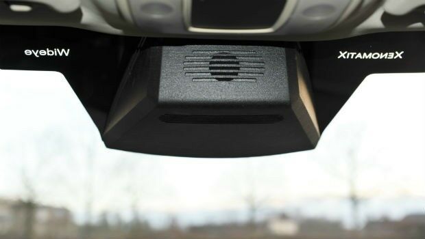
A seamless integration of LiDAR sensors behind vehicles’ windshield
4th January 2019
A seamless integration of LiDAR sensors behind vehicles’ windshield
Tory Elmore Named URISA Young Professional of the Year
4th January 2019
Tory Elmore Named URISA Young Professional of the Year
HERE secures top spot in Strategy Analytics' 2018
3rd January 2019
HERE secures top spot in Strategy Analytics' 2018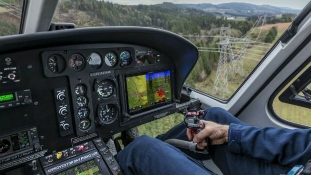
Garmin® announces certification of the G500H TXi flight displays
3rd January 2019
Garmin® announces certification of the G500H TXi flight displays
u-blox seeks fair, reasonable and non-discriminatory (FRAND) licensing terms
2nd January 2019
u-blox seeks fair, reasonable and non-discriminatory (FRAND) licensing terms
Next Generation GPS III Satellite Responding to Commands
27th December 2018
Next Generation GPS III Satellite Responding to Commands
PCI Geomatics Announces Remote Sensing Young Scholars Program
27th December 2018
PCI Geomatics Announces Remote Sensing Young Scholars Program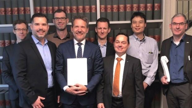
GAF has been awarded a Framework Contract by the European Union Satellite Centre
21st December 2018
GAF has been awarded a Framework Contract by the European Union Satellite Centre
FREE Registration Opens for Ocean Business 2019
21st December 2018
FREE Registration Opens for Ocean Business 2019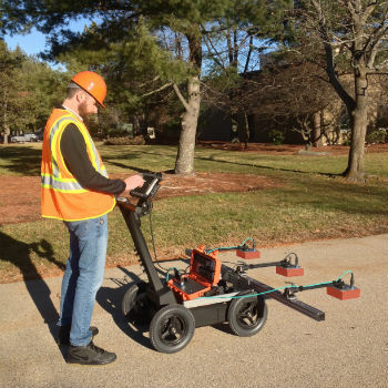

GSSI Showcases Its Latest GPR Technology at World of Concrete
21st December 2018
GSSI Showcases Its Latest GPR Technology at World of Concrete
OGC Announces its 110th Technical and Planning Committee Meeting
21st December 2018
OGC Announces its 110th Technical and Planning Committee Meeting


Headwall Photonics Further Builds Business in Europe
20th December 2018
Headwall Photonics Further Builds Business in Europe
GEO Business Opens Registration for 2019 event
20th December 2018
GEO Business Opens Registration for 2019 event
French military Earth observation satellite (CSO) launched successfully
19th December 2018
French military Earth observation satellite (CSO) launched successfully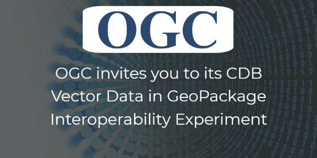
CDB Vector Data in GeoPackage Interoperability Experiment
19th December 2018
CDB Vector Data in GeoPackage Interoperability Experiment
Esri UK - annual conference call for papers
19th December 2018
Esri UK - annual conference call for papers
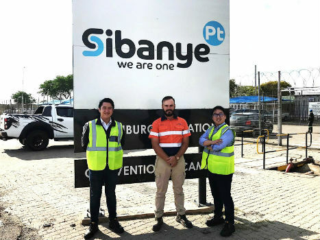
Terra Drone South Africa succeeded the underground mining demonstration
19th December 2018
Terra Drone South Africa succeeded the underground mining demonstration
Submission Deadline for CalGIS 2019 Presentation Proposals Approaching
19th December 2018
Submission Deadline for CalGIS 2019 Presentation Proposals Approaching