
Cartography
The compilation, reproduction and dissemination of maps and charts by means of manual (analogue) or digital techniques, tools and workflows. This topic covers the compilation, reproduction, dissemination and use of both analogue (paper) and digital maps, charts and atlases. As well as the science of cartography, including georeferencing and geocoding, digital techniques for compiling and generating various types of raster and vector maps and charts are covered, as are the digital mapping tools and Geographic Information Systems available for this purpose. The application of cartography for aeronautical, terrestrial and marine purposes is also covered
IN-FLIGHT Data awarded three GUINNESS WORLD RECORDS™
19th February 2019
IN-FLIGHT Data awarded three GUINNESS WORLD RECORDS™
Juniper Systems Limited Launches New Cedar CT8 Rugged Tablet
19th February 2019
Juniper Systems Limited Launches New Cedar CT8 Rugged Tablet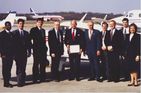
Garmin® celebrates a GPS milestone in aviation
18th February 2019
Garmin® celebrates a GPS milestone in aviation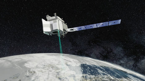
Mapping and Monitoring the Carbon Content of Earth’s Forests
18th February 2019
Mapping and Monitoring the Carbon Content of Earth’s Forests
Offshore Survey 2019 Launches Technology Packed Programme
16th February 2019
Offshore Survey 2019 Launches Technology Packed Programme
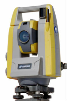
Topcon introduces GT-503M motorised total station
15th February 2019
Topcon introduces GT-503M motorised total station

New radar systems enable quick integration
15th February 2019
New radar systems enable quick integration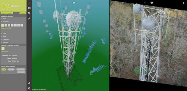

Terra Drone Optimizes Long-Distance Power Line inspection
15th February 2019
Terra Drone Optimizes Long-Distance Power Line inspection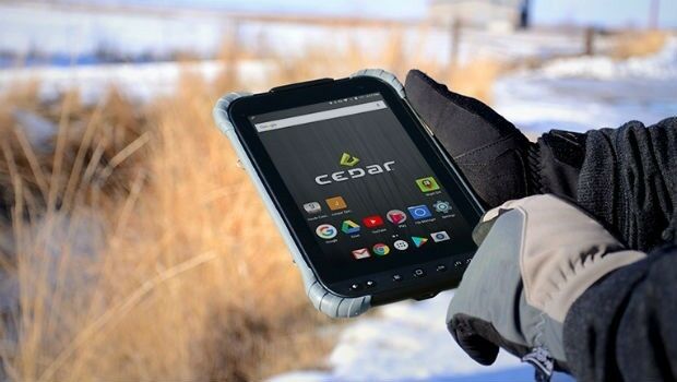
Juniper Systems releases Cedar CT8 Rugged Tablet
15th February 2019
Juniper Systems releases Cedar CT8 Rugged Tablet
exactEarth’s Revolutionary Global Real-Time Maritime Tracking
15th February 2019
exactEarth’s Revolutionary Global Real-Time Maritime Tracking
Research project to offer neural networks training
15th February 2019
Research project to offer neural networks training
OGC requests public comment on draft charter for new Portrayal Domain Working Group
15th February 2019
OGC requests public comment on draft charter for new Portrayal Domain Working Group
HERE establishes groundbreaking AI research institute
15th February 2019
HERE establishes groundbreaking AI research institute
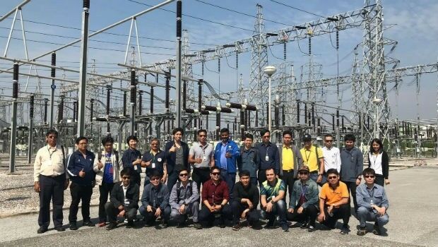
Bentley Systems Announces OpenUtilities™ Solutions for DER
15th February 2019
Bentley Systems Announces OpenUtilities™ Solutions for DER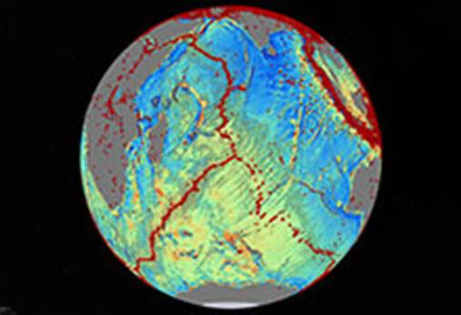
Navy-Sponsored Scientist Awarded for Sea-Floor Mapping
15th February 2019
Navy-Sponsored Scientist Awarded for Sea-Floor Mapping
OGC Seeks Public Comment on MetOcean profile and extensions to WCS 2.1
15th February 2019
OGC Seeks Public Comment on MetOcean profile and extensions to WCS 2.1

Esri's Dr. Dawn Wright to Speak at the College of William & Mary
13th February 2019
Esri's Dr. Dawn Wright to Speak at the College of William & Mary
Navixy Integrates Two-Way Messaging Powered by tyntec
13th February 2019
Navixy Integrates Two-Way Messaging Powered by tyntec
Dstl Announce Swarming Drone Hackathon Challenge
13th February 2019
Dstl Announce Swarming Drone Hackathon Challenge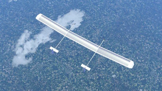
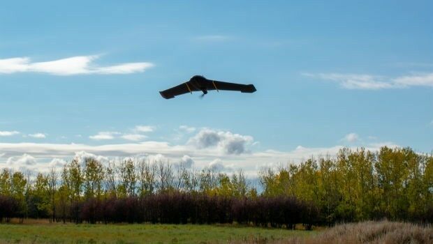
New high-altitude platform to revolutionise the way we look at earth
13th February 2019
New high-altitude platform to revolutionise the way we look at earth
Parkbob and ESA join forces for satellite-driven parking availability services in smart cities
13th February 2019
Parkbob and ESA join forces for satellite-driven parking availability services in smart cities
Unifly partners with Terra Drone India to support UTM in India
13th February 2019
Unifly partners with Terra Drone India to support UTM in India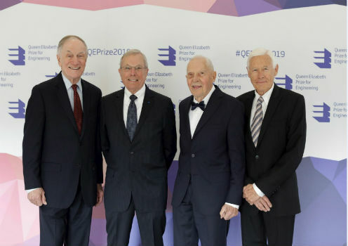
Queen Elizabeth Prize for Engineering awarded
13th February 2019
Queen Elizabeth Prize for Engineering awarded
Drive, Park, Ride: Moovit and TomTom Align With Microsoft
13th February 2019
Drive, Park, Ride: Moovit and TomTom Align With Microsoft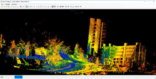
Mobile Mapping System Road-Scanner for the first tram line in Bologna
13th February 2019
Mobile Mapping System Road-Scanner for the first tram line in Bologna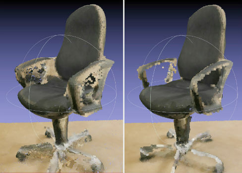
NavVis now uses SLAM to automatically remove point cloud artifacts
12th February 2019
NavVis now uses SLAM to automatically remove point cloud artifacts
RIMS in certification as Remote Inspection Specialist using drones
12th February 2019
RIMS in certification as Remote Inspection Specialist using drones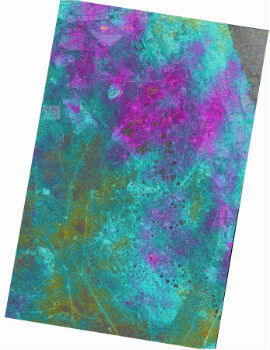
Airbus and Hisdesat successfully processed the first TerraSAR-X / PAZ
12th February 2019
Airbus and Hisdesat successfully processed the first TerraSAR-X / PAZ
New for 2019 – GeoDATA Forum co-locates at GEO Business 2019
12th February 2019
New for 2019 – GeoDATA Forum co-locates at GEO Business 2019
PCI Geomatics Releases Geomatica and GXL 2018, SP1
12th February 2019
PCI Geomatics Releases Geomatica and GXL 2018, SP1
SimActive Expands its Partner Network for Medium Format Camera Solutions
12th February 2019
SimActive Expands its Partner Network for Medium Format Camera Solutions
Two new training courses available from Newcastle University
12th February 2019
Two new training courses available from Newcastle University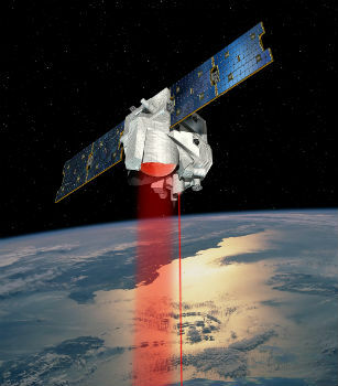
Airbus invests €25 million in the future of its aerospace site
11th February 2019
Airbus invests €25 million in the future of its aerospace site
Exalto Emirates adds Martek's Anti Drone System to it's portfolio
11th February 2019
Exalto Emirates adds Martek's Anti Drone System to it's portfolio
CGG and TGS Announce Greater Castberg Survey in Barents Sea
11th February 2019
CGG and TGS Announce Greater Castberg Survey in Barents Sea
MAPPS Presents the 2018 Geospatial Products and Services Excellence Awards
11th February 2019
MAPPS Presents the 2018 Geospatial Products and Services Excellence Awards
Ubirider: the Portuguese startup disrupting urban mobility
11th February 2019
Ubirider: the Portuguese startup disrupting urban mobility
Airbus and JSAT sign cooperation agreement
8th February 2019
Airbus and JSAT sign cooperation agreement
Aireon Takes Full Control of Final ADS-B Payloads
8th February 2019
Aireon Takes Full Control of Final ADS-B Payloads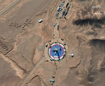
Pre- and Post-Launch at of Iranian Satellite
8th February 2019
Pre- and Post-Launch at of Iranian Satellite
The ISDE11 Call for Abstracts is now open
8th February 2019
The ISDE11 Call for Abstracts is now open