
Spectra MobileMapper 50 Combines Smartphone with GNSS Capabilities
29th June 2016
Spectra MobileMapper 50 Combines Smartphone with GNSS CapabilitiesThe compilation, reproduction and dissemination of maps and charts by means of manual (analogue) or digital techniques, tools and workflows. This topic covers the compilation, reproduction, dissemination and use of both analogue (paper) and digital maps, charts and atlases. As well as the science of cartography, including georeferencing and geocoding, digital techniques for compiling and generating various types of raster and vector maps and charts are covered, as are the digital mapping tools and Geographic Information Systems available for this purpose. The application of cartography for aeronautical, terrestrial and marine purposes is also covered
29th June 2016
Spectra MobileMapper 50 Combines Smartphone with GNSS Capabilities
29th June 2016
Longitude Announces Offering of Rare Soviet Maps of U.S. Cities29th June 2016
Pinellas County Receives Esri Enterprise GIS Award

29th June 2016
Septentrio Announces Upgrades for Altus NR2 and PinPoint-GIS29th June 2016
Arun District Council grasps opportunities by migrating to Cadcorp GIS

29th June 2016
TomTom and sensewhere Team Up to Bring Location Based Service Indoors29th June 2016
1Spatial’s 1Integrate for ArcGIS Goes Mobile with Collector for ArcGIS
28th June 2016
Cyber Security for Critical Infrastructure Exchange
28th June 2016
DigitalGlobe and Esri Announce New Long-Term Partnership27th June 2016
Charlotte Uses Cityworks across Entire City27th June 2016
Bentley Announces Global Framework Agreement with Shell27th June 2016
Septentrio's Enhanced Georeferencing Solutions for Drone Aerial Survey
27th June 2016
Extreme Runners to be Protected by Globalstar’s SPOT Gen3
27th June 2016
CMS-Geotech Ltd launches new Monitoring System.
27th June 2016
Inmarsat solution certified for Airbus A320 aircraft family27th June 2016
Mapillary Awarded as Technology Pioneer by World Economic Forum

25th June 2016
Nonincendive Mesa 2 Rugged Tablet™ Certified for Hazardous Locations24th June 2016
MapAction and World Food Programme help Sri Lankan Government

24th June 2016
Driverless Technology Conference 2016 Update
24th June 2016
Airbus Defense and Space Partners with AMREL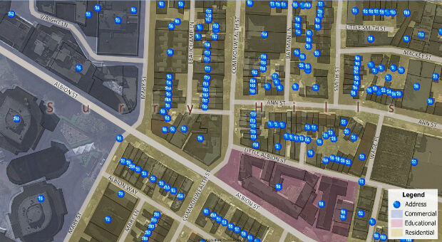
23rd June 2016
Maptitude Now Has 14+ Million Australian Address Points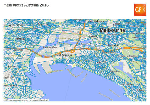
23rd June 2016
GfK releases new geodata for Australia and New Zealand23rd June 2016
CompassDrone™ Your One-Stop-Shop for Drone Based Remote Sensing
23rd June 2016
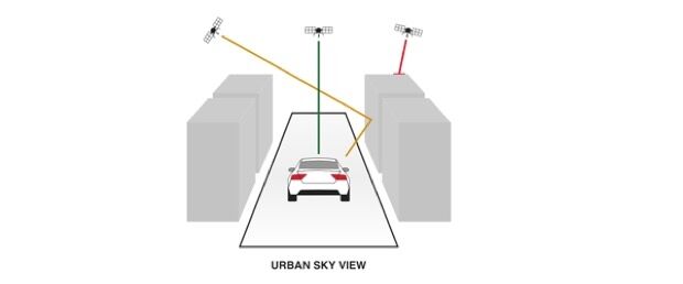
u-blox Untethered Dead Reckoning technology
23rd June 2016
ATrack Announces Strategic Partnership with PodsystemM2M22nd June 2016
Esri's Federal Small Business Program Grows at Rapid Pace22nd June 2016
GSSI Announces Flexible, Configurable Ground Penetrating Radar System
22nd June 2016
Hemisphere GNSS Announces New Eclipse Positioning OEM Boards22nd June 2016
Airbus Defense and Space and 3v Geomatics Partner for TerraSARX"
22nd June 2016
Cadcorp’s fire service resource planning tool is even more realistic22nd June 2016
Icaros Releases 4.2.2 of OneButton™ UAS Image Processing Software
22nd June 2016
PTV Transport Consult is one of Germany’s best consulting companies
22nd June 2016
Build Smart 3D Cities in Minutes with Game-Changing Esri CityEngine

21st June 2016
CompassCom and Latitude Geographics Announce Application Partnership21st June 2016
LandWorks Introduces New Spatial Alignment Tool at Esri Conference21st June 2016
North Carolina selects HERE to manage traffic congestion21st June 2016
Spirent Announces World’s Smallest 16-bit Record and Playback System
21st June 2016
Fugro Deploys Q1400 Trenchers at Three North Sea Oil and Gas Projects21st June 2016
GSDI 15 Workshop Opportunities in Taiwan, 29 November to 2 December