
New Managing Director For Fugro Geoservices
26th July 2016
New Managing Director For Fugro GeoservicesThe compilation, reproduction and dissemination of maps and charts by means of manual (analogue) or digital techniques, tools and workflows. This topic covers the compilation, reproduction, dissemination and use of both analogue (paper) and digital maps, charts and atlases. As well as the science of cartography, including georeferencing and geocoding, digital techniques for compiling and generating various types of raster and vector maps and charts are covered, as are the digital mapping tools and Geographic Information Systems available for this purpose. The application of cartography for aeronautical, terrestrial and marine purposes is also covered
26th July 2016
New Managing Director For Fugro Geoservices
26th July 2016
Maptek and BBE collaborate around advanced mine ventilation solutions
26th July 2016
TM Forum Recognizes Randy Frantz for IoT and GIS Leadership25th July 2016
HERE appoints Peter Meier as Chief Financial Officer25th July 2016
A look around the UAS boom industry at interaerial SOLUTIONS
25th July 2016
Praise for The Survey School’s prize-winning 2016 graduates
25th July 2016
Garmin introduces G5 electronic flight instrument
22nd July 2016
Apply to Geovation now to secure funding for your GeoTech start-up
22nd July 2016
Van Deliveries Growth Highlights Need for Flexible Road Safety Systems22nd July 2016
Loudoun County Honored for 30 Years of Innovation with GIS
21st July 2016
Airbus to operate Heron 1 drones for Germany also in Mali
21st July 2016
BARTHAUER Company Bicycle Program German Company Gets Employees Moving
21st July 2016
TomTom City extends to Manchester and Glasgow
21st July 2016
Location Matters in Manchester CityVerve Project
20th July 2016
Airbus Defence and Space Launches “One Tasking”
19th July 2016
SSTL expands LEO platform capability with VESTA nanosatellite19th July 2016
Masternaut launches fuel module to improve compliance and cut costs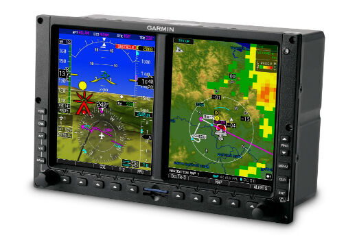
19th July 2016
Garmin announces new enhancements to the G500/G600
18th July 2016
Fugro Commences Offshore Geotechnical Contract For ONGC India
18th July 2016
QuestUAV Provides Own PPK Solution For Q-200 Surveyor UAV18th July 2016
NM Group awarded contract to deliver transmission powerline survey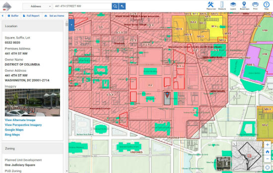
16th July 2016
Blue Raster Incorporates Esri Technology into DC Office of Zoning Map15th July 2016
Bentley Announces Autodesk License Upgrade Program15th July 2016
Esri and ICMA Partner to Educate Smart Communities15th July 2016
OriginGPS and TDK Shrink GNSS Footprint for Wearables
14th July 2016
25 years ago – Europe’s first Earth observation satellite was launched14th July 2016
Eircode data and services now available from Europa Technologies
13th July 2016
Hexagon Geospatial Releases Power Portfolio 201613th July 2016
Cityworks Staff Earn Asset Management Certifications
13th July 2016
Esri finalist for 2016 Microsoft Azure Certified ISV Solution13th July 2016
Advanced GPS-tracking of vehicles with BITREK CONNECT
12th July 2016
Leica Geosystems completes CAA qualifications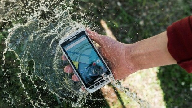
12th July 2016
Handheld Launches the NAUTIZ X2 All-in-One Rugged Android Device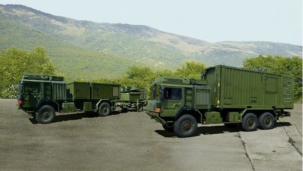
12th July 2016
Airbus Defence and Space presents its Mobile General Ground Station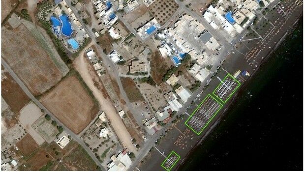
12th July 2016
Shelter from the summer sun under legal umbrellas11th July 2016
CompeGPS and the OS team up to produce the ‘OS Range of GPS Units’11th July 2016
3 Major key management system contracts won by Airbus D&S
11th July 2016
Elbit Systems Launches Light SPEAR™ UAS Jamming System8th July 2016
ARBOR 8" Android Based HMI Panel PC perfect for telematics applications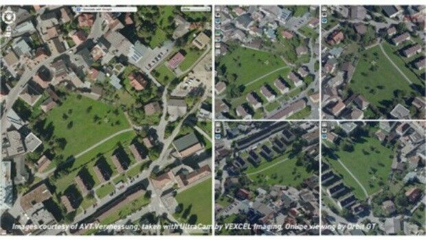
8th July 2016
Orbit GT and Vexcel Imaging, Austria sign Reseller Agreement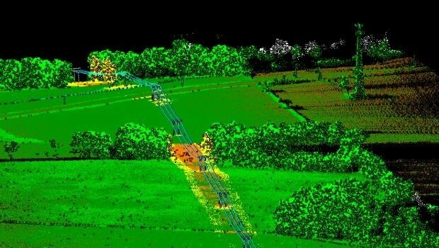
8th July 2016
Patrol+® a flying success with survey completed for National Grid
8th July 2016
The Truth About Drones in Construction and Infrastructure Inspection8th July 2016
Topcon poll reveals cost of stolen equipment8th July 2016
Vexcel Imaging and Orbit GT sign Reseller Agreement7th July 2016
Esri Education Manager Presented with Highest Honor