
MGISS Helps Highways Sector Adopt New Highways England Standards
2nd July 2020
MGISS Helps Highways Sector Adopt New Highways England Standards
2nd July 2020
MGISS Helps Highways Sector Adopt New Highways England Standards1st July 2020
Topcon expands intelligent paving portfolio with Thermal Mapper system1st July 2020
Munir Ismet appointed as new MD at Ordnance Survey1st July 2020
Landmark appoints Alex Wrottesley as Managing Director of Environment and Mapping division
8th June 2020
Online training: Learn how to add easy-to-use SAR processing to your remote sensing applications27th May 2020
Landmark extends Promap Premium Layers with free access to all layers until the end of June
25th May 2020
Ordnance Survey to create the Ordnance Survey of Dubai
18th May 2020
Teledyne Optech partners with Aerial Surveys International to provide hyper-realistic mapping solution13th May 2020
Launch of NavVis VLX readies mobile mapping for mainstream use in surveying by delivering unprecedented data quality
8th May 2020
TerraMotion to develop solution for monitoring land motion in peatland areas across the UK


27th April 2020
Jupiter probe JUICE: Final integration in full swing
24th April 2020
RIEGL’s Combining Terrestrial and UAV-borne Scan Data in an Archeology Application15th April 2020
Gexcel webinar: Fast stockpile volume evaluation
25th February 2020
New Power BI custom visual for embedding interactive maps
4th February 2020
1Spatial announce the release of 1Integrate v2.6
14th January 2020
Welwyn Hatfield Borough Council ‘Think Digital’ with Web GIS
3rd December 2019
Getmapping partners with 3D Visualisation Technology Leaders28th November 2019
GeoSeer Releases Licensed Database of Spatial Web Services
28th October 2019
Setting out weed control tender made easier with geospatial data analysis15th October 2019
thinkWhere Releases New Version of groundMapper Web Mapping Tool
15th October 2019
thinkWhere Releases New groundMapper Web Mapping Tool
9th October 2019
thinkWhere Appointed Government Digital Specialist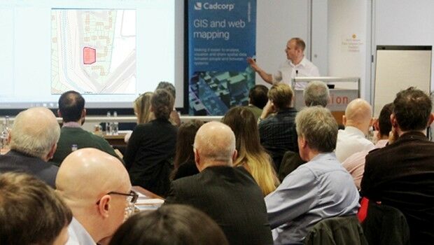
10th September 2019
Cadcorp announces 2020 dates for Local Government Conferences5th September 2019
thinkWhere Supports Scottish Government Planning Process
2nd September 2019
AND (AMS: AND) LAUNCHES NEW SUITE OF API FOR LOCATION-AWARE CONTENT
15th August 2019
OGC requests public comment on draft charter for new ‘OGC API - Catalogues’ Standards Working Group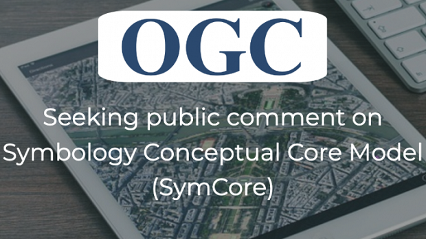
13th August 2019
OGC seeks public comment on Symbology Conceptual Core Model (SymCore)5th August 2019
KUALA LUMPUR TO PLAY HOST TO THE 2ND CITIES 4.0 CONFERENCE AND EXHIBITION

23rd July 2019
Satellite Imagery: Captured British Oil Tanker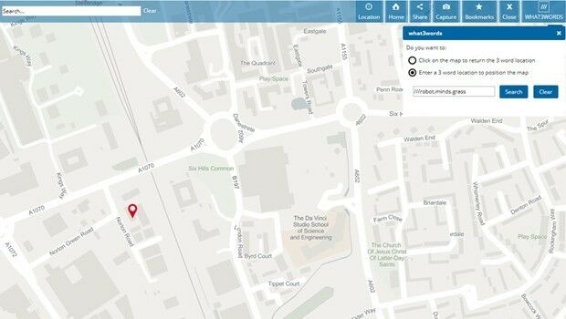
22nd July 2019
Cadcorp SIS WebMap offers access to what3words addressing
11th July 2019
OGC announces the creation of a new Domain Working GroupGEO.jpg)
3rd July 2019
Kinesis Seeks Partners to Expand Vehicle Tracking Business3rd July 2019
GeoCalc SDK 7.5 Released with an Expanded Geodetic Database
3rd July 2019
Cadcorp introduces Spatial Database Service in G-Cloud 11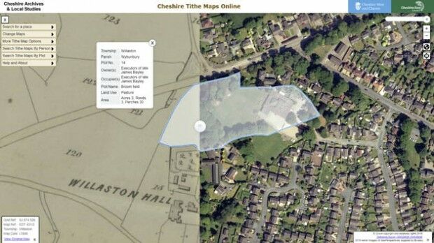
5th June 2019
Aerial Photographs Bring to Life Early Tax Maps of Cheshire
30th May 2019
Ancient Landforms of the Australian Rainforest Revealed by Airborne LiDAR
28th May 2019
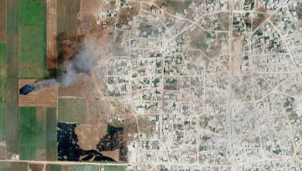
Satellite Imagery: Syrian Government Offensive in Idlib Province, Syria24th May 2019
Extensis to Cameo Digital Asset Management Solution