
IOT WEEK 2019 – WHERE INNOVATIVE TECH MEETS BUSINESS AND SOCIETY!
23rd May 2019
IOT WEEK 2019 – WHERE INNOVATIVE TECH MEETS BUSINESS AND SOCIETY!23rd May 2019
IOT WEEK 2019 – WHERE INNOVATIVE TECH MEETS BUSINESS AND SOCIETY!
23rd May 2019
Topcon announces advanced Bentley integration23rd May 2019
thinkWhere Online Mapping Tool Helps Falkirk Residents Access Essential Services21st May 2019
Airbus signs MOU with Hellenic Space Agency for future space cooperation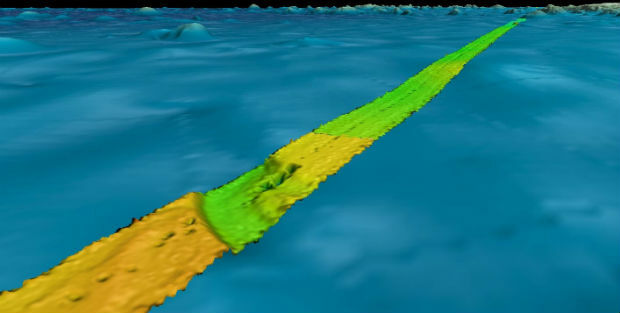
20th May 2019
Fugro supports two ocean mapping initiatives

16th May 2019
OGC seeks public comment on candidate Sensor Model Language (SensorML) v2.1 standard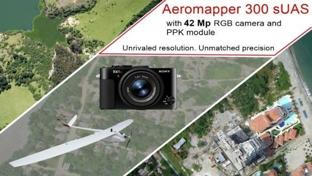
15th May 2019
AEROMAPPER 300 & 42Mp camera with PPK bundle15th May 2019
Geodata – the currency of the future centre stage at INTERGEO 2019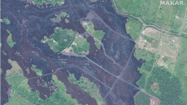
15th May 2019
Satellite Imagery: Hawaii One Year After Kilauea Eruption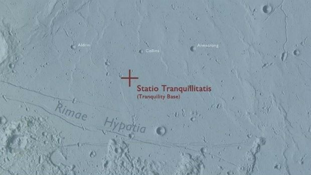
14th May 2019
Ordnance Survey map commemorates 1969 moon landing14th May 2019
Bentley Systems Announces the Acquisition of Keynetix10th May 2019
New digital maps available for Germany, Austria and Switzerland
9th May 2019
Cadcorp SIS 9 service release extends support for Ordnance Survey data formats
8th May 2019
Workshop and Presentation Proposals Invited for #GIS/ValTech20206th May 2019
Esri releases ArcGIS 10.7 unifying Esri software and services6th May 2019
Airbus takes next major step for Telesat’s LEO satellite constellation
6th May 2019
Airbus to build multimission satellite for MEASAT
6th May 2019
Hisdesat appoints Airbus and Thales Alenia Space
3rd May 2019
Download your copy of the Little Book of Spatial Data Quality
2nd May 2019
GeoDATA Forum Announce thought provoking programme2nd May 2019
Submissions for Galileo Masters 2019 Open May 12nd May 2019
Samsung SDS and Telensa Partner for Smart City Infrastructure
2nd May 2019
OGC calls for Sponsors of a major Innovation Initiative, Testbed 1629th April 2019
Yotta Incorporates Blueprints In Latest Alloy Release29th April 2019
Ordnance Survey and partners to create pilot map of the North East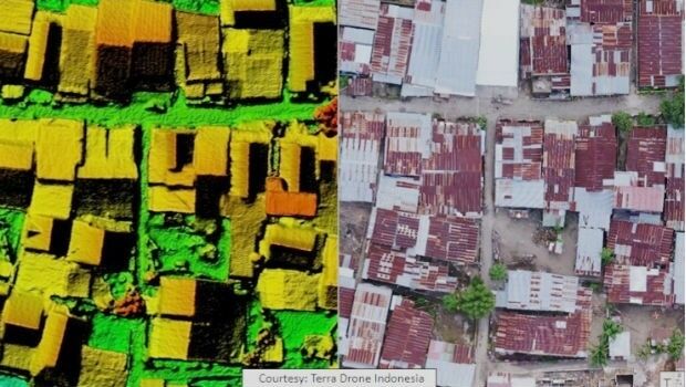
26th April 2019
Terra Drone Indonesia Performed Baseline Modeling26th April 2019
Defence IQ releases its Military Radar Trends and Acquisitions Report for 2019

24th April 2019
Brazil’s Civil Aviation Authority Approves senseFly Drones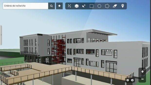
23rd April 2019
Innovation CARL Software presents its new solutions for operational BIM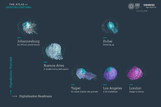
18th April 2019
Johannesburg: Siemens launches Atlas of Digitalization17th April 2019
Blue Marble’s Global Mapper Mobile App Now Available16th April 2019
Start-ups to receive funding, business support and more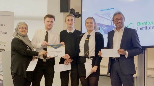
12th April 2019
Bentley Systems Announces Drummond Community High School Team as Winners

11th April 2019
OGC Requests Information on Earth Observation Big Data Architecture
11th April 2019
Garmin® receives EASA approval of the GFC 500 autopilot
8th April 2019
Sercel Brings its Technical Expertise to Structural Health
4th April 2019
Smart cities predicted to deliver more than USD 20 trillion
3rd April 2019
OGC invites developers to the OGC API Hackathon