
Samsung SDS and Telensa Partner for Smart City Infrastructure
2nd May 2019
Samsung SDS and Telensa Partner for Smart City Infrastructure
OGC calls for Sponsors of a major Innovation Initiative, Testbed 16
2nd May 2019
OGC calls for Sponsors of a major Innovation Initiative, Testbed 16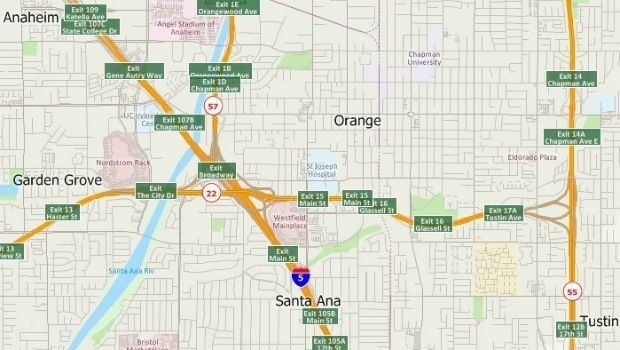
Free Highway Exits & Interchanges Data for Use with Maptitude 2019
1st May 2019
Free Highway Exits & Interchanges Data for Use with Maptitude 2019
Bluesky Tree Map Aids Natural Flood Management Project
1st May 2019
Bluesky Tree Map Aids Natural Flood Management Project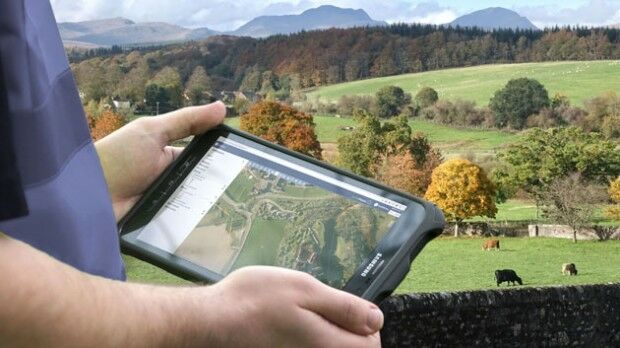
Scotland’s Rural College Contracts thinkWhere to Deliver GIS
30th April 2019
Scotland’s Rural College Contracts thinkWhere to Deliver GIS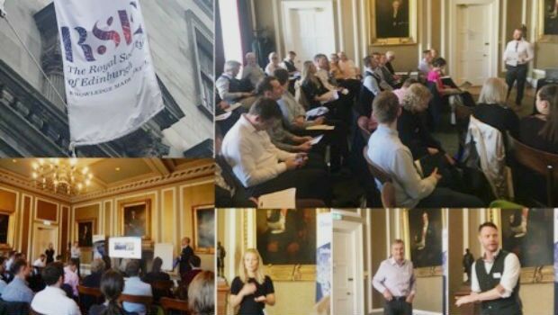
OceanWise Scottish Marine Data Workshop – a great success!
30th April 2019
OceanWise Scottish Marine Data Workshop – a great success!
Tugdual Le Bouar appointed to lead CARL Software, as Managing Director
30th April 2019
Tugdual Le Bouar appointed to lead CARL Software, as Managing Director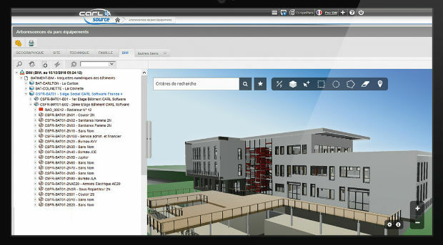
CARL Software presents its new solutions for operational BIM
30th April 2019
CARL Software presents its new solutions for operational BIM
Geodata provides the basis, but collaboration is key
30th April 2019
Geodata provides the basis, but collaboration is key
Europa Technologies announces v2019.1 of premier global data products
30th April 2019
Europa Technologies announces v2019.1 of premier global data products
What’s behind the ground-breaking 3D habitat map of the Great Barrier Reef?
30th April 2019
What’s behind the ground-breaking 3D habitat map of the Great Barrier Reef?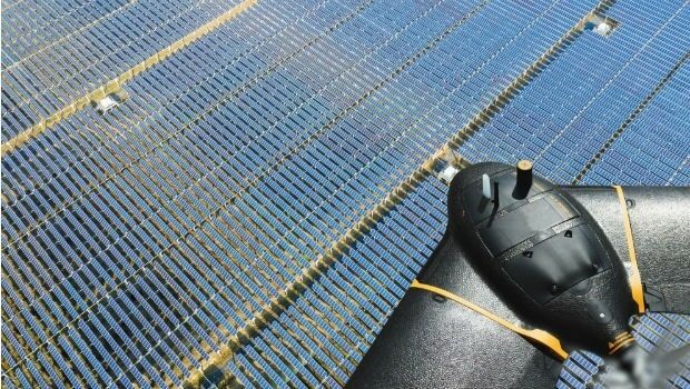
senseFly introduces the Solar 360 thermal drone solution
30th April 2019
senseFly introduces the Solar 360 thermal drone solution
OGC invites developers to participate in the CityGML Hackathon
30th April 2019
OGC invites developers to participate in the CityGML Hackathon
Yotta Incorporates Blueprints In Latest Alloy Release
29th April 2019
Yotta Incorporates Blueprints In Latest Alloy Release
Ordnance Survey and partners to create pilot map of the North East
29th April 2019
Ordnance Survey and partners to create pilot map of the North East
World-first Artificial Intelligence-based simulation model
29th April 2019
World-first Artificial Intelligence-based simulation model
Oriient Secures $4M to Finally Bring in-Store Navigation to the Masses
26th April 2019
Oriient Secures $4M to Finally Bring in-Store Navigation to the Masses

Advanced mapping and object tracking technology to be featured at AUVSI 2019
24th April 2019
Advanced mapping and object tracking technology to be featured at AUVSI 2019-Airbus-Orbital-Insight.jpg)
Airbus and Orbital Insight launch Earth Monitor
24th April 2019
Airbus and Orbital Insight launch Earth Monitor
Four Ways Maptitude 2019 Saves You Time & Money
23rd April 2019
Four Ways Maptitude 2019 Saves You Time & Money
INS Technology company wins prestigious award
23rd April 2019
INS Technology company wins prestigious award
Innovation CARL Software presents its new solutions for operational BIM
23rd April 2019
Innovation CARL Software presents its new solutions for operational BIM
GeoCue Releases New and Improved Way to Access Public LIDAR and Image Data
22nd April 2019
GeoCue Releases New and Improved Way to Access Public LIDAR and Image Data
PARIS: Satellite Images of Notre Dame Cathedral
18th April 2019
PARIS: Satellite Images of Notre Dame Cathedral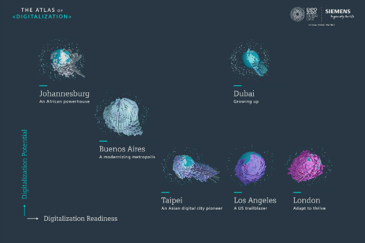
Johannesburg: Siemens launches Atlas of Digitalization
18th April 2019
Johannesburg: Siemens launches Atlas of Digitalization
Satellite Imagery: Before/After of Notre Dame Cathedral Fire
18th April 2019
Satellite Imagery: Before/After of Notre Dame Cathedral Fire
CGG’s Dan Hampson and Brian Russell Honored
17th April 2019
CGG’s Dan Hampson and Brian Russell Honored
WGIC and ITU Partner to Leverage Geospatial Knowledge
17th April 2019
WGIC and ITU Partner to Leverage Geospatial Knowledge
Blue Marble’s Global Mapper Mobile App Now Available
17th April 2019
Blue Marble’s Global Mapper Mobile App Now Available
LEADING EDGE GEOMATICS LEVERAGES LiDAR TECHNOLOGY
17th April 2019
LEADING EDGE GEOMATICS LEVERAGES LiDAR TECHNOLOGY

Space Flight Laboratory Reaches Century Milestone in Microspace Operations
16th April 2019
Space Flight Laboratory Reaches Century Milestone in Microspace Operations
Start-ups to receive funding, business support and more
16th April 2019
Start-ups to receive funding, business support and more
PCI Geomatics announces educational campaign in Brazil
13th April 2019
PCI Geomatics announces educational campaign in Brazil
Esri's Participation in Dubai's Future Cities Show 2019
13th April 2019
Esri's Participation in Dubai's Future Cities Show 2019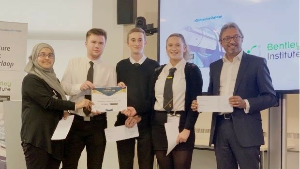
Bentley Systems Announces Drummond Community High School Team as Winners
12th April 2019
Bentley Systems Announces Drummond Community High School Team as Winners
UAVOS Developed New Auto-Tracking Antenna System f
12th April 2019
UAVOS Developed New Auto-Tracking Antenna System f
SimActive Software Used with eBee X for Shoreline Mapping
12th April 2019
SimActive Software Used with eBee X for Shoreline Mapping
OGC Requests Information on Earth Observation Big Data Architecture
11th April 2019
OGC Requests Information on Earth Observation Big Data Architecture.jpg)
Exploiting the potential of the Augmented Reality technologies within the utility network sector
11th April 2019
Exploiting the potential of the Augmented Reality technologies within the utility network sector
Trimble Announces High-Accuracy Field Solution for GIS Applications
10th April 2019
Trimble Announces High-Accuracy Field Solution for GIS Applications
Bentley Systems Names Dr. Nabil Abou-Rahme as Chief Research Officer
10th April 2019
Bentley Systems Names Dr. Nabil Abou-Rahme as Chief Research Officer