
Torus appoints Cadcorp as cloud GIS supplier
9th December 2021
Torus appoints Cadcorp as cloud GIS supplier
9th December 2021
Torus appoints Cadcorp as cloud GIS supplier
8th December 2021
Teign Housing appoints Cadcorp as cloud GIS supplier
1st December 2021
New u-blox AWS IoT ExpressLink Modules Offer Out-of-the-Box Secure Connectivity to the AWS Cloud
3rd November 2021
Trimble and Microsoft Partner to Drive Digital Transformation Across Industries
25th October 2021
Staffordshire County Council awards contract to Cadcorp for corporate GIS in the cloud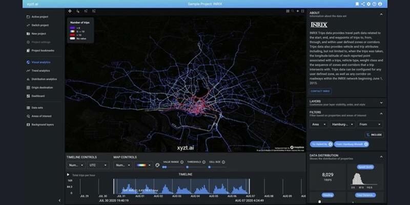
14th October 2021
xyzt.ai announces the availability of mobility data from INRIX on the xyzt.ai platform19th August 2021
AWS Announces General Availability of Amazon Location Service
19th August 2021
Bentley Systems Announces Acquisition of SPIDA
4th August 2021
Bentley Systems Announces Seequent’s Acquisition of Imago
29th July 2021
G-Core Labs strengthens its CDN network in Europe and North America by launching PoPs in Romania and Canada
27th July 2021
Landmark Information Group appoints Group Software Engineering Director to spearhead technology transformation agenda
1st July 2021
Cloud location service brings power autonomy to constrained IoT devices
1st July 2021
thinkWhere Mapping Portal Helps Scotland Achieve 100 percent Superfast Broadband Coverage1st July 2021
Amazon Web Services Becomes USGIF Strategic-Level Member22nd June 2021
Babergh and Mid Suffolk District Councils move to cloud GIS
9th June 2021
Hexagon introduces HxGN Connect, a SaaS workspace enabling seamless, citywide collaboration, planning and response
8th June 2021
AWS Announces General Availability Of Amazon Location Service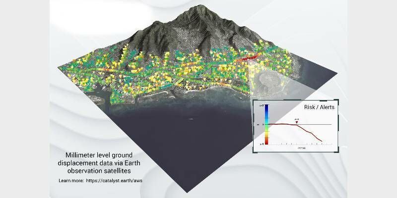
2nd June 2021
CATALYST Collaborates with Amazon Web Services to Deliver Geospatial Insights to Decision Makers
18th May 2021
PMRExpo 2021: from November 23 to 25 in Cologne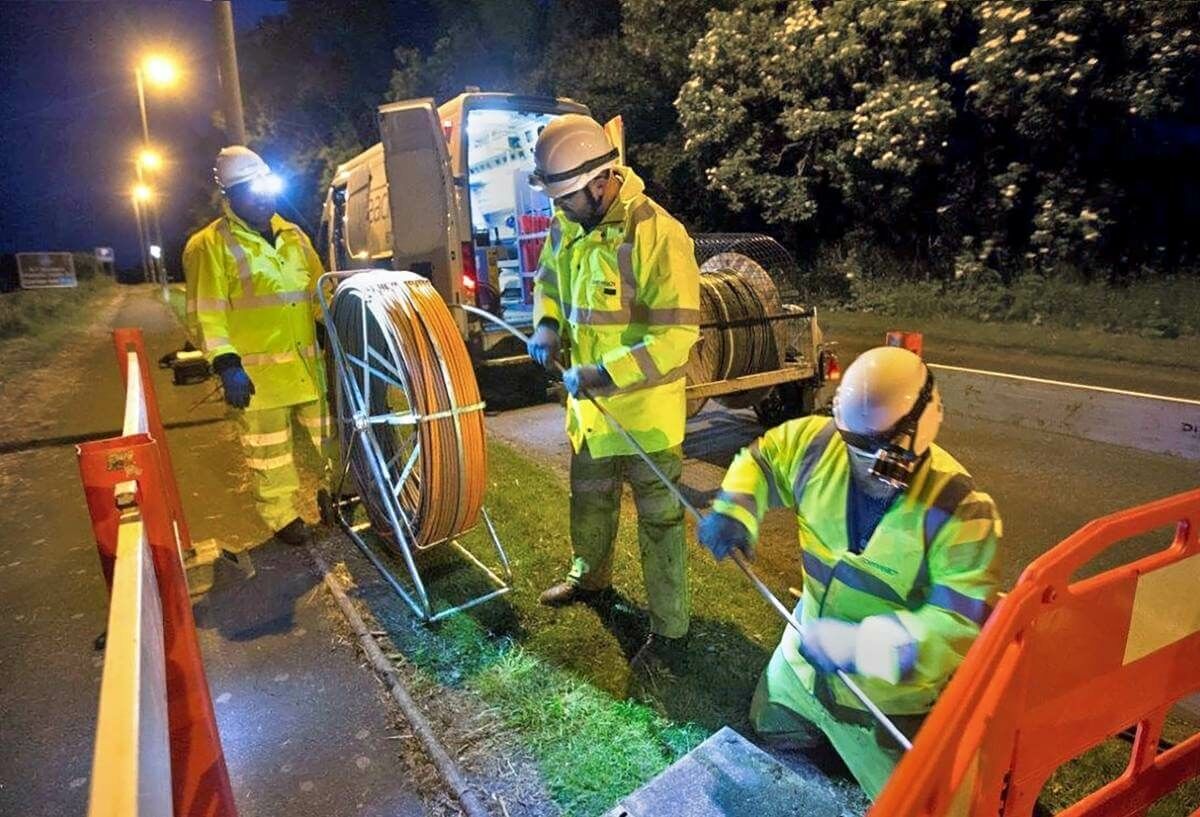
14th May 2021
thinkWhere Mapping Portal Helps Scotland Achieve 100 percent Superfast Broadband Coverage
4th May 2021
GeoMax introduces new X-PAD 365 service platform
4th May 2021
Hexagon selected by Munich for shared mobility solution29th April 2021
1Spatial announce the release of 1DataGateway 2.3.0
28th April 2021
Telespazio announces support for AWS Ground Station with its cloud-based service platform ENABLE28th April 2021
GAF Has Been Awarded A Multi-Year Contract By The German Federal State Of Saxony-Anhalt
22nd April 2021
CGG’s Smart Data Solutions Business Optimizes Performance of PleXus Data Management System
9th April 2021
Cloud location service brings power autonomy to constrained IoT devices
8th April 2021
Pix4D announces new Tokyo office to strengthen APAC commercial operations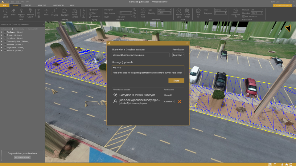
7th April 2021
Virtual Surveyor Introduces Dropbox Integration for Easy Collaboration and File Access from Anywhere
16th March 2021
1Spatial announce the release of 1DataGateway 2.3.0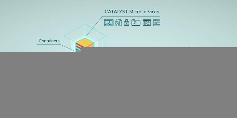
25th February 2021
CATALYST Announces Cost-Effective, Fully Scalable Processing of Earth Observation Imagery on the Cloud
27th January 2021
L3Harris - You're Invited to Spectral Sessions!14th January 2021
Aggregion opens new opportunities for secure collaboration when working with data
14th January 2021
1Spatial announce multi-year contract with California’s Office of Emergency Services
13th January 2021
FARO Launches New Webshare Software ‘Enterprise’ Feature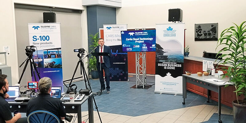
13th January 2021
Teledyne CARIS receives Canada’s Ocean Supercluster award
4th January 2021
1Spatial’s CPO elected to form OS Partner Advisory Council
30th November 2020
Autodesk Acquires Spacemaker: Offers Architects AI-powered Generative Design to Explore Best Urban Design Options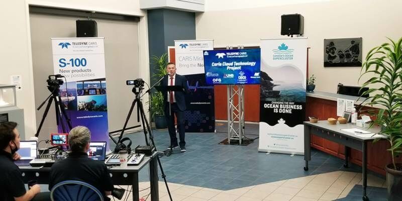
26th November 2020
Teledyne CARIS receives Canada’s Ocean Supercluster award through the Accelerated Ocean Solutions Program
22nd November 2020
FARO Launches New WebShare Software Enterprise
18th November 2020
NavVis Introduces Processing in the Cloud for Even Faster Laser Scanning Workflows
17th November 2020
Bluesky Launches Online Streaming Service for Panoramic Aerial Images
9th November 2020
OGC simplifies EO data access and analysis through novel, standards-based technique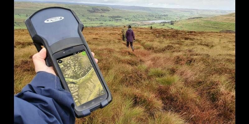
5th November 2020
Yorkshire Wildlife Uses MGISS Cloud Technology to Map and Protect Habitats
29th October 2020
MGISS Scores Accreditation Hat-trick for Cloud Software and Workplace Wellbeing29th October 2020
1Spatial Have Been Named as a Supplier for G-Cloud 12 Digital Marketplace