.jpg)
Emoji map by Europa Technologies wins Most Unique award at Esri UC
19th July 2017
Emoji map by Europa Technologies wins Most Unique award at Esri UC
19th July 2017
Emoji map by Europa Technologies wins Most Unique award at Esri UC
13th July 2017
Bluesky Launches Nationwide Map of Building Heights.jpg)
12th July 2017
Learn More About Maptitude at the NCSL Annual Conference.jpg)
11th July 2017
CATSURVEYS Launches their Purpose Driven Brand
11th July 2017
Geoblink selects HERE to help the retail industry10th July 2017
Esri and HERE sign multi-year map data licensing agreement10th July 2017
Schneider Electric to Showcase at 2017 Esri User Conference
10th July 2017
OS releases open dataset and free map of Britain’s Greenspaces6th July 2017
DAT/EM Systems International Updates Landscape Software
6th July 2017
Esri's Online Learning Guide for Working with Imagery and ArcGIS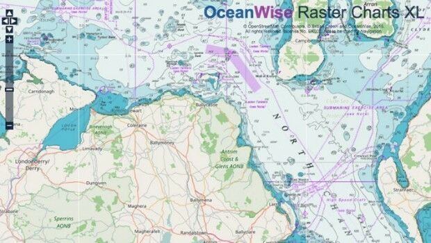
6th July 2017
Marine Mapping Agreement for Northern Ireland
29th June 2017
Free Business Location Data for Use with Maptitude Mapping Software28th June 2017
HERE partners with Mapillary to make better maps
22nd June 2017
Garmin selects HERE map data and traffic for Russian PNDs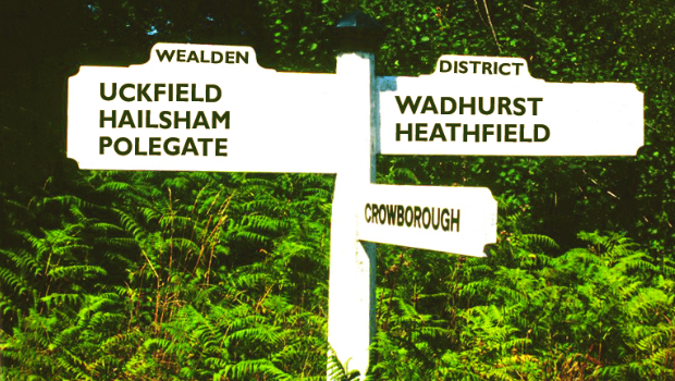
22nd June 2017
Cadcorp selected by Wealden District Council via G-Cloud for corporate GIS
22nd June 2017
Applanix Workshop on Direct Georeferencing for Airborne Mapping & Surveying21st June 2017
Golden Software Releases Network Licenses for Surfer® and Grapher™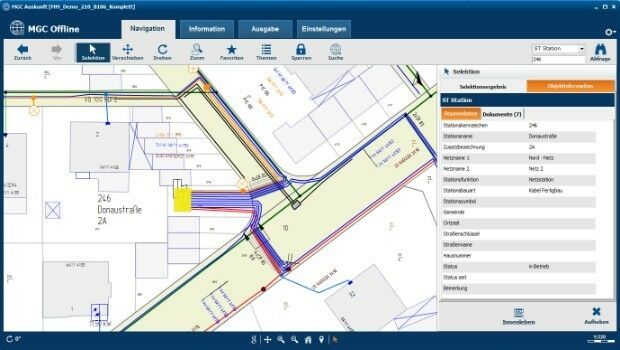
20th June 2017
Mettenmeier Integrates TatukGIS into MGC View Offline App
20th June 2017
CSA Unveils Release of the EDGSonline 2.0 Web-Based Mapping Platform20th June 2017
Spanish Language Version of Global Mapper Now Available
19th June 2017
KilletSoft converts Geodata for Navigation in free Map Services.
14th June 2017
University of the Punjab Selects SuperGIS Desktop 10
13th June 2017
Computer Aided Marine Contingency Planning System Developed5th June 2017
Department of Interior Awards Major Contract to Hexagon US Federal5th June 2017
viaEuropa with Ordnance Survey base maps now on Tableau2nd June 2017
ENERGIC OD: New Important Results In The Apps’ Development31st May 2017
Mapmaker AND releases first High Definition Autonomous Vehicle Maps
23rd May 2017
New Features of SuperSurv 10 that You Cannot Ignore
18th May 2017
GeoSLAM Expands Far East Operations With New Distributors

15th May 2017
1Spatial releases dates for exciting FME World Tour, courses, webinars12th May 2017
Toronto selects HERE for smart city and traffic mitigation initiative
10th May 2017
Duke of Edinburgh's Award Entrusts SPOT and Mapyx
9th May 2017
2G Robotics and Sonardyne announce new collaboration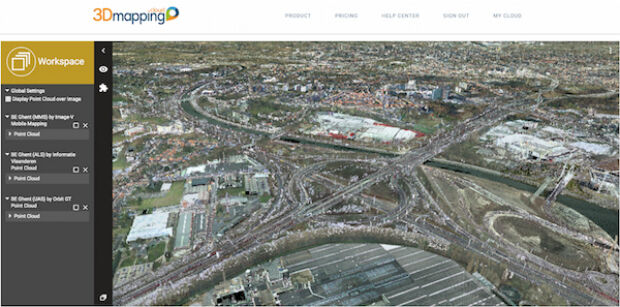
9th May 2017
Orbit GT updates 3D Mapping Cloud with faster Performance Measurements3rd May 2017
Harvard Seeking Submissions for “Map of the Month” Contest
27th April 2017
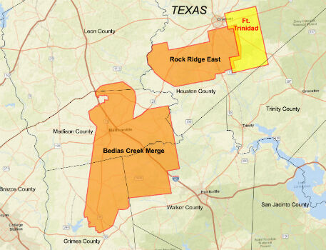
CGG Delivers Reservoir-Oriented Data for Fort Trinidad in East Texas
27th April 2017
Esri's Dr. Dawn Wright to Discuss Mapping the Ocean27th April 2017
3D Laser Mapping Mines Good Fortunes in Africa26th April 2017
Maptitude Mapping Software Team Provides Awards & Prizes