
GeoSLAM To Showcase The Future Of Construction At GEO Business 2018
17th May 2018
GeoSLAM To Showcase The Future Of Construction At GEO Business 2018
17th May 2018
GeoSLAM To Showcase The Future Of Construction At GEO Business 2018
16th May 2018
Mapping, Charts, Aerial Imagery Available from East View Geospatial15th May 2018
Maptitude Mapping Software Donated to UTDallas GIS Workshop
9th May 2018
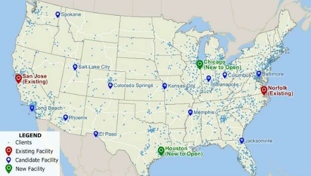
Data Gateway brings powerful data validation and processing via a self-serve, training-free experien7th May 2018
GPI Geospatial Purchases RIEGL VQ-1560i Airborne LiDAR System!
3rd May 2018
Maptitude Mapping Software Team Provides Awards & Prizes
24th April 2018
ArcGIS Pro Workstation Customized for the Intelligence Community18th April 2018
Geospatial data making a difference in Commonwealth nations
17th April 2018
Story Maps Team Leader Recognized with AAG Award
17th April 2018
GIS4BUSINESS achieves Esri ArcGIS Online Specialty
12th April 2018
HERE Technologies opens self-driving car R&D site in Boulder, Colorado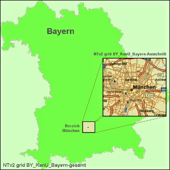
11th April 2018
Solutions for problems with large NTv2 files in GIS and Geosoftware
7th April 2018
Updated Global Mapper Academic Labs Now Available5th April 2018
1Spatial awarded contract by the European Union Satellite Centre
4th April 2018
Bentley Systems’ Year in Infrastructure 2018 Conference and Awards Gala
26th March 2018
Maptitude 2018 Adds Enhanced MapPoint and Streets & Trips Features22nd March 2018
GfK releases new digital maps for Germany, Austria and Switzerland_GEO.jpg)
21st March 2018
Lincolnshire County Council Implements thinkWhere’s Cloud GIS
19th March 2018
SCTX 2018: technology for greater security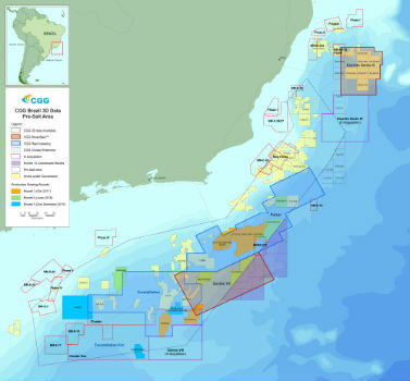
16th March 2018
CGG Adds New Santos VIII Multi-Client Survey
14th March 2018
New 2018 School District Data for Maptitude Mapping Software
13th March 2018
Maptitude 2018 USA Legislative and Congressional Districts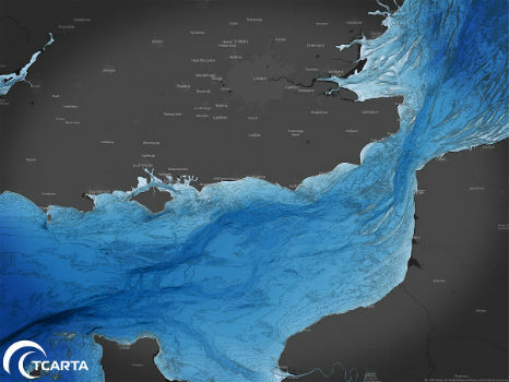
8th March 2018
TCarta to Highlight Safety Benefits at Oceanology International 2018
7th March 2018
Rezatec extends its global reach into Canada
6th March 2018
Data for Use with Maptitude for entire USA1st March 2018
GeoPlace announces launch of 2018 Exemplar Awards

1st March 2018
Course on mapping for disaster response and humanitarian projects
28th February 2018
South African Nautical Charts Now Available from EVG
13th February 2018
A Turkish Point of View on the Gallipoli Campaign13th February 2018
RegioGraph: 2018 update available end of March8th February 2018
Esri Releases Operations Dashboard for ArcGIS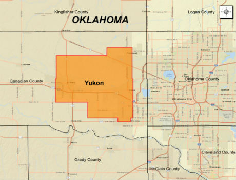
6th February 2018
CGG Extends Oklahoma Coverage with Yukon Multi-Client Survey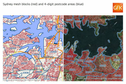
6th February 2018
GfK releases new digital maps for Australia
4th February 2018
Orbit GT releases major update of 3D Mapping Cloud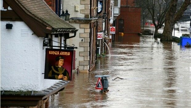
1st February 2018
National flood map provides future climate change flood scenarios
1st February 2018
EarthSense Systems Appoints Thomas Hall as Managing Director
31st January 2018
New noise maps created for the German Federal Railway Authority
29th January 2018
Supergeo Offers Educational Site License at a Competitive Price29th January 2018
Change your life and make 2018 your year to GetOutside