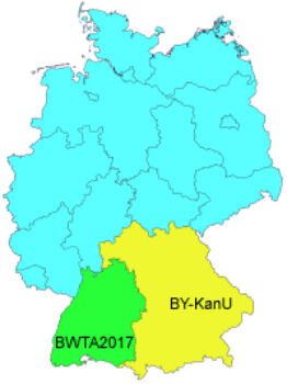
GeoTools support precise NTv2 Solutions for Real Estate Cadastres
10th April 2017
GeoTools support precise NTv2 Solutions for Real Estate Cadastres
10th April 2017
GeoTools support precise NTv2 Solutions for Real Estate Cadastres
8th April 2017
Managing Data with Versioning in Upcoming SuperGIS Desktop
8th April 2017
Taxation Authority in Indonesia Selects SuperPad 3.3 to Collect Data
7th April 2017
Cambridge Conference 2017 - Mapping Nations: The Next Decade
29th March 2017
Bluesky 3D maps help protect coastal heritage sites in new EU Project29th March 2017
OGC requests public comment on proposed GeoRSS Community Standard
28th March 2017
Research reveals that fleet managers select routing software solutions that ‘make life easier’
27th March 2017
Bluesky Launches New Online Resource for Geographic Information of Ireland
24th March 2017
Next SuperSurv 10 Release Will Add Powerful Features20th March 2017
4 Ways Maptitude 2017 Saves You Time & Money
15th March 2017
Bluesky Acquires US Aerial Survey Company Col-East
15th March 2017
Shih Hsin University Winner of SuperGIS Youth Award 2017
9th March 2017
Scottish / UK Post Brexit Maps Now Available on Avenza Maps
9th March 2017
Geospatial mapping solution for New York Power Authority
8th March 2017
New School District Data for Maptitude Mapping Software
3rd March 2017
Caliper Offers State Legislative Districts with Updated Census Data
3rd March 2017
Maptitude 2017 Adds Enhanced MapPoint and Streets & Trips Features
2nd March 2017
what3words addresses South African township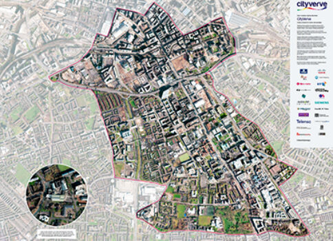
2nd March 2017
Opening the doors to innovation in Manchester’s corridor1st March 2017
UK Input to Phase 3 of European High Resolution Seabed Mapping Project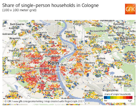
28th February 2017
Share of single-person households in Cologne27th February 2017
2017 version of Mobile Coverage Explorer Released
27th February 2017
Occipital and Inuitive present new integrated solution
27th February 2017
Qualcomm Working with TomTom on Mapping Data for Autonomous Driving
22nd February 2017
Gritter Tracker coming to the rescue for snowed-in Scots
15th February 2017
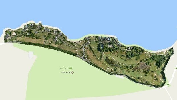
Three reasons golf courses are the next drone mapping territory15th February 2017
Golden's new 2D and 3D Mapping, Modeling, and Analysis Software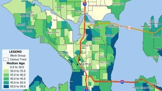
9th February 2017
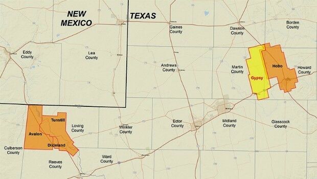
CGG Delivers Final PreSTM Data for Hobo Multi-Client Survey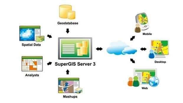

6th February 2017
Jesi, Historic City in Italy Uses SuperSurv to Collect Spatial Data
2nd February 2017
Rwanda forges forward in drone mapping use
31st January 2017
Comprehensive Bathymetry and Marine Mapping Solutions26th January 2017
Requests for geocoding rising after Google changes pricing policy
25th January 2017
Abstract Submissions Invited for GIS-Pro 2017 in Jacksonville, Florida
25th January 2017
Orbit GT releases Indoor Mapping solution with Floor Plan Builder
24th January 2017
TomTom and Mappy extend their long-term relationship16th January 2017
HERE supports rollout of Baidu Maps to rest of world
13th January 2017
The Excellent Helper for Processing Spatial Data—SuperGIS Desktop
12th January 2017
Caltrans Takes Delivery of the RIEGL VMX-1HA5th January 2017
AI technology for HD mapping from cloud to car
4th January 2017
Lucid Motors Selects TomTom as Infotainment Partner