
Qlucore Projection Score aids better visualization of large data sets
20th February 2017
Qlucore Projection Score aids better visualization of large data setsThe compilation, reproduction and dissemination of maps and charts by means of manual (analogue) or digital techniques, tools and workflows. This topic covers the compilation, reproduction, dissemination and use of both analogue (paper) and digital maps, charts and atlases. As well as the science of cartography, including georeferencing and geocoding, digital techniques for compiling and generating various types of raster and vector maps and charts are covered, as are the digital mapping tools and Geographic Information Systems available for this purpose. The application of cartography for aeronautical, terrestrial and marine purposes is also covered
20th February 2017
Qlucore Projection Score aids better visualization of large data sets20th February 2017
Maptek provides resilience during a challenging economic environment18th February 2017
EdgeData and Harris Corporation Collaboration17th February 2017
Winners of 7th Annual ION Autonomous Snowplow Competition Announced17th February 2017
FIG Working Week 2017 - Early Bird Registration ends 20 February 2017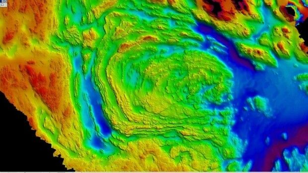
17th February 2017
Fugro Announces Partnership With Shell Ocean Discovery XPRIZE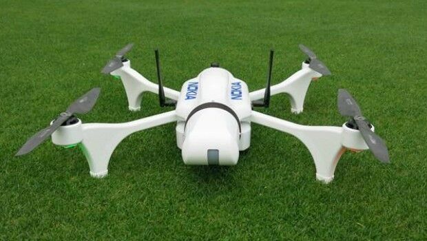
17th February 2017
Nokia showcases power of drones and LTE connectivity for public safety17th February 2017
MERLIN – the first Franco-German Earth observation satellite17th February 2017
Autonomous driving state of the art solutions presented in Brussels17th February 2017
Oroville Lake Water Elevation seen from Space17th February 2017
Biggest Collection of Arctic Elevation Data Yet16th February 2017
Post Conference Press Release – 8 November, 2017 – (UDT Asia 2017)

16th February 2017
LuxCarta for Global IoT Network Deployment Geodata Requirements
16th February 2017
CGG Completes Industry-First FalconPlus Survey for Bapco
16th February 2017
Change in the Division Management at PTV Transport Consult16th February 2017
Elbit US Subsidiary Receives $102m Contract From US Army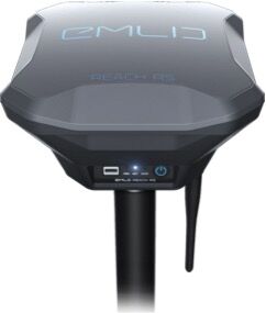
16th February 2017
Emlid unveils Reach RS: field-ready RTK GNSS receiver for only $699
16th February 2017
Advanced Groundwater Technologies Joins PCI Reseller Partner Network
15th February 2017
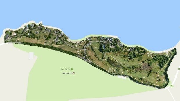
Three reasons golf courses are the next drone mapping territory15th February 2017
Djibouti adopts what3words as national postal addressing system15th February 2017
UK’s national standard for engineering drawings revised15th February 2017
Smart Cities Challenged by Stakeholder Buy-in and Project Funding15th February 2017
Koko GPS Watch providing parents with peace of mind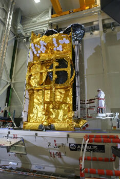
15th February 2017
Airbus-built SKY Brasil-1 satellite successfully launched by Ariane 515th February 2017
Golden's new 2D and 3D Mapping, Modeling, and Analysis Software
15th February 2017
Fast Company's Top 10 Most Innovative Companies in Data Science

14th February 2017
VicRoads Builds for the Future with Yotta’s Horizons Software
14th February 2017
Exprodat Offers ArcGIS Pipeline Referencing Implementation Services
14th February 2017
Fugro Acquires REM Etive IRM Support Vessel
14th February 2017
Efficient and Safe Driving with Ctrack Vehicle Tracking System
14th February 2017
3D Repo Appoints Andrew Norrie as Commercial Director
14th February 2017
Delegation from the emirate of Ajman visit Karlsruhe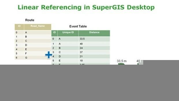
14th February 2017
SuperGIS Desktop Will Have Linear Referencing Soon
13th February 2017
Esri Partners Honored at Esri FedGIS Conference13th February 2017
OGC invites expertise on underground maps and models13th February 2017
URISA's GIS Hall of Fame Nominations Process Opens
13th February 2017
New Leica SPL100 brings up to 10x more efficiency to airborne LiDAR mapping13th February 2017
Maritime Safety and Security Centre in Cuxhaven officially open