
Live stream of rare solar eclipse captures imaginations worldwide
28th February 2017
Live stream of rare solar eclipse captures imaginations worldwideThe compilation, reproduction and dissemination of maps and charts by means of manual (analogue) or digital techniques, tools and workflows. This topic covers the compilation, reproduction, dissemination and use of both analogue (paper) and digital maps, charts and atlases. As well as the science of cartography, including georeferencing and geocoding, digital techniques for compiling and generating various types of raster and vector maps and charts are covered, as are the digital mapping tools and Geographic Information Systems available for this purpose. The application of cartography for aeronautical, terrestrial and marine purposes is also covered
28th February 2017
Live stream of rare solar eclipse captures imaginations worldwide27th February 2017
2017 version of Mobile Coverage Explorer Released
27th February 2017
Elbit Systems to Showcase Capabilities for Situational Awareness27th February 2017
Occipital and Inuitive present new integrated solution27th February 2017
Airbus Partners with Bird.i for Access to Earth Observation Imagery27th February 2017
Qualcomm Working with TomTom on Mapping Data for Autonomous Driving26th February 2017
MacDonald Dettwiler Buying DigitalGlobe for $2.4 Billion25th February 2017
em-trak is pleased to announce the launch of the new B300 AIS Class B24th February 2017
Aeryon SkyRanger sUAS Successfully Completes BVLOS Flight Test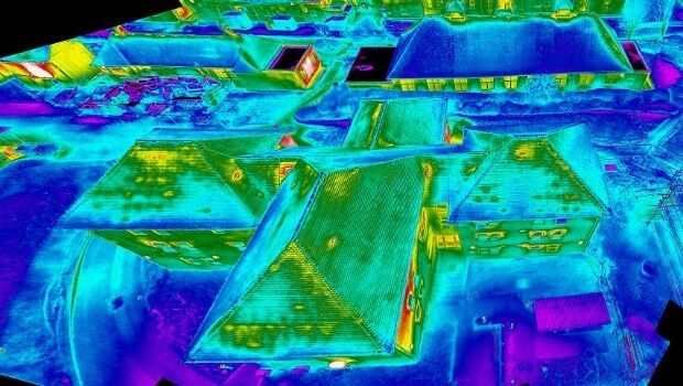
24th February 2017
Specialist Infrared Payload Course for Drone Operators is a UK First24th February 2017
LizardTech Releases MrSID Generation 4 Decode SDK Version 9.5.4
24th February 2017
Why desktop is essential for drone mapping in agriculture24th February 2017
OceanWise to Deliver Water Level Monitoring System for Dominica24th February 2017
Sentinel-2B satellite ready for launch from Kourou23rd February 2017
Airbus and ISAE-SUPAERO join forces to train future space experts23rd February 2017
Luminent Solutions for PHMSA Pipeline Safety and Regulatory Compliance23rd February 2017
OGC invites you to the Arctic Spatial Data Pilot demonstration23rd February 2017
NOC Hosts Exciting Series of Workshops at Ocean Business 201723rd February 2017
Businesses Aided with Turn-key Streetview Camera Solution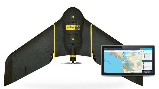
23rd February 2017
AirMap and senseFly Partner to Advance Safety for Commercial Drones
23rd February 2017
New Enterprise Tracks Headline InterDrone 2017 Call For Speakers23rd February 2017
Building the IoT: Critical Device-Level Technologies22nd February 2017
EU Peacekeepers Choose Globalstar-enabled SafeFleet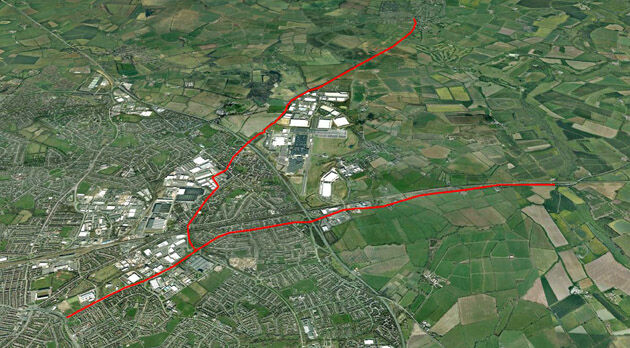
22nd February 2017
CartoConsult Brings GIS Innovation to Government Programme to Tackle Traffic Congestion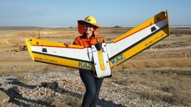
22nd February 2017
QuestUAV – Drone Girls versus Drone Boys22nd February 2017
GAUSS+LÖRCHER: New BARTHAUER training partner in southern Germany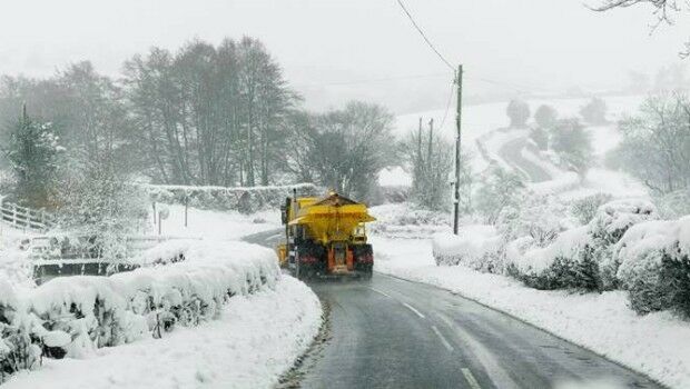
22nd February 2017
Gritter Tracker coming to the rescue for snowed-in Scots22nd February 2017
Awards entry deadline extended - 28 February
22nd February 2017
NAUTIZ X2 All-In-One Rugged Android Handheld Upgraded to Android 6.022nd February 2017
AddressBase Toolkit for Mapinfo Released By Aligned Assets22nd February 2017
Unmanned Cargo Ground Vehicle Conference
22nd February 2017
Global Mapper 18.1 Released with Improved 3D Viewing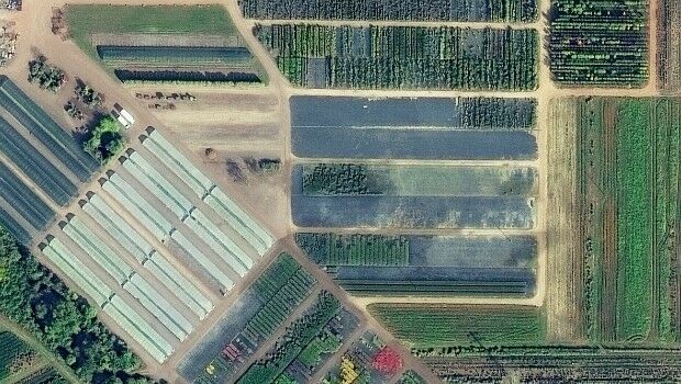
22nd February 2017
European Space Imaging main provider of VHR satellite imagery to EC22nd February 2017
NAVITIME JAPAN Launches “Kamakura NAVITIME Travel”21st February 2017
Siteimprove chooses Digital Element to enrich its offering21st February 2017
UAV's help U.S. Military Boost Demand for Satellite Communication21st February 2017
GfK study on product-line purchasing power in Poland20th February 2017
K2 Geospatial launches the latest version of JMap20th February 2017
Business Geografic - new mapping software innovation program20th February 2017
There’s a new girl in town: Joanna James20th February 2017
Acquisition Extends Pinkerton’s European Range