
OGC Calls for Participation in Testbed 13 Part 2 ESA Threads
6th February 2017
OGC Calls for Participation in Testbed 13 Part 2 ESA ThreadsThe compilation, reproduction and dissemination of maps and charts by means of manual (analogue) or digital techniques, tools and workflows. This topic covers the compilation, reproduction, dissemination and use of both analogue (paper) and digital maps, charts and atlases. As well as the science of cartography, including georeferencing and geocoding, digital techniques for compiling and generating various types of raster and vector maps and charts are covered, as are the digital mapping tools and Geographic Information Systems available for this purpose. The application of cartography for aeronautical, terrestrial and marine purposes is also covered
6th February 2017
OGC Calls for Participation in Testbed 13 Part 2 ESA Threads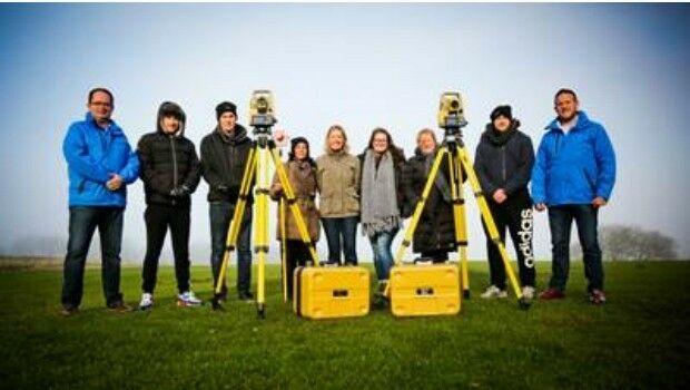
6th February 2017
Topcon helps COYO to inspire the next generation of land surveyors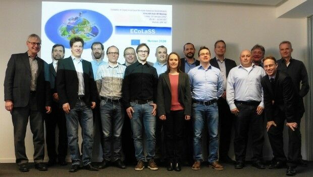
6th February 2017
GAF AG and Partners to Investigate the Future Evolution of Copernicus6th February 2017
Airbus and ENGIE Ineo help control French military air operations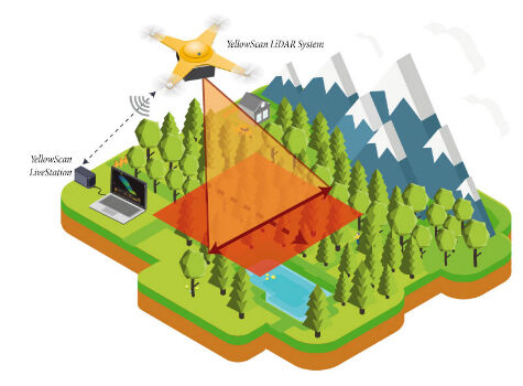
6th February 2017
YellowScan launches YellowScan LiveStation4th February 2017
The Institute of Navigation Announces Executive Committee and Council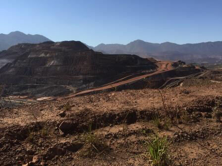
3rd February 2017
Pakistan Government Chooses Fugro for Extensive Minerals Exploration3rd February 2017
Planning and Design Solutions for Utilities jointly offered3rd February 2017
OGC seeks public comment on candidate GeoPackage 1.2 standard3rd February 2017
Dassault Systèmes Announces SOLIDWORKS World 20173rd February 2017
VSTEP joins the United Nations Global Compact
3rd February 2017
Tonga adopts what3words as national postal addressing system
3rd February 2017
Latest Ocean Technology Showcasing at Ocean Business 20173rd February 2017
Seafloor Systems Introduces Its EchoBoat-G2 Survey Boat3rd February 2017
Digital Earth & Locate17 Showcases Geospatial‚s Enabling Role2nd February 2017
Get Started Working with Configurable Apps from Esri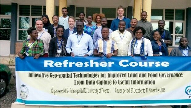
2nd February 2017
Rwanda forges forward in drone mapping use2nd February 2017
Oncor Upgrades to Hexagon Safety & Infrastructure’s GIS2nd February 2017
CartoPac Adds iOS Support to Mobile Asset Management Software Suite2nd February 2017
RGS-IBG and AGI announce strategic alliance2nd February 2017
Masternaut appoints Olivier Mansard as Vice President of Global Sales2nd February 2017
Leica Geosystems wins prestigious PRISM Award2nd February 2017
NAUSICAA, the French National Sea Centre - now re-open for 20172nd February 2017
Satcom for EU security missions in Mali, Niger and Somalia2nd February 2017
Enabling a breakthrough in hybrid underwater vehicles1st February 2017
Location Powers event scaling linked data to big data1st February 2017
Surrey Heath Council Explore the Versatility of the Arrow 100.1st February 2017
The 2nd generation Meteosat-8 satellite takes over Meteosat-71st February 2017
Quartix announces the appointments of two new directors1st February 2017
The Getech Group Brings Greater Insight to Myanmar’s Geology1st February 2017
AVANGRID Chooses Itron for Energy Smart Community in New York1st February 2017
East View Expands South China Sea Imaging Capabilities31st January 2017
Comprehensive Bathymetry and Marine Mapping Solutions31st January 2017
Popular Line of Miniature Inertial Sensors from SBG Systems31st January 2017
Ordnance Survey International helps the UAE manage Climate Change31st January 2017
New Ordnance Survey Champion, Ben Fogle, urges nation to GetOutside31st January 2017
New supported devices, flight missions, and mission settings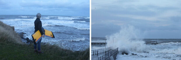
31st January 2017
A Case Study on Long-Term Erosion Mapping in Northeast England31st January 2017
Diamond Aircraft introduces new Garmin G1000 NXi Flight Deck31st January 2017
Esri Brings Operational Intelligence to 2017 DistribuTECH Conference31st January 2017
ALGIZ RT7 ultra-rugged tablet now with Android 6.0 and 2 GB of RAM31st January 2017
Successful Ground Trials of Volcanic Ash Detection