Geospatial data improves the performance of agriculture
1st March 2018
Geospatial data improves the performance of agricultureThe compilation, reproduction and dissemination of maps and charts by means of manual (analogue) or digital techniques, tools and workflows. This topic covers the compilation, reproduction, dissemination and use of both analogue (paper) and digital maps, charts and atlases. As well as the science of cartography, including georeferencing and geocoding, digital techniques for compiling and generating various types of raster and vector maps and charts are covered, as are the digital mapping tools and Geographic Information Systems available for this purpose. The application of cartography for aeronautical, terrestrial and marine purposes is also covered
1st March 2018
Geospatial data improves the performance of agriculture

1st March 2018
Course on mapping for disaster response and humanitarian projects1st March 2018
Disasters Interoperability Concept Development Study28th February 2018
Winner of AVIATION WEEK NETWORK’S Annual Laureate Awards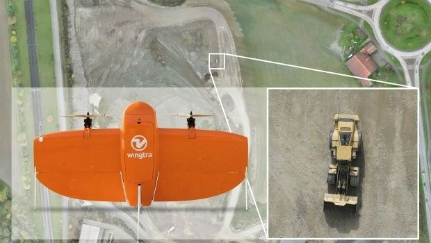
28th February 2018
Wingtra selects Septentrio GNSS board for new drone28th February 2018
Overfunded on their first day of being live!
28th February 2018
South African Nautical Charts Now Available from EVG28th February 2018
GC seeks public comment on GML in JPEG 2000 (GMLJP2) v2.1
28th February 2018
GeoPlace launches new service to help councils with business rates27th February 2018
Wingtra launches a drone that sets a new benchmark in photogrammetry27th February 2018
Intelligent Telematics Launches Connected Multi-Camera Solution27th February 2018
British ESA astronaut Tim Peake visits Airbus Portsmouth27th February 2018
Raytheon and Thales as Silver Sponsors for DIMDEX26th February 2018
Developing new tools to build climate change resilience into WASH26th February 2018
Changes to the FREQUENTIS AG Executive Board26th February 2018
ERM Advanced Telematics set to expand its offering26th February 2018
TEOCO launches UAV Service Enablement Platform for Drones26th February 2018
Esri Acquires ClearTerra Location Data Extraction Technology23rd February 2018
exactEarth High Performance AIS Payload Launched on Paz Radar Satellite23rd February 2018
EOMAP wins UK Hydrographic Office contract23rd February 2018
Geovation Conference 2018 winning start ups announced
22nd February 2018
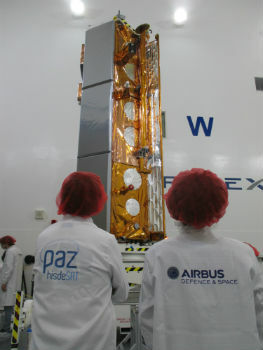
Airbus-built PAZ radar satellite successfully launched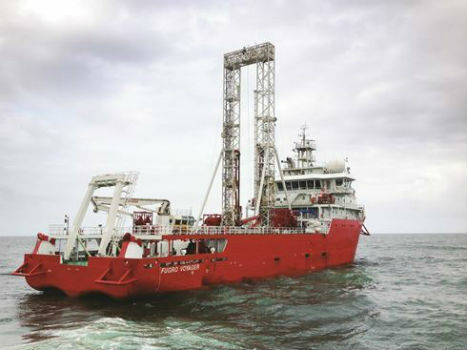
22nd February 2018
Fugro Returns To China For Gas Hydrate Research Project
22nd February 2018
BMW Group to switch on HERE HD Live Map for future models22nd February 2018
ATrack Integrates Mobileye ADAS to Enhance Driving Safety
22nd February 2018
Topcon To Showcase The Latest Automated Workflows

21st February 2018
GeoSLAM to Demo Time & Cost Saving 3D Mobile Laser Scanners
20th February 2018
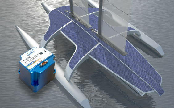
Autopilot for the Mayflower Autonomous Ship equiped
20th February 2018
Class approval for Drone inspection of confined spaces for RIMS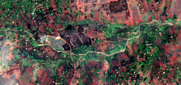
20th February 2018
Earth-i receives £2.7 million from UK Government to improve crop yield20th February 2018
Professor Joe Smith: new Director of Royal Geographical Society16th February 2018
BARTHAUER and the city of Sousse: joined by shared roots16th February 2018
New CGG GeoSoftware Technology Drives Greater E&P Efficiency16th February 2018
OGC seeks public comment on Web Coverage Service (WCS)16th February 2018
Elbit Systems Features Advanced Capabilities for Air Warfare16th February 2018
Leading an Earth Observation project to predict dengue fever outbreaks16th February 2018
AND signs map license agreement with Mapbox