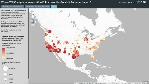
Esri Story Map Explores Communities Impacted by Immigration Changes
15th February 2018
Esri Story Map Explores Communities Impacted by Immigration ChangesThe compilation, reproduction and dissemination of maps and charts by means of manual (analogue) or digital techniques, tools and workflows. This topic covers the compilation, reproduction, dissemination and use of both analogue (paper) and digital maps, charts and atlases. As well as the science of cartography, including georeferencing and geocoding, digital techniques for compiling and generating various types of raster and vector maps and charts are covered, as are the digital mapping tools and Geographic Information Systems available for this purpose. The application of cartography for aeronautical, terrestrial and marine purposes is also covered
15th February 2018
Esri Story Map Explores Communities Impacted by Immigration Changes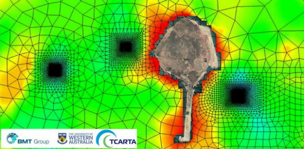
15th February 2018
Satellite Derived Bathymetry from TCarta Plays Key Role in Aquaculture15th February 2018
United States Air Force selects Garmin® D2 Charlie aviator watch
14th February 2018
Rezatec announces completion of £2m financing14th February 2018
Microsoft and Ordnance Survey join forces14th February 2018
Global Mapper v19.1 Now Available with New Features14th February 2018
OGC Announces Earth Observation Exploitation Platform Hackathon 201813th February 2018
A Turkish Point of View on the Gallipoli Campaign13th February 2018
RegioGraph: 2018 update available end of March13th February 2018
Assess the requirements to counter Drones in the Middle East13th February 2018
National Gendarmerie Conducts Post-Hurricane Missions with SimActive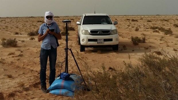
13th February 2018
Mauritanian HV Electric Transmission Corridor to be Surveyed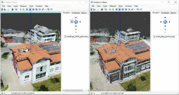
13th February 2018
ICAROS Uses TatukGIS SDK to Develop New Aerial Geospatial Data Viewer13th February 2018
AirGon LLC Appointed North American Distributor for YellowScan
12th February 2018
Bluesky Innovation Uses Mobile Phones to Create 3D Maps12th February 2018
Airbus-built Aeolus successfully passes all tests in Liège (Belgium)

9th February 2018
GEOINT 2018 Registration and Housing Now Open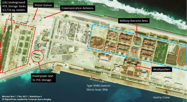
9th February 2018
Satellite images unveil Chinese military fortresses in Spratly Islands
9th February 2018
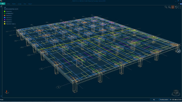
Bentley Systems Expands Concrete Building Design and Documentation8th February 2018
GSSI Proudly Announce Launch of New Website8th February 2018
PCI Geomatics Releases Geomatica Software Update
8th February 2018
CyArk and Phase One Partner to Preserve the World’s Cultural Heritage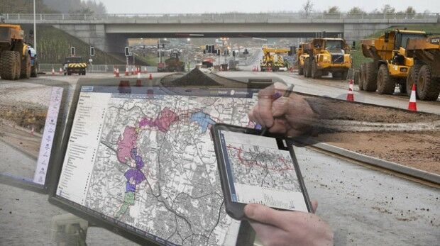
8th February 2018
thinkWhere Online Mapper Connects Aberdeen Bypass Project8th February 2018
Esri Releases Operations Dashboard for ArcGIS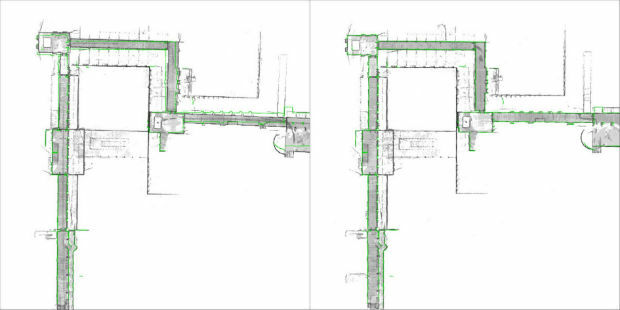
8th February 2018
NavVis sets new standard in SLAM precision8th February 2018
OGC Requesting Responses to its Portrayal Concept Development Study
8th February 2018
ESA and Airbus Sign Partnership Agreement8th February 2018
Airbus and human spaceflight: from Spacelab to Orion
7th February 2018
3DUserNet To Power Texodrone Online 3D Data Platform7th February 2018
Dubai and HERE with data infrastructure for driverless transportation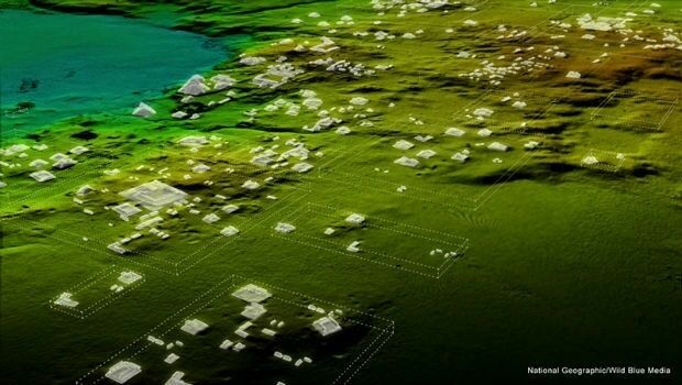
7th February 2018
Teledyne Optech Titan lidar enables discovery of extended Mayan ruins7th February 2018
Winners Of The Eighth Annual ION Autonomous Snowplow Competition7th February 2018
Cepton and May Mobility Accelerate the Delivery of Autonomous Vehicles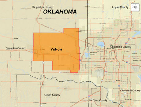
6th February 2018
CGG Extends Oklahoma Coverage with Yukon Multi-Client Survey6th February 2018
Category Winners Announced at the Inaugural LIDAR Leader Awards Ceremony6th February 2018
Trimble Announces New MX9 Mobile Mapping System
6th February 2018
YellowScan unveils its new UAV-LiDAR System
6th February 2018
A partnership to integrate LiDAR and Photogrammetric technologies6th February 2018
Doha International Maritime Defence Exhibition and Conference 2018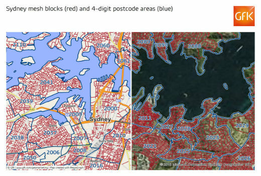
6th February 2018
GfK releases new digital maps for Australia
6th February 2018
Announcement at the International LiDAR Mapping Forum Symposium5th February 2018
Sundbybergs Stadsnät increases the control of the fiber network