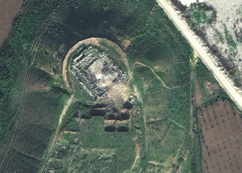
Satellite Images of Afrin Identifies Massive Damage to Ancient Temple
5th February 2018
Satellite Images of Afrin Identifies Massive Damage to Ancient TempleThe compilation, reproduction and dissemination of maps and charts by means of manual (analogue) or digital techniques, tools and workflows. This topic covers the compilation, reproduction, dissemination and use of both analogue (paper) and digital maps, charts and atlases. As well as the science of cartography, including georeferencing and geocoding, digital techniques for compiling and generating various types of raster and vector maps and charts are covered, as are the digital mapping tools and Geographic Information Systems available for this purpose. The application of cartography for aeronautical, terrestrial and marine purposes is also covered
5th February 2018
Satellite Images of Afrin Identifies Massive Damage to Ancient Temple
4th February 2018
Orbit GT releases major update of 3D Mapping Cloud
3rd February 2018
Fugro’s Rig Positioning Services Reduce Mobilisation Time For Statoil2nd February 2018
ABPmer launches redesigned coastal and marine habitat creation website2nd February 2018
PCI Geomatics Releases GXL 2017, Service Pack 12nd February 2018
SSTL and 21AT announce new Earth Observation Capacity Contract
2nd February 2018
3D Laser Mapping releases real-time automated mine monitoring solutions2nd February 2018
Blue Marble to Showcase Global Mapper's Pixels-to-Points™ Tool2nd February 2018
URISA Announces 2018-2019 Vanguard Cabinet of Young Professionals.jpg)
2nd February 2018
3D at Depth Completes 300 Offshore LiDAR Metrologies2nd February 2018
U.S. Customs and Border Protection Certifies Elbit Systems of America
1st February 2018
Intelligent Telematics Opens New European Headquarters In Reading
1st February 2018
RIEGL Wins a Prestigious MAPPS Geospatial Excellence Award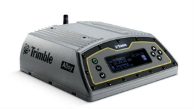
1st February 2018
Alloy ushers in the future of GNSS reference receivers1st February 2018
Reach for the stars with Drone Major Group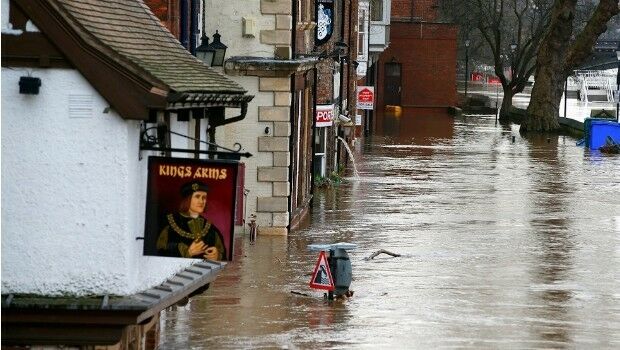
1st February 2018
National flood map provides future climate change flood scenarios31st January 2018
Columbus: 10 years in Space, close to 60,000 Earth orbits
31st January 2018
New noise maps created for the German Federal Railway Authority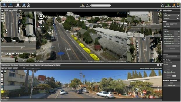
31st January 2018
Orbit GT releases 3D Mapping Content Manager v18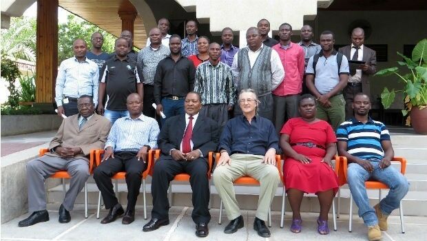
31st January 2018
GDMIS System for Ministry of Natural Resources in Malawi31st January 2018
Boundless Launches Scalable Geospatial Server for the Enterprise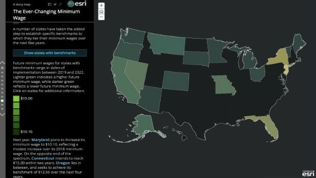
31st January 2018
Space Flight Laboratory Highlights 20 Years of Microspace Achievements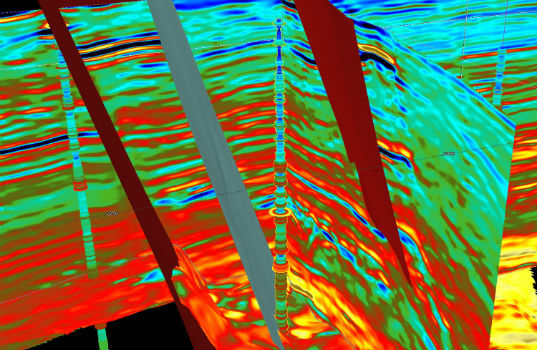
31st January 2018
CGG GeoSoftware Donates Jason Reservoir Characterization Software30th January 2018
L&M Surveys (UK) purchase 22 HDR Camera Systems for VR Capturing30th January 2018
Airbus to provide near real-time access to its satellite data
30th January 2018
ABPmer appointed Designated Person for Chichester Harbour
29th January 2018
Supergeo Offers Educational Site License at a Competitive Price29th January 2018
Change your life and make 2018 your year to GetOutside29th January 2018
Geovation Programme seeks new GeoTech and PropTech disruptors29th January 2018
Swedish municipality Vansbro chooses Digpro29th January 2018
Airbus to exhibit latest products, services, innovations in Singapore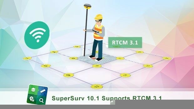
29th January 2018
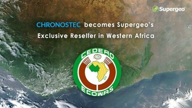
Chronostec Becomes Supergeo’s Exclusive Reseller in Western Africa26th January 2018
Airbus selected by ESA for EGNOS V3 programme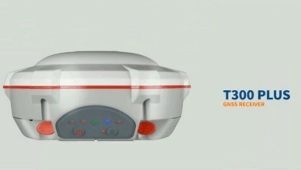
26th January 2018
ComNav Technology Introduces Powerful T300 Plus GNSS Receiver
25th January 2018
SSTL Joins Viasat’s Real Time Earth Network25th January 2018
GGP Systems partners with Strata Service Solutions Limited (Strata)
25th January 2018
Linking health and care providers in Kent through the UPRN25th January 2018
Elbit Systems Awarded $150M Australian deal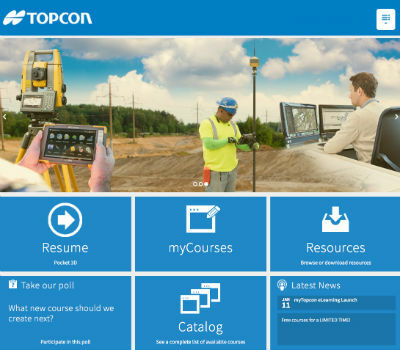
25th January 2018
Topcon announces new online courses for myTopcon support site25th January 2018
2018 URISA Exemplary Systems in Government Awards Process Opens25th January 2018
SSE Chooses Martek Aviation to Inspect 683 Wind Turbines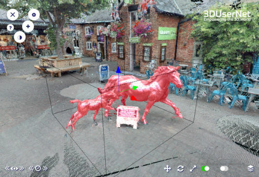
25th January 2018
3DUserNet Adds Point Cloud Clipbox and IFC and FBX Model Formats25th January 2018
HERE to acquire global indoor maps provider Micello