
Cloud to power Canary Wharf Digital Transformation
25th June 2018
Cloud to power Canary Wharf Digital TransformationThe compilation, reproduction and dissemination of maps and charts by means of manual (analogue) or digital techniques, tools and workflows. This topic covers the compilation, reproduction, dissemination and use of both analogue (paper) and digital maps, charts and atlases. As well as the science of cartography, including georeferencing and geocoding, digital techniques for compiling and generating various types of raster and vector maps and charts are covered, as are the digital mapping tools and Geographic Information Systems available for this purpose. The application of cartography for aeronautical, terrestrial and marine purposes is also covered
25th June 2018
Cloud to power Canary Wharf Digital Transformation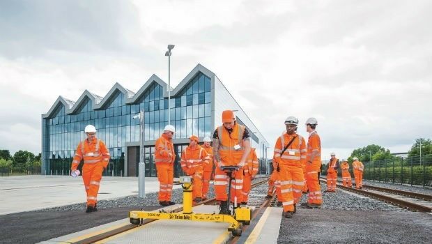
25th June 2018
KOREC launches Trimble’s GEDO IMS to key players in the UK rail industry25th June 2018
“Forecasts for drones are wrong” says leading British drone expert
25th June 2018
Creating Mobile Apps with Big Data from Space
25th June 2018
Airbus and Planet join forces to bring new geospatial products to market
25th June 2018
GEOMAKANI 2018 “3rd Geospatial Technologies Conference”
23rd June 2018
Free Business Location Data for Use with Maptitude 2018
23rd June 2018
Airbus to supply satellite communications system
22nd June 2018
GeoPlace and JAG(UK) help councils cut driver disruption22nd June 2018
Esri User Conference Highlights Where Mapping Technology Is Headed Next22nd June 2018
Safe Software renews FME Certification for 1Spatial's Mary O'Brien22nd June 2018
Soar TGE to generate the world’s first fully decentralised global super-map using drones
22nd June 2018
con terra and GEO Jobe announce partnership21st June 2018
Launch of sobloo - a Copernicus Data and Information Access Service (DIAS)21st June 2018
exactEarth and IHS Markit to Deliver Real-time Vessel Tracking Solution21st June 2018
Bentley Systems Acquires Synchro Software to Extend Digital Workflows
21st June 2018
YellowScan, UAV LiDAR specialist, opens YellowScan Inc. in Salt Lake City.

20th June 2018
ERM Advanced Telematics Completes Development of Anti-Ransomware20th June 2018
Ordnance Survey appoints Philippa Hird as Non-Executive Director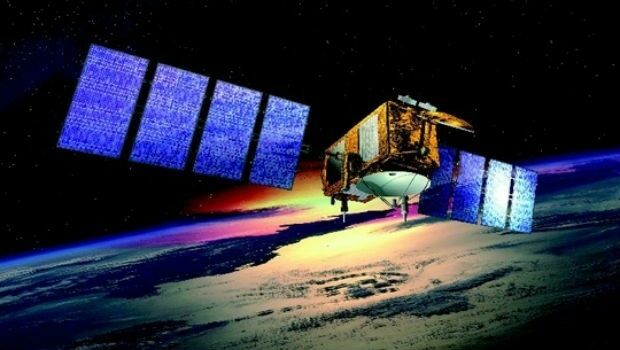
20th June 2018
US/European oceans-monitoring satellite marks 10 years in service20th June 2018
Digitalisation and the question of “where?”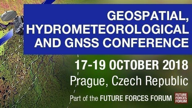
20th June 2018
Join Geospatial, Hydrometeorological and GNSS Conference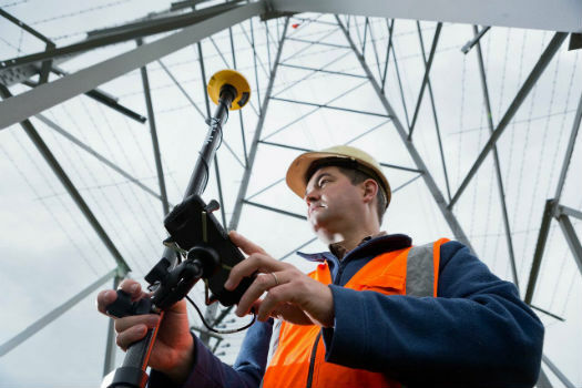
20th June 2018
RIEGL to Attend and Present at the 19th Annual JALBTCX20th June 2018
Topcon releases new edition of MAGNET software suite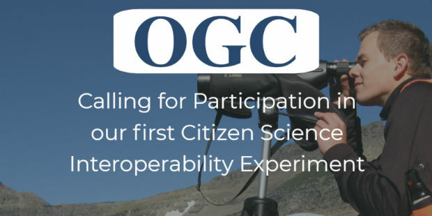
19th June 2018
Participation in Citizen Science Interoperability Experiment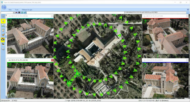
19th June 2018
ObliMapper Transforming Drone Imagery into Actionable Visual Intelligence19th June 2018
PCI Geomatics Attend 39th Annual Canadian Symposium on Remote Sensing19th June 2018
Call for Proposals - ISPRS Scientific Initiatives 2019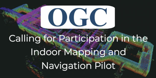
19th June 2018
OGC Calls for Participation in its Indoor Mapping and Navigation Pilot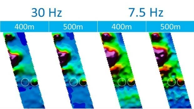
18th June 2018
CGG’s Helitem Shatters AEM Low-Frequency Barrier18th June 2018
We are pleased to announce the GRASS GIS 7.4.1 release18th June 2018
Inaugural European Drone Summit in Frankfurt
16th June 2018
Expanded Focus on Drones in Public Safety at InterDrone16th June 2018
Third 2018 URISA GIS Leadership Academy Announced15th June 2018
Bentley Systems Named 2018 Microsoft CityNext Partner of the Year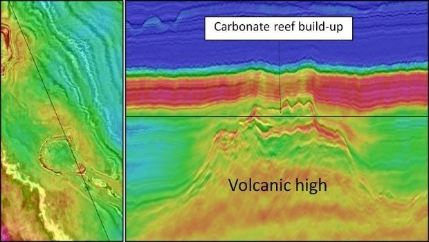
15th June 2018
CGG Delivers Final PSTM Products for Dunquin Multi-Client Survey15th June 2018
Hexagon introduces HxGN MineOperate UG Pro for Miners15th June 2018
PDF3D's Global Expansion Continues with IDI Collaboration in Japan15th June 2018
New Light Technologies and Boundless Announce Strategic Partnership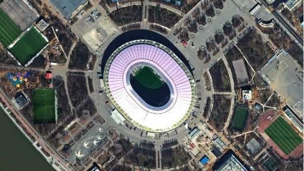
15th June 2018
FIFA World Cup 2018 Stadiums As Seen From Space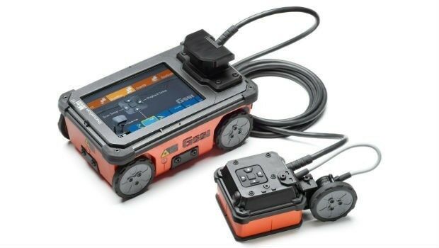
15th June 2018
GSSI Showcases and Demonstrates World Leading GPR Systems in Switzerland
15th June 2018
GAF to provide consulting services in Mozambique