Cartography
The compilation, reproduction and dissemination of maps and charts by means of manual (analogue) or digital techniques, tools and workflows. This topic covers the compilation, reproduction, dissemination and use of both analogue (paper) and digital maps, charts and atlases. As well as the science of cartography, including georeferencing and geocoding, digital techniques for compiling and generating various types of raster and vector maps and charts are covered, as are the digital mapping tools and Geographic Information Systems available for this purpose. The application of cartography for aeronautical, terrestrial and marine purposes is also covered

Grid Analytics Europe 2018, 25-27 September 2018, London
14th June 2018
Grid Analytics Europe 2018, 25-27 September 2018, London
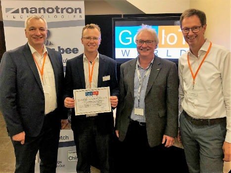
Nanotron wins Geo IOT World award for indoor location and proximity
14th June 2018
Nanotron wins Geo IOT World award for indoor location and proximity
Sunshine Coast Council and Pitney Bowes Develop Smart City Results
14th June 2018
Sunshine Coast Council and Pitney Bowes Develop Smart City Results
Hexagon's Mining division launches streamlined product portfolio
14th June 2018
Hexagon's Mining division launches streamlined product portfolio
Registration Opens For 17th Annual Benelux Infrastructure Forum 2018
12th June 2018
Registration Opens For 17th Annual Benelux Infrastructure Forum 2018
Sercel Extends Capability of 508XT Seismic Acquisition System
12th June 2018
Sercel Extends Capability of 508XT Seismic Acquisition System
Headwall Integrates Hyperspectral and LiDAR Aboard UAV Platforms
12th June 2018
Headwall Integrates Hyperspectral and LiDAR Aboard UAV Platforms
SimActive Software for Precision Agriculture in Brazil
12th June 2018
SimActive Software for Precision Agriculture in BrazilIntelligent Telematics Targets Sales Growth
11th June 2018
Intelligent Telematics Targets Sales Growth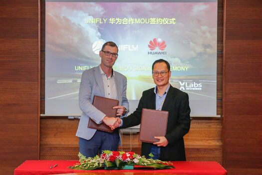
Huawei and Unifly Collaborate to Identify and Track Drone Flights
11th June 2018
Huawei and Unifly Collaborate to Identify and Track Drone Flights
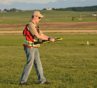
AP-Flyer is the Latest Sponsor of UAV Technology Conference
10th June 2018
AP-Flyer is the Latest Sponsor of UAV Technology ConferenceCollaboration to future-proof offshore wind turbine monopiles
8th June 2018
Collaboration to future-proof offshore wind turbine monopiles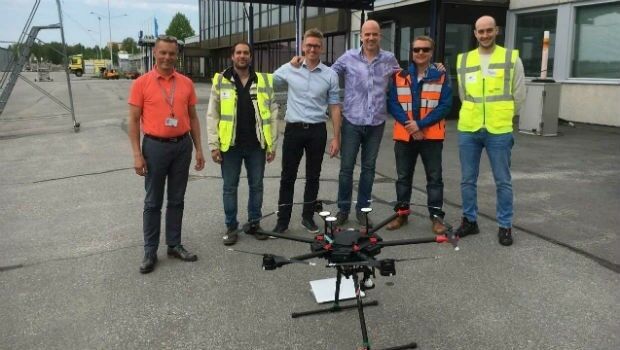
Unifly and CanardDrones show real capabilities in Finland
8th June 2018
Unifly and CanardDrones show real capabilities in Finland
Silent Auction to Benefit URISA's GISCorps Announced
8th June 2018
Silent Auction to Benefit URISA's GISCorps Announced
Sofradir and ULIS undergo structural reorganization
8th June 2018
Sofradir and ULIS undergo structural reorganizationSeaRobotics Delivers Two Autonomous Hydrographic Survey Vehicles
8th June 2018
SeaRobotics Delivers Two Autonomous Hydrographic Survey Vehicles
Pix4D launches its first fully dedicated product for agriculture
8th June 2018
Pix4D launches its first fully dedicated product for agriculture
Airbus and U.S. Air Force Commemorate 25yrs of Eagle Vision Program
7th June 2018
Airbus and U.S. Air Force Commemorate 25yrs of Eagle Vision Program
OGC Invites you to the Disasters CDS Workshop at the NOAA Auditorium
7th June 2018
OGC Invites you to the Disasters CDS Workshop at the NOAA Auditorium
Going Deeper Underground – Can We Build An Underground Map Of The UK?
7th June 2018
Going Deeper Underground – Can We Build An Underground Map Of The UK?
NAKANIHON and RIEGL to Give Joint Presentation
7th June 2018
NAKANIHON and RIEGL to Give Joint Presentation
thinkWhere Helps Manage Disasters in Cambodia
7th June 2018
thinkWhere Helps Manage Disasters in Cambodia
Rezatec join forces with specialist contractor, Detection Services
7th June 2018
Rezatec join forces with specialist contractor, Detection Services
Airbus is showcasing an array of innovative products
7th June 2018
Airbus is showcasing an array of innovative products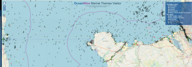
OceanWise awarded GIS Marine Data contract for the Scottish Government
7th June 2018
OceanWise awarded GIS Marine Data contract for the Scottish Government
Hexagon’s Geospatial Division to Unveil 5D Location Intelligence
7th June 2018
Hexagon’s Geospatial Division to Unveil 5D Location Intelligence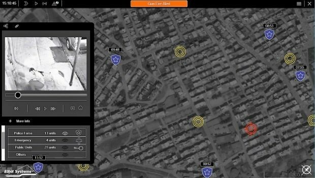
Elbit Systems Launches MAY, a Wide-area Acoustic-based Situational Awareness Solution
7th June 2018
Elbit Systems Launches MAY, a Wide-area Acoustic-based Situational Awareness Solution
2018 World Football Championship stadiums seen from space
6th June 2018
2018 World Football Championship stadiums seen from space
Earth-i Expands Team To Meet Demand for Insight and Analysis
6th June 2018
Earth-i Expands Team To Meet Demand for Insight and Analysis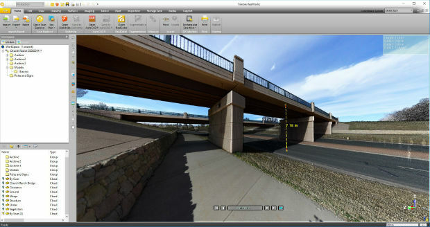
Trimble RealWorks Announces Performance and UI Enhancements
6th June 2018
Trimble RealWorks Announces Performance and UI Enhancements
Envitia appoints Roger Brackin as Strategic Geospatial Advisor
6th June 2018
Envitia appoints Roger Brackin as Strategic Geospatial Advisor
SXblue Introduces Android Application ToolBox
6th June 2018
SXblue Introduces Android Application ToolBox
Boundless Server Enterprise Now Available as Managed Cloud Service
6th June 2018
Boundless Server Enterprise Now Available as Managed Cloud Service
HR Wallingford and the University of Salento partner
5th June 2018
HR Wallingford and the University of Salento partner
Esri Location Intelligence to Integrate with SAP HANA Spatial Services
5th June 2018
Esri Location Intelligence to Integrate with SAP HANA Spatial Services
TomTom announce collaboration with what3words
5th June 2018
TomTom announce collaboration with what3words
GeoSpock Welcomes New Chief Commercial Officer
5th June 2018
GeoSpock Welcomes New Chief Commercial Officer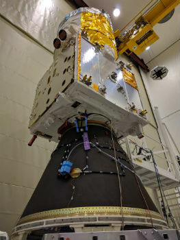
Airbus-built Aeolus wind sensor satellite ready for shipment
5th June 2018
Airbus-built Aeolus wind sensor satellite ready for shipment
HERE and Decawave partner on high-accuracy indoor tracking technology
5th June 2018
HERE and Decawave partner on high-accuracy indoor tracking technology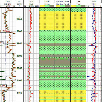
CGG GeoSoftware Releases PowerLog 9.7.2 Petrophysical Software
5th June 2018
CGG GeoSoftware Releases PowerLog 9.7.2 Petrophysical SoftwareCorbley Communications Celebrates 25th Anniversary
5th June 2018
Corbley Communications Celebrates 25th Anniversary
Nanotron to showcase swarm bee location awareness technology
5th June 2018
Nanotron to showcase swarm bee location awareness technology