TCarta Wins National Science Foundation Grant
7th August 2018
TCarta Wins National Science Foundation GrantThe compilation, reproduction and dissemination of maps and charts by means of manual (analogue) or digital techniques, tools and workflows. This topic covers the compilation, reproduction, dissemination and use of both analogue (paper) and digital maps, charts and atlases. As well as the science of cartography, including georeferencing and geocoding, digital techniques for compiling and generating various types of raster and vector maps and charts are covered, as are the digital mapping tools and Geographic Information Systems available for this purpose. The application of cartography for aeronautical, terrestrial and marine purposes is also covered
7th August 2018
TCarta Wins National Science Foundation Grant
7th August 2018
Productivity And Efficiency Improvements With Ctrack Online
7th August 2018
Urban-themed Location Powers Event Agenda Finalized
7th August 2018
Renovo and HERE Technologies Form Partnership7th August 2018
CHC Navigation Completes Acquisition of AMW
7th August 2018
ERM Advanced Telematics launches StarLink Tracker with Wi-Fi
7th August 2018
Elbit Systems Awarded $85 Million Contract to Supply EW Suites
7th August 2018
1Spatial adds Linear Reference System (LRS) support to 1Integrate
7th August 2018
EarthSense App Promotes Clean Air Routes for Exercise
6th August 2018
The ‘corniest’ attraction in the UK is back!6th August 2018
HERE announces new partnership with Motorola Solutions6th August 2018
ENGIE to build 8 hybrid solar power plants in Gabon6th August 2018
1Spatial adds Linear Reference System (LRS) support to 1Integrate6th August 2018
Dr. Teresa Thorpe Joins CSA Ocean Sciences as Proposal Coordinator6th August 2018
Hexagon acquires mine safety specialist, Guardvant4th August 2018
Linkfast to Provide Applanix Products and Solutions3rd August 2018
Airbus Defence and Space selected by Telesat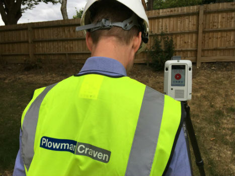
3rd August 2018
Plowman Craven collaborates with Leica Geosystems on RTC3603rd August 2018
GSSI Announces New Technical Applications Specialist2nd August 2018
OceanWise will be running a Marine Data Management Awareness Course
2nd August 2018
Single Channel Pyroelectric Detector Housed in a 4 Pin Package
2nd August 2018
Freemium plan for developers to build location-aware applications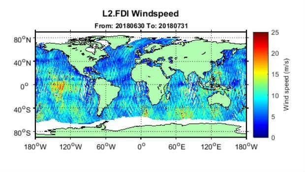
1st August 2018
First global GNSS-Reflectometry ocean wind data service1st August 2018
UK New Space Launch capability to be discussed at Global MilSatCom 2018
31st July 2018
Skanska Speeds BIM Workflows with Pointfuse As-Built Models30th July 2018
OceanWise delivers accurate real-time weather data30th July 2018
Fugro’s David Millar To Serve On IHO-IOC GEBCO Guiding Committee27th July 2018
CGG announces the Appointment of Yuri Baidoukov as Group CFO27th July 2018
3D PluraView Monitor Product Family expanded – new 22″ Full-HD Model
26th July 2018
South Downs National Park Plans GIS Future with thinkWhere26th July 2018
ip.access collaborates with Blue Arcus Technologies Inc.
25th July 2018
Human individuals at the centre of attention at the GI_Forum 201825th July 2018
NGA Efforts to Drive Innovation by Partnering with Industry24th July 2018
OS and Mountain Rescue ask people to keep cool this summer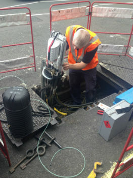
24th July 2018
Government’s Framework for UK Fibre Delivery
23rd July 2018
Rewire Security announces a Major Software update for GPSLive
23rd July 2018
The Survey School’s 2018 graduates take home the prizes23rd July 2018
Terra Drone Corporation Developed New of Unmanned Aircraft System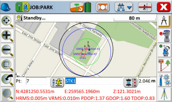
21st July 2018
Carlson SurvCE and SurvPC 6.0 Available Now21st July 2018
RENEXPO® INTERHYDRO Europe’s meeting point for hydropower20th July 2018
Yotta Accelerates Growth in Australia with Strategic PMS Partnership20th July 2018
3D Laser Mapping And GeoSLAM Global Merger Announcement
20th July 2018
BARSC Welcomes Two New Earth Observation Companies as Members