
Munir Ismet appointed as new MD at Ordnance Survey
1st July 2020
Munir Ismet appointed as new MD at Ordnance SurveyThe compilation, reproduction and dissemination of maps and charts by means of manual (analogue) or digital techniques, tools and workflows. This topic covers the compilation, reproduction, dissemination and use of both analogue (paper) and digital maps, charts and atlases. As well as the science of cartography, including georeferencing and geocoding, digital techniques for compiling and generating various types of raster and vector maps and charts are covered, as are the digital mapping tools and Geographic Information Systems available for this purpose. The application of cartography for aeronautical, terrestrial and marine purposes is also covered
1st July 2020
Munir Ismet appointed as new MD at Ordnance Survey
13th May 2020
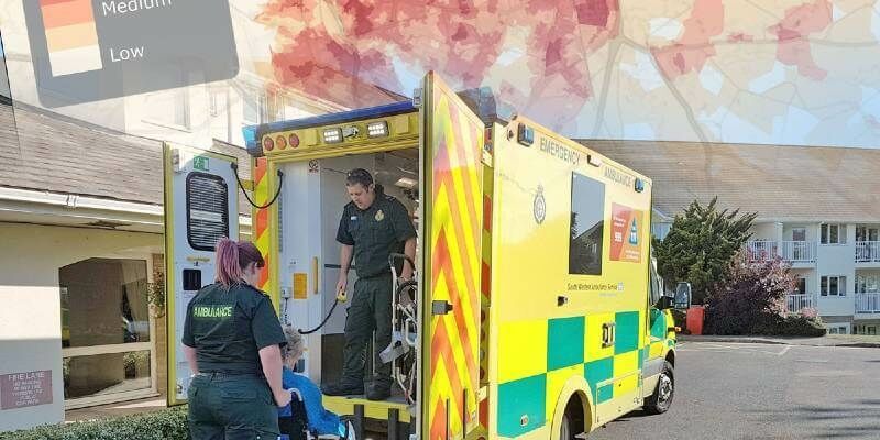
4 Earth Intelligence Publishes Heat Hazard Data as Vulnerable Population Remains in Lockdown

4th May 2020
MicroSurvey - FieldGenius For Android Point Line
29th April 2020
Juniper Systems Announces New Windows 10 Rugged Tablet: Mesa 2™
24th April 2020
MicroSurvey - FieldGenius for Android Staking
1st April 2020
Lovell Johns Unveils GIS Consultancy Service - gi Perspective
24th March 2020
USGIF Announces 2020 Stu Shea Endowed Scholarship Recipient
13th March 2020
The National Construction Expo - The Arena MK, Milton Keynes - 6th May, 2020
12th March 2020
Bentley Systems Announces the Acquisition of GroupBC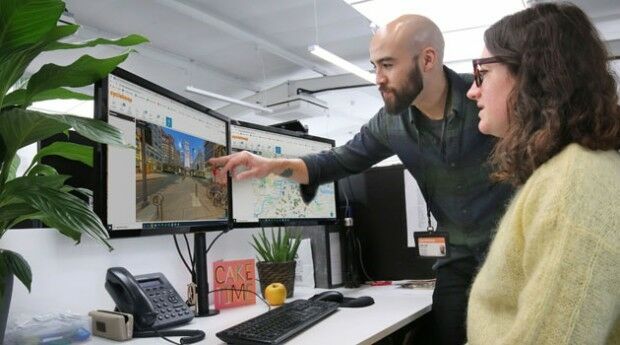
11th March 2020
BigChange Maps Out Cyclehoop’s On-Street Cycle Parking Revolution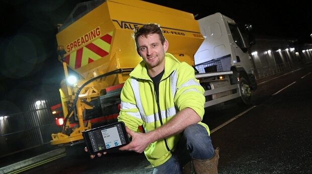
13th February 2020
BigChange Mobile Workforce App & Telematics Speeds Road Gritting Operations
2nd February 2020
G-Core Labs launched CDN & hosting point of presence in Mumbai
8th January 2020
Hexagon introduces visualisation platform
7th January 2020
Buchanan Computing Launches Traffic Order Data Open API
22nd December 2019
G-Core Labs has opened new content delivery and hosting point of presence
3rd December 2019
Getmapping partners with 3D Visualisation Technology Leaders
28th November 2019
Bluesky Launches MetroVista 3D City Mapping Service in US
21st November 2019
Pointfuse Launches Simple BIM Solution for Facilities Management
21st November 2019
Leica Geosystems launches BLK3D Web, integrates with Autodesk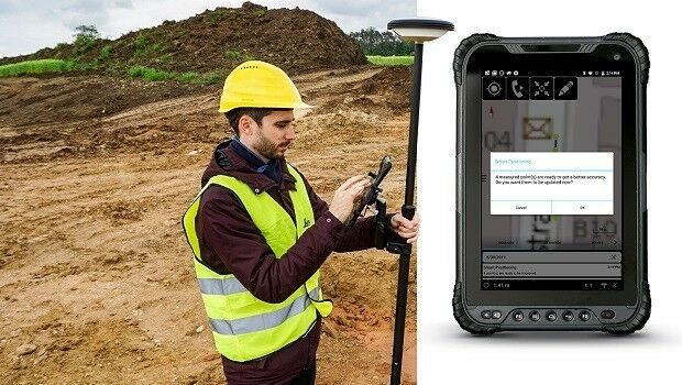
19th November 2019
Leica Geosystems enables a new era for GIS data capture
30th October 2019
T-MAPY User Conference Attracts Record Numbers
28th October 2019
Galbraith Adopts thinkWhere’s Web Mapping Tool
24th October 2019
Bentley Systems Announces Support of IFC for Digital Twins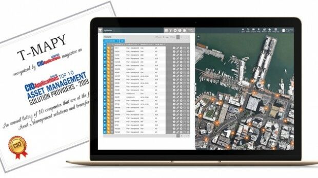
22nd October 2019
Assetino Asset Management Platform Scoops Top European Award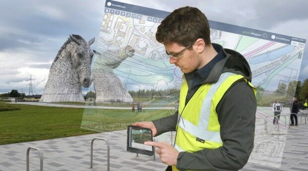
15th October 2019
thinkWhere Releases New groundMapper Web Mapping Tool
14th October 2019
Orbit GT launches 3D Mapping Cloud v19.10
9th October 2019
thinkWhere Appointed Government Digital Specialist
7th October 2019
International SCADA SECURITY Conference, PRAGUE, Czech Republic
1st October 2019
G-Core Labs speeds up its content delivery network
27th September 2019
Streetwise Services Improve Traffic Surveys with thinkWhere’s Online Maps5th September 2019
thinkWhere Supports Scottish Government Planning Process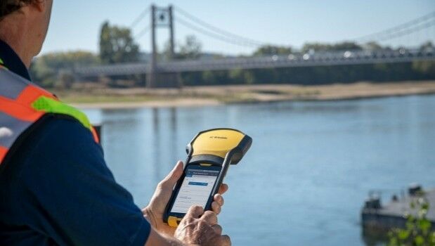
5th September 2019
Trimble Announces New Offline Data Transfer and Post-Processing Workflow
30th August 2019
Sourcing, Storing and Analysing Imagery in the Digital Era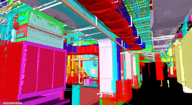
22nd August 2019
Pointfuse Laser Scanning Software Transforms Digital Construction Workflows25th July 2019
SoundHound Inc. Integrates HERE Mapping and Location Data i
25th July 2019
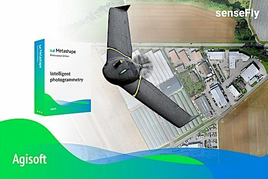
Introducing the senseFly eBee X with Agisoft Metashape
25th July 2019
Orbit GT launches 3D Mapping portfolio v19.7 with new website
25th July 2019
Visiontrack recuits European Sales Director25th July 2019
2019 URISA Exemplary Systems in Government Award Recipients Announced
24th July 2019
Yanmar Demonstrates Autonomous Tractors Using Precision Positioning
24th July 2019
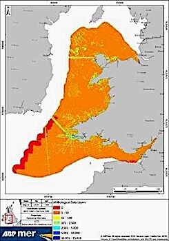
ABPmer to deliver Sustainable Management of Marine Natural Resources
23rd July 2019
Terra Drone Brazil complete Brazil’s first FPSO tank inspection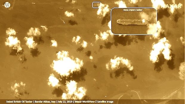
23rd July 2019
Satellite Imagery: Captured British Oil Tanker
23rd July 2019
QuickSwitch® Recognised for Excellence in Sensors Innovation