
Master Class 4: Vertical Mobility in Urban Environments
23rd July 2019
Master Class 4: Vertical Mobility in Urban EnvironmentsThe compilation, reproduction and dissemination of maps and charts by means of manual (analogue) or digital techniques, tools and workflows. This topic covers the compilation, reproduction, dissemination and use of both analogue (paper) and digital maps, charts and atlases. As well as the science of cartography, including georeferencing and geocoding, digital techniques for compiling and generating various types of raster and vector maps and charts are covered, as are the digital mapping tools and Geographic Information Systems available for this purpose. The application of cartography for aeronautical, terrestrial and marine purposes is also covered
23rd July 2019
Master Class 4: Vertical Mobility in Urban Environments23rd July 2019
OGC and RTCA Announce Signing of Memorandum of Understanding22nd July 2019
Wheeler Financial from Pitney Bowes Helps Ghilotti Bros Inc
22nd July 2019
Pitney Bowes Named to Forbes Magazine List of America's Best Employers21st July 2019
Surveying Firm Highly Commended at Prestigious National Construction Awards20th July 2019
2019 EuroSDR Award for the best PhD thesis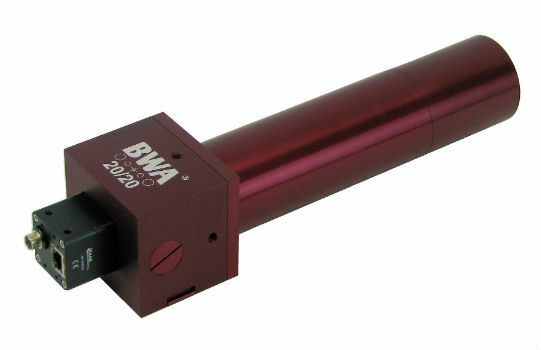
19th July 2019
BWA-CAM 20/20 - The World‘s First ‘Plug-and-Play‘ Solution
19th July 2019
GeoIgnite’s inaugural ‘Diversity in Leadership’ award
19th July 2019
Chinese C-V2X Direct Communication Interoperability Testing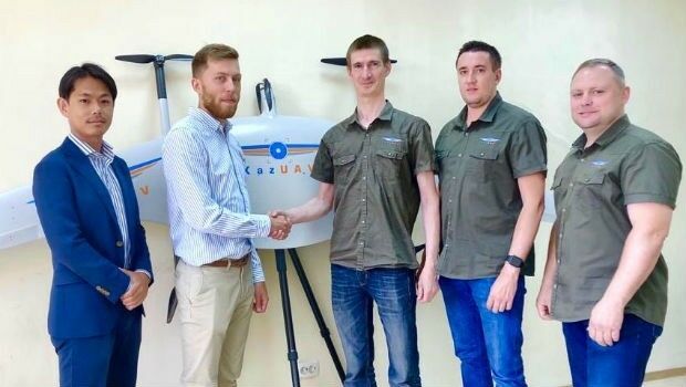
19th July 2019
Japan’s Terra Drone gains footing in Central Asia17th July 2019
Planners Can Earn Ample CM Credits at GIS-Pro 201917th July 2019
Safety Management Systems within the Pipeline & Utilities Industries
17th July 2019
TDI-Brooks International, Inc. hires Mrs. Jayme McBee
15th July 2019
RIEGL Invests in New Office and Production Facilities!
15th July 2019
Europa Technologies strikes gold with two awards at Esri User Conference
15th July 2019
Goonhilly opens new data centre with green HPC platform for AI and ML
13th July 2019
GSSI Receives Presidential Award for Exports
12th July 2019
Fugro performs first North Sea remote heading control operation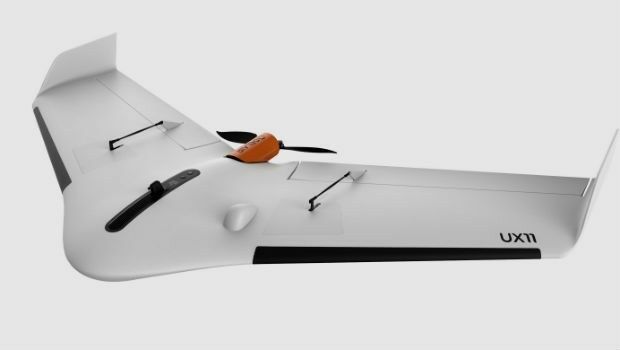
12th July 2019
high performance UX11 & UX11 Ag surveying and mapping drones1.jpg)
11th July 2019
Ecometrica Manager wins BusinessGreen Leaders Award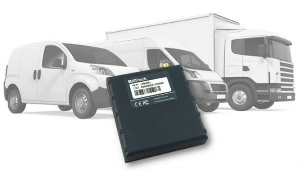
11th July 2019
ATrack Announces Launch of New AK7V Device
11th July 2019
Fugro succeeds with new seep survey license sales offshore Newfoundland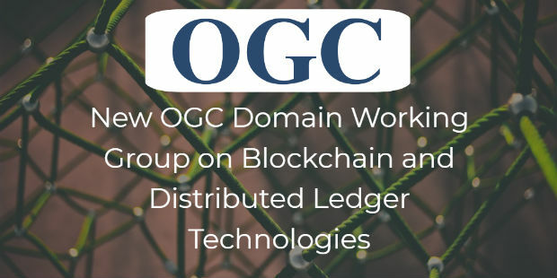
11th July 2019
OGC announces the creation of a new Domain Working Group11th July 2019
Save the Date ! Webinar July 18 at 6 PM CET
11th July 2019
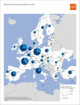
Retail share of private consumption, Europe 2018
11th July 2019
CTRACK HELPS PROTECT NORFOLK’S OLDEST WORKING MOTOR CAR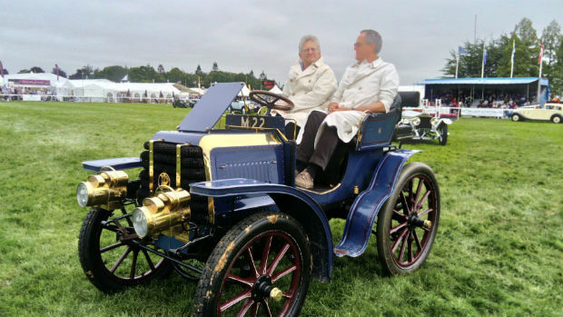
11th July 2019
CTRACK HELPS PROTECT NORFOLK’S OLDEST WORKING MOTOR CAR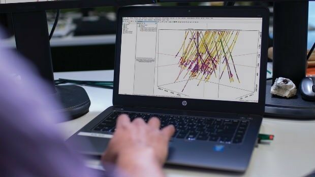
11th July 2019
Seequent continues investment in innovative geoscience technology
10th July 2019
Trimble announces new usage-based plans for Trimble Catalyst
10th July 2019
Cesium launches with $5 million investment9th July 2019
Ordnance Survey creates ‘win-win’ for construction and geospatial industries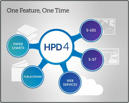
9th July 2019
New CARIS HPD 4.0 release will advance existing capabilities
8th July 2019
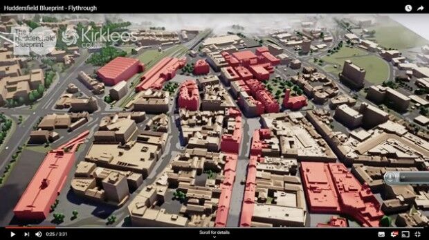
Bluesky 3D Model Helps AECOM Create Blueprint for Yorkshire Town Redevelopment-Airbus-2019.jpg)
8th July 2019
Airbus to develop CO3D Earth Observation programme for CNES
8th July 2019
Virtual Surveyor Enhances LiDAR Point Cloud Handling8th July 2019
Second Lockheed Martin-Built GPS III Satellite Ready for July 25 Liftoff