

Content


Elane Inc. procures OceanWise Web Mapping Service
25th October 2018
Elane Inc. procures OceanWise Web Mapping Service
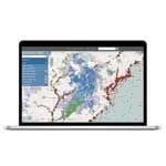
Driving geospatial innovation in Singapore and the United Kingdom
25th October 2018
Driving geospatial innovation in Singapore and the United Kingdom
UNAM, Argentina Has Applied SuperGIS Desktop 10 to Elevate Geospatial Education
25th October 2018
UNAM, Argentina Has Applied SuperGIS Desktop 10 to Elevate Geospatial Education
GSSI Adds Drill Hole Feature to StructureScan™ Mini XT GPR Concrete Inspection System
25th October 2018
GSSI Adds Drill Hole Feature to StructureScan™ Mini XT GPR Concrete Inspection System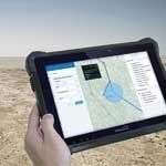
DT Research Introduces 7” Rugged Tablet with Scientific-grade GNSS
25th October 2018
DT Research Introduces 7” Rugged Tablet with Scientific-grade GNSS
Ctrack Launches Tracking Solution For Unpowered Assets
25th October 2018
Ctrack Launches Tracking Solution For Unpowered Assets
ezMetr Provides Transportation Platform for Smarter Cities
25th October 2018
ezMetr Provides Transportation Platform for Smarter Cities
Dr. Oliver Montenbruck Receives Johannes Kepler Award
25th October 2018
Dr. Oliver Montenbruck Receives Johannes Kepler Award
Bob Erickson Joins CSA Ocean Sciences Inc.
25th October 2018
Bob Erickson Joins CSA Ocean Sciences Inc.
Dr. Yu Jiao Receives Bradford W. Parkinson Award
25th October 2018
Dr. Yu Jiao Receives Bradford W. Parkinson Award
Joan Masó receives OGC’s 2018 Gardels Award
25th October 2018
Joan Masó receives OGC’s 2018 Gardels Award
David Glennon joins the UK BIM Alliance Executive Team
25th October 2018
David Glennon joins the UK BIM Alliance Executive Team
UAVOS Fixed-Wing UAV Sitaria Completed Flight Tests
25th October 2018
UAVOS Fixed-Wing UAV Sitaria Completed Flight Tests
USGIF Launches Third Annual EdGEOcation Giving Campaign
25th October 2018
USGIF Launches Third Annual EdGEOcation Giving Campaign
ERM Advanced Telematics launches a unique product to improve driving using human voice warnings
25th October 2018
ERM Advanced Telematics launches a unique product to improve driving using human voice warnings
Unifly and Terra Drone co-develop UTM system with Hitachi
25th October 2018
Unifly and Terra Drone co-develop UTM system with Hitachi
Esri Incorporates BuildingFootprintUSA Data for Deep Learning
25th October 2018
Esri Incorporates BuildingFootprintUSA Data for Deep Learning

How Drones Can Optimize Surveying and Mapping Projects
25th October 2018
How Drones Can Optimize Surveying and Mapping Projects
Teledyne CARIS’ Burns Foster debuted advanced algorithms
25th October 2018
Teledyne CARIS’ Burns Foster debuted advanced algorithms
Garmin joins HERE Venues Marketplace, the fast-growing source for venue maps
25th October 2018
Garmin joins HERE Venues Marketplace, the fast-growing source for venue maps
Garmin announces availability of cost-effective navigation databases for South America
25th October 2018
Garmin announces availability of cost-effective navigation databases for South America
PCI Geomatics Completes Historical Airphoto Mapping Project for Virginia County
25th October 2018
PCI Geomatics Completes Historical Airphoto Mapping Project for Virginia County
Nanotron releases new production version of location tracking software
25th October 2018
Nanotron releases new production version of location tracking software
US Air Force Announces selection of GPS III follow-on contract
25th October 2018
US Air Force Announces selection of GPS III follow-on contract
SITECO announces full compatibility of Road-Scanner data with TopoDOT
25th October 2018
SITECO announces full compatibility of Road-Scanner data with TopoDOT
Pitney Bowes Now Offering Data for Purchase Online
25th October 2018
Pitney Bowes Now Offering Data for Purchase Online
Airbus and Orbital Insight partner on The OneAtlas Platform
25th October 2018
Airbus and Orbital Insight partner on The OneAtlas Platform
Aurecon Group and Digpro enters new partnership agreement
25th October 2018
Aurecon Group and Digpro enters new partnership agreement
Boundless introduces GIS solution for state & local governments
25th October 2018
Boundless introduces GIS solution for state & local governments
Delair Receives Funding From Intel Capital
25th October 2018
Delair Receives Funding From Intel Capital
HawkEye 360 Announces Eagle Technology as Partner for New Zealand
25th October 2018
HawkEye 360 Announces Eagle Technology as Partner for New Zealand
Swift Navigation Introduces Starling, a GNSS Positioning Engine
25th October 2018
Swift Navigation Introduces Starling, a GNSS Positioning Engine
Hemisphere GNSS Acquires Outback Guidance Business from AgJunction, Inc.
25th October 2018
Hemisphere GNSS Acquires Outback Guidance Business from AgJunction, Inc.
Elbit Systems of Australia to Help Train ADF Cyber Warriors
25th October 2018
Elbit Systems of Australia to Help Train ADF Cyber Warriors
DigitalGlobe Satellite Imagery of Russian Military Exercise
25th October 2018
DigitalGlobe Satellite Imagery of Russian Military Exercise
OGC requests comment on candidate standard: Geographic Information
25th October 2018
OGC requests comment on candidate standard: Geographic Information
URISA Releases White Paper Defining the Boundaries of Practice Between Surveyors and GIS Professiona
25th October 2018
URISA Releases White Paper Defining the Boundaries of Practice Between Surveyors and GIS Professiona

senseFly launches the eBee X fixed-wing drone
25th October 2018
senseFly launches the eBee X fixed-wing drone
Archive