
NM Group undertake Machine Learning research project
25th September 2018
NM Group undertake Machine Learning research projectThe 2D and 3D measurement of points, distances and angles of features and objects on the Earth’s surface. See also Surveying Instrumentation topic. This topic covers the science and techniques that govern the 2D and 3D measurement of points, distances and angles of natural and man-made features and objects on the Earth’s surface. These measurements are acquired for a wide range of practical applications in construction, engineering, land use planning, mapmaking and cadastral projects, See also Surveying Instrumentation topic for the various tools employed to acquire survey measurements.
25th September 2018
NM Group undertake Machine Learning research project25th September 2018
Discover more with new OS Maps 3D feature (WITH VIDEO22nd September 2018
Mirasense and XenomatiX Win Technology Showcase22nd September 2018
Discover the Septentrio PolaRx5e at ION GNSS+ in Miami18th September 2018
GSSI Adds Drill Hole Feature to StructureScan™ Mini XT18th September 2018
Topcon announces acquisition of ThunderBuild17th September 2018
DT Research Introduces 7” Rugged Tablet with Scientific-grade GNSS17th September 2018
CGG Conducts Innovative Rich-Azimuth Multi-Client Survey NW of Shetland15th September 2018
Fugro Helps Western Power Strengthen Its Network’s Asset Management15th September 2018
SITECO announces full compatibility of Road-Scanner data with TopoDOT
14th September 2018
DigitalGlobe Satellite Imagery of Russian Military Exercise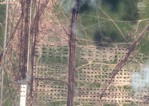
14th September 2018
DigitalGlobe Satellite Imagery of Russian Military Exercise13th September 2018
RIEGL to Attend and Exhibit at AREMA 2018!13th September 2018
Delair Receives Funding From Intel Capital12th September 2018
Teledyne Optech’s Dr. Paul LaRocque to deliver address at ION GNSS+11th September 2018
Introducing the upgraded MTi 1-series modules.10th September 2018
Greenvalley International Launches New Premium Mobile Mapping Systems
6th September 2018
senseFly launches the eBee X fixed-wing drone
6th September 2018
Fugro Secures E&P Support Contracts In Trinidad And Gulf Of Mexico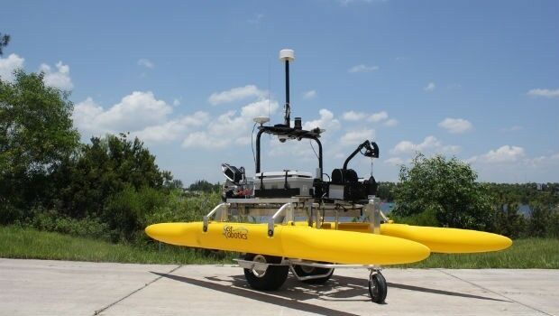
6th September 2018
SeaRobotics Delivers 3.6 Meter Collapsible ASV to USACE
6th September 2018
Juniper Systems Limited Expands Into the Nordics, Welcomes Paul Collins4th September 2018
Acquisition of Outback Guidance Business from AgJunction, Inc.
3rd September 2018
V.Ships and Martek Marine to fight sudden cardiac arrest at sea
3rd September 2018
Wärtsilä Ballast Water Management System endorsed3rd September 2018
NOVACAVI’S CABLE SOLUTIONS CHOSEN FOR IN-SITU MONITORING DOWN TO 4000M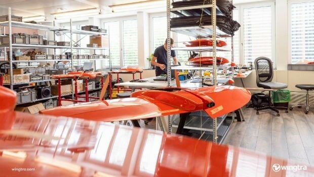
30th August 2018
Withstands Operating Temperatures up to 300ºC30th August 2018
Trimble Launches New Model of its R10 GNSS System for Land Surveyors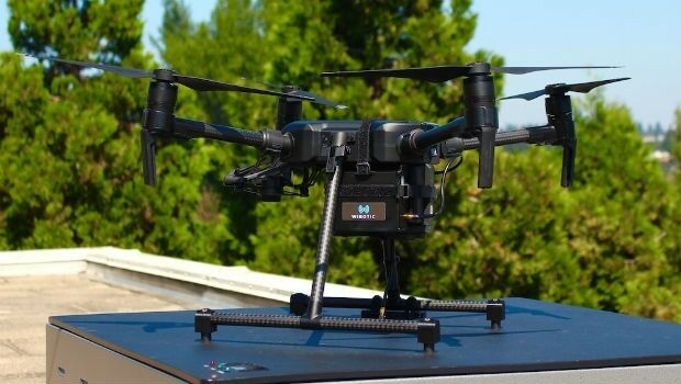
29th August 2018
WiBotic Announces a Wireless Power System for DJI Matrice 200 Series Drones
29th August 2018
ClassNK adds to RIMS portfolio of class approvals28th August 2018
SimActive for Mining: Drones & Volume Calculation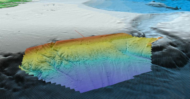
28th August 2018
Fugro Acquires Data In Frontier Region Seep Hunting Programme
28th August 2018
Laser Technology, Inc. Announces a New TruPulse 360 Laser Rangefinder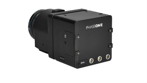
28th August 2018
Phase One Industrial Launches 150MP Metric Camera22nd August 2018
Geneq Inc. Announces the new F90 GNSS Receiver21st August 2018
Hemisphere GNSS Acquires Outback Guidance Business from AgJunction, Inc.
16th August 2018
Drone Major Group invests in SUAS Global expansion
15th August 2018
Martek Announce New Head of Counter-Drone Technology M.A.DS15th August 2018
The Danish Geodata Agency selects Teledyne CARIS
13th August 2018
Acquisition Of Data For Norway’s Mareano Seabed Mapping Programme
9th August 2018
Topcon Supports Major Improvement Works On The A14
9th August 2018
The DataBio project starts trials of 26 bioeconomy pilots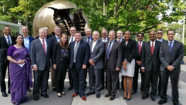
9th August 2018
RIEGL a Founding Member of the World Geospatial Industry Council!7th August 2018
CHC Navigation Completes Acquisition of AMW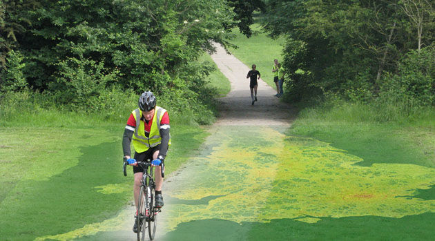
7th August 2018
EarthSense App Promotes Clean Air Routes for Exercise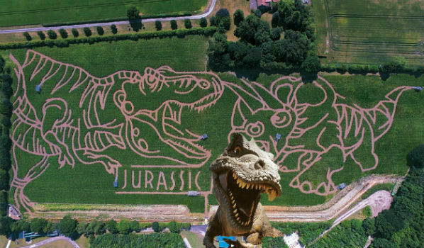
6th August 2018
The ‘corniest’ attraction in the UK is back!