Terrestrial Surveying
The 2D and 3D measurement of points, distances and angles of features and objects on the Earth’s surface. See also Surveying Instrumentation topic. This topic covers the science and techniques that govern the 2D and 3D measurement of points, distances and angles of natural and man-made features and objects on the Earth’s surface. These measurements are acquired for a wide range of practical applications in construction, engineering, land use planning, mapmaking and cadastral projects, See also Surveying Instrumentation topic for the various tools employed to acquire survey measurements.

FREQUENTIS contributes to Mission Critical Services Standard testing
7th March 2019
FREQUENTIS contributes to Mission Critical Services Standard testingFlexpoint® Long Range Laser Modules - For Use Over Distances up to 200m
7th March 2019
Flexpoint® Long Range Laser Modules - For Use Over Distances up to 200mGSSI Collaborates with Jamestown Rediscovery Foundation
7th March 2019
GSSI Collaborates with Jamestown Rediscovery Foundation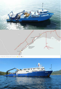
Tdi-Brooks International Completes Texas Colt Offshore Pipeline Route Investigation
7th March 2019
Tdi-Brooks International Completes Texas Colt Offshore Pipeline Route InvestigationGSSI Announces New Sales Professional for Western Canada
7th March 2019
GSSI Announces New Sales Professional for Western Canada
Juniper Systems Limited Reports Growth and Expansion throughout EMEA
6th March 2019
Juniper Systems Limited Reports Growth and Expansion throughout EMEA
Dennis Hirota is Titans of Technology Hall of Fame Recipient!
5th March 2019
Dennis Hirota is Titans of Technology Hall of Fame Recipient!Predicting plastic pathways in the Thames and beyond
4th March 2019
Predicting plastic pathways in the Thames and beyondCarlson Unveils New C-ALS® Gyro at SME 2019
2nd March 2019
Carlson Unveils New C-ALS® Gyro at SME 2019
Hexagon’s Mining division partners with FluidIntel
2nd March 2019
Hexagon’s Mining division partners with FluidIntelFugro To Apply Specialist Geodata Services
1st March 2019
Fugro To Apply Specialist Geodata Services
DMC Constellation strengthens wide area monitoring capabilities
1st March 2019
DMC Constellation strengthens wide area monitoring capabilities
GSSI Releases Improved StructureScan™ Mini XT GPR
1st March 2019
GSSI Releases Improved StructureScan™ Mini XT GPR
Palatiello Promotes USGS 3DEP Before Congress
27th February 2019
Palatiello Promotes USGS 3DEP Before Congress
Maxar Technologies’ MDA Aids Preservation of Indonesian Rainforest
27th February 2019
Maxar Technologies’ MDA Aids Preservation of Indonesian Rainforest
HawkEye 360 Begins First-of-its-Kind Commercial Geolocation
26th February 2019
HawkEye 360 Begins First-of-its-Kind Commercial Geolocation

TCarta Wins Contract to Map Seafloor around Remote Pacific Island Nation
26th February 2019
TCarta Wins Contract to Map Seafloor around Remote Pacific Island Nation
Goonhilly Partners with the Australian Space Agency
26th February 2019
Goonhilly Partners with the Australian Space Agency
Cobham SATCOM extends partnership with Inmarsat
26th February 2019
Cobham SATCOM extends partnership with Inmarsat
Commercial UAV Expo Americas Announces Massive Support
26th February 2019
Commercial UAV Expo Americas Announces Massive Support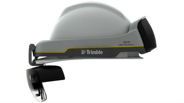
Trimble Announces Next Generation Mixed-Reality Device
26th February 2019
Trimble Announces Next Generation Mixed-Reality Device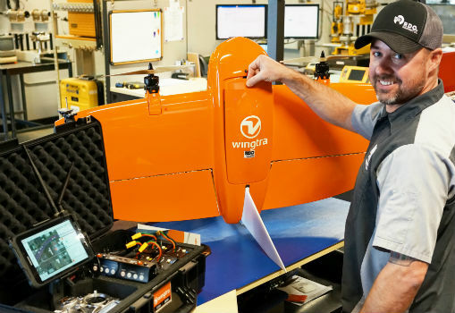
RDO becomes first WingtraOne drone Certified Repair Center
22nd February 2019
RDO becomes first WingtraOne drone Certified Repair Center
Satellite building on an entirely new scale
22nd February 2019
Satellite building on an entirely new scale
Terra Drone brings proven UAS solutions to India
21st February 2019
Terra Drone brings proven UAS solutions to India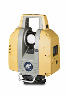
Topcon GLS-2000 scanner update enhances data capture
20th February 2019
Topcon GLS-2000 scanner update enhances data capture

Improves Accuracy On Replica Grade 1 Listed Building Redevelopment
20th February 2019
Improves Accuracy On Replica Grade 1 Listed Building Redevelopment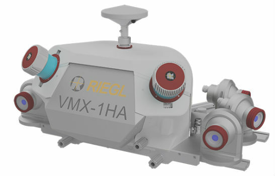
COMPLETE MOBILE SURVEYING OF AMTRAK’S NEW YORK PENN STATION
19th February 2019
COMPLETE MOBILE SURVEYING OF AMTRAK’S NEW YORK PENN STATION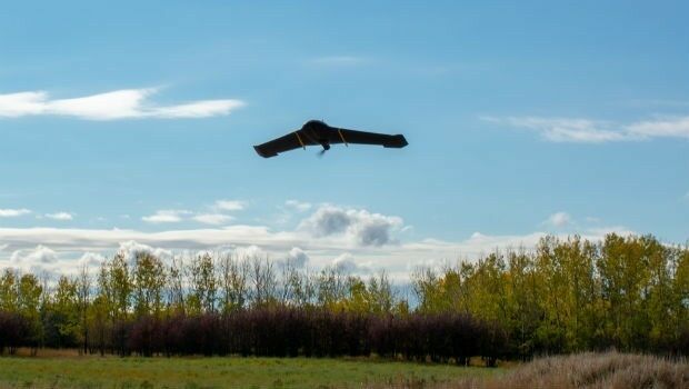
IN-FLIGHT Data awarded three GUINNESS WORLD RECORDS™
19th February 2019
IN-FLIGHT Data awarded three GUINNESS WORLD RECORDS™
Juniper Systems Limited Launches New Cedar CT8 Rugged Tablet
19th February 2019
Juniper Systems Limited Launches New Cedar CT8 Rugged Tablet
Juniper Systems Limited Launches New Cedar CT8 Rugged Tablet
19th February 2019
Juniper Systems Limited Launches New Cedar CT8 Rugged Tablet
Mapping and Monitoring the Carbon Content of Earth’s Forests
18th February 2019
Mapping and Monitoring the Carbon Content of Earth’s Forests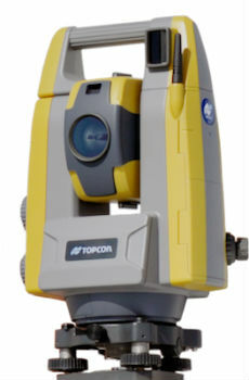
Topcon introduces GT-503M motorised total station
15th February 2019
Topcon introduces GT-503M motorised total station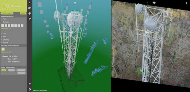

Terra Drone Optimizes Long-Distance Power Line inspection
15th February 2019
Terra Drone Optimizes Long-Distance Power Line inspection
Juniper Systems releases Cedar CT8 Rugged Tablet
15th February 2019
Juniper Systems releases Cedar CT8 Rugged Tablet
Navy-Sponsored Scientist Awarded for Sea-Floor Mapping
15th February 2019
Navy-Sponsored Scientist Awarded for Sea-Floor Mapping
Link between trees and mental health revealed by researchers using Bluesky Tree Map
14th February 2019
Link between trees and mental health revealed by researchers using Bluesky Tree Map
Dstl Announce Swarming Drone Hackathon Challenge
13th February 2019
Dstl Announce Swarming Drone Hackathon Challenge
Unifly partners with Terra Drone India to support UTM in India
13th February 2019
Unifly partners with Terra Drone India to support UTM in India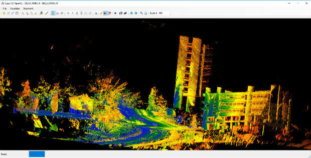
Mobile Mapping System Road-Scanner for the first tram line in Bologna
13th February 2019
Mobile Mapping System Road-Scanner for the first tram line in Bologna
SimActive Expands its Partner Network for Medium Format Camera Solutions
12th February 2019
SimActive Expands its Partner Network for Medium Format Camera Solutions
Airbus invests €25 million in the future of its aerospace site
11th February 2019
Airbus invests €25 million in the future of its aerospace site
Exalto Emirates adds Martek's Anti Drone System to it's portfolio
11th February 2019
Exalto Emirates adds Martek's Anti Drone System to it's portfolio